T.D.S/ Le pilier Traditional Geocache
-
Difficulty:
-

-
Terrain:
-

Size:  (small)
Please note Use of geocaching.com services is subject to the terms and conditions
in our disclaimer.
Le pilier
Le mont Thélod appelé également "Le Volcan", le mont culmine à 450 mètres d'altitude au lieu dit "le pilier". Ce volcan n'a jamais craché de lave, celle-ci s'étant répandue en surface. L'éruption qui remonte à soixante dix millions d'années, s'est produite à un niveau supérieur de plusieurs centaines de mètres par rapport au niveau actuel, ce qui fait que l'érosion n'a laissé que les traces des deux cheminées a une altitude de 360 mètres. Vous pouvez en voir les traces sur les photos aériennes.
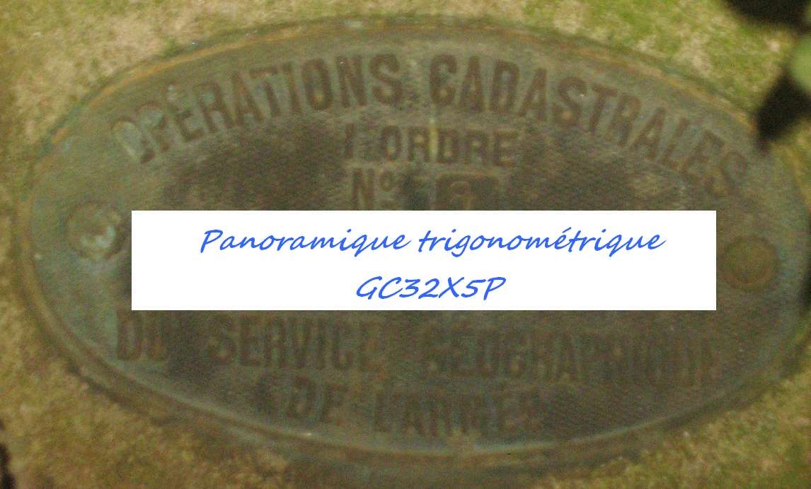
Mais qui parle de pilier, savez vous qu'en fait la construction qui est face à vous est une tour géodésique, elle est même référencée comme "THELOD I" par l'IGN (Institut Géographique National).
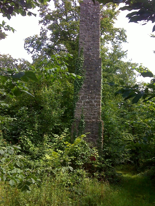
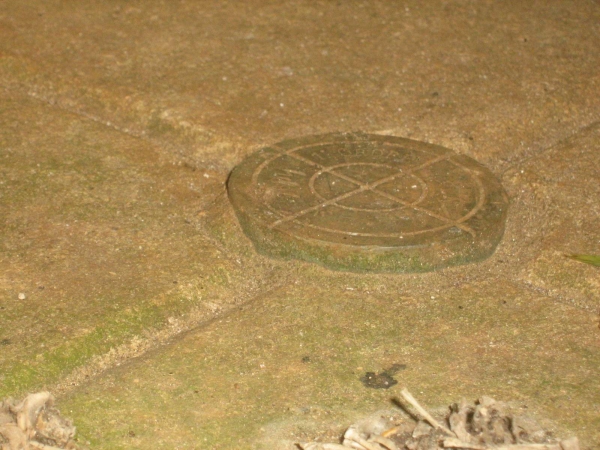
La géodésie a pour objet l'étude de la forme et des dimensions de la terre. Quant aux cheminées géodésiques elles sont, ou plutôt étaient avant la photographie aérienne, de hauts repères au sommet desquels un opérateur pouvait effectuer une visée très précise, moyennant le passage d'un fil à plomb à l'intérieur et dans toute la hauteur de la colonne. Ainsi protégé des remous du vent, ce fil devait s'aligner dans l'axe d'une borne qui constituait l'un des points secrètement gardés par l'armée du temps des "cartes d'état major".
Aujourd'hui devenus désuets, ces repères ont été enlevés ou sont oubliés.
Au début en briques, puis en pierre et enfin en ciment, ces hauts vestiges, peu connus du grand public, rappellent encore l'époque où, les guerres aidant, on s'attelait prioritairement à cartographier les zones du front. C'est ainsi que sur la cinquantaine de tours recensées par l'Institut Géographique National, la majeure partie de ces vestiges se rencontre dans les régions du nord et de l'est du Bassin Parisien.
Si le sujet vous interresse vous pourrez au travers du géocaching visiter une autre tour dans la région:
La tour geodésique GC1ZGEC de Grunch pres d'Ancerville (direction saint Dizier)
Je vous souhaite une bonne découverte
 (excuse me for the rough translation, google is my best friend)
Mount Thélod also called "The Volcano" Mount rises to 450 meters at a place called "the pillar". This volcano has never spit lava, the latter being spread on the surface. The eruption dating back to seventy million years, occurred at a higher level of several hundred meters from the current level, so that erosion has left only traces of the two chimneys has an altitude of 360 meters. You can see the traces on aerial photographs.
But speaking as a pillar, do you know that in fact the building is facing you turn is a geodesic, it is even referenced as "Thélod I" by IGN (National Geographical Institute).
Geodesy is to study the shape and dimensions of the earth. As for fireplaces are geodesic, or rather were before the aerial photography, high marks on top of which an operator could perform a highly accurate, with the passage of a plumb line in and throughout the height of the column. Thus protected from the wind swirls, this thread should be aligned in the axis of a terminal which was one of the items secretly guarded by the army of the time "maps of Staff."
Now obsolete, these markers have been removed or are forgotten.
At first brick, stone and cement, and finally, the top remains unknown to the general public, still remember the days when wars helping, we got down to map priority areas of the forehead. Thus the fifty laps recorded by the National Geographic Institute, most of these relics is found in northern and eastern Paris Basin.
If the subject interests you you can through the geocaching visit another tour in the region:
Tower of geodesic GC1ZGEC Grunch pressure of Ancerville (direction Saint Dizier)
Have a good discovery
Additional Hints
(Decrypt)
fbhpur