Oklahoma Land Run - Cheyenne - Arapaho Country 2 Traditional Geocache
Oklahoma Land Run - Cheyenne - Arapaho Country 2
-
Difficulty:
-

-
Terrain:
-
Size:  (small)
Please note Use of geocaching.com services is subject to the terms and conditions
in our disclaimer.
Cheyenne - Arapaho Country 2
Stake a claim on the
The Oklahoma Land Run is a
series of caches that will run across the whole state east to west!
This project will take some time to complete, but with Oklahoma
Geocachers working together it will happen!
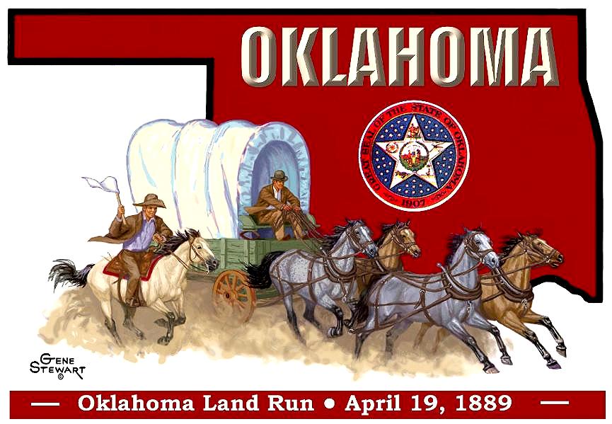
The first Oklahoma Land Run began as a perfect spring
day--bright, balmy and cloudless. The Oklahoma prairie was green
with the new year, a little glimpse of paradise to the thousands of
land-starved pioneers. This was it, the greatest rush for land in
the history of mankind. More than 2 million acres of unassigned
land in the heart of Indian territory were opened to settlement.
50,000 hopefuls surrounded the area to stake their claim for less
than 12,000 homesteads!
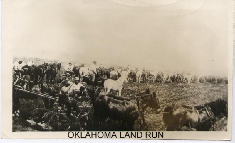
The rushers waited impatiently in all the little towns just outside
the new lands: Darlington, Buffalo Springs, Silver City and
Purcell. Then across the territory at high noon on April 19, 1889,
blasts rang out from gun shot, cannon fire and bugle charge and the
race started. During the next six hours, about 10,000 people
settled in what became the capital of the new Territory of
Oklahoma: Guthrie. The U.S. land offices were mobbed, both in
Kingfisher and in Guthrie. Monstrous lines appeared instantly
outside both, as men stood, usually for days, to register their
land.
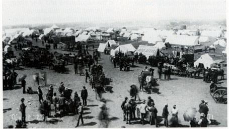
By the time the red dust settled that evening, a new era had begun
in Oklahoma. The foundation had been laid for this "Sooner" State.
It took legislation, proclamations, five land rushes, a land
lottery, and a land auction, to lead to settlement and eventual
statehood of Oklahoma. At 10:15 on the morning of November 16,
1907, President Roosevelt took a seat at the cabinet table
surrounded by a small delegation of government clerks and newspaper
men. By 10:16 he signed the statehood proclamation and declared
"Oklahoma is now a state."
The center of series
starts north of Guthrie, which was the first state capital for
Oklahoma. The city has beautiful victorian architecture, which
provides a unique backdrop for Wild West and territorial-style
entertainment, carriage tours, replica trolley cars, specialty
shops, and art galleries.
You will navigate through back roads and byways to explore the
sprawling ranches, endless sky, miles of rolling grass dunes,
windmills and the most unspoiled landscapes in Oklahoma. Discover
charming small towns, scenic beauty, and local history that awaits
you as you travel through the OKLAHOMA LAND RUN! Whether you are
looking for a wonderful day trip or a multiday immersion, the
OKLAHOMA LAND RUN puts it all within reach.
The center of the run is located in Guthrie, Oklahoma
at coordinates
N 35° 54.785 W 097° 23.418
The west series will carefully navigate you through beautiful
Oklahoma countryside twisting from County Road 76 to County Road
73. Finding its way to County Road 720 to Loyal, Oklahoma.
Traveling north towards Highway 51, following west towards
Texas.
The series to the east will be a tricky one, following County Road
76 crossing Highway 33 to travel north to Hiwassee Road to County
Road 74. Following County Road 74 to Langston, south down Choctaw
Road. Traveling down to County Road 75, twisting through
countryside heading north to County Road 720 into Cushing through
Drumright along country state roads along highway 16 leading east
towards Arkansas. The series does not have end points yet, since it
is starting in the center and spreading towards its
borders.
The run will be set up by volunteers only. If you would like to
add to series, please do so! Any help to continue this project will
be great! Central Oklahoma Geocachers -COG- are excited to see this
come alive!
The caches were placed near or by either a driveway, a road
shoulder or a turn-off intersection. So please look for these as
your hunting the caches to pull your geocar off the roads. Not all
roadways are paved so use caution while driving down the gravel and
dirt roads.
Please do not cross any fences while geocaching, there will be some
no trespassing signs posted, but all caches are not placed on other
side fences.
Please bring your own
writing stick to sign logs. When signing logs, please sign only the
date and your geoname to leave room for future geocashers. Abusing
logs will get your log deleted. Please post any great times you had
while traveling the Oklahoma Land Run
on geocaching.com logs.
Since they are placed in
rural Oklahoma areas, you will find barbwire by many of the
locations, so please watch your children during the fun. To keep
the run going, please place caches back in same place as you found.
With so many caches on this route, will be hard to maintain, any
help will caches will be much appreciated. There are wild animals
in the area so use Caution!
Click here to learn more
about Land Run of 1889.
Additional Hints
(No hints available.)