Findlingspark Darnewitz
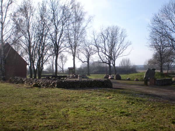
In Darnewitz befindet sich ein Findlingspark.
Findlinge auch als „erratische Blöcke“ bezeichnet
(errare = lat. „umherirren“) die in Nord- und
Nordostdeutschland zu finden sind, stammen meistens aus
Skandinavien und wurden von den eiszeitlichen Gletschern in unsere
Regionen transportiert. Als Geschiebe werden Gesteinsbrocken
bezeichnet, die vom Gletschereis transportiert wurden und aufgrund
des Entlangschiebens am Gesteinsbett des Gletschers
unterschiedlichsten mechanischen Beanspruchungen ausgesetzt sind.
Der Eistransport veränderte auch den Untergrund, so wurde Fels
geglättet, Täler ausgehoben und Lockermaterial verfrachtet. Diese
mechanischen Beanspruchungen sind auch an einzelnen Steinen gut zu
erkennen. Geschiebe dessen Herkunftsort aufgrund ihrer spezieller
Zusammensetzung ermittelt werden kann, nennt man Leitgeschiebe.
Damit lassen sich Rückschlüsse auf die Bewegungen des Eises ziehen.
Findlinge in dieser Region bestehen meist aus skandinavischen
Graniten, Granodioten, Porphyren, Basalten oder Kalksteinen.
Im Gelände des Findlingsparks befinden sich über 60 Findlinge.
Diese sind alle beschriftet nach: Gesteinsart, vermutliche oder
auch gesicherte Herkunft und geschätztes Alter. Diverse Findlinge
haben Anschleifflächen zur Verdeutlichung der eigentlichen Struktur
oder des Gefüges. Der Park ist hervorragend als Lernort im Rahmen
von Projekttagen und Exkursionen geeignet, um die Eiszeiten und
ihre Folgen zu veranschaulichen. In einer kleinen Austellung gibt
es Präsentationsmappen zu den unterschiedlichen Gesteinen und eine
Steinsammlung aus verschiedenen Regionen der Erde.
In Darnewitz there is a boulder park.
Boulders as well as "erratic blocks"means (errare = Latin for
"wandering") that are found in northern and northeastern Germany
originate mostly from Scandinavia and was transported by the
ice-age glaciers in our regions. Are referred to as glacial
boulders that were transported by glacial ice and due to the
sliding along the rock bed of the glacier are exposed to various
mechanical stresses. The ice transport also changed the background,
it was smoothed rocks, valleys excavated and transported loose
material. These mechanical forces are also at individual stones to
recognize. Sediment whose origin because of their special
composition can be determined, is called leadrocks. This is
possible to draw conclusions about the movements of the ice.
Boulders in this region consist mostly of Scandinavian granite,
Granodioten, porphyry, basalt or limestone.
In the area of the boulder parks are over 60 boulders. These are
all labeled by: rock type, probable or reliable sources and
estimated age. Several boulders have grinding surfaces to
illustrate the actual structure or texture. The park is ideal as a
place of learning in the course of project days and excursions
suited to illustrate the ice ages and their consequences.In a small
exhibition there Folders to the different rocks and a collection of
stones from different regions of the world.
Logbedingungen:
Bei den Koordinaten findet ihr den Findlingspark und auch
Infotafeln.
Bitte beantwortet folgende Fragen:
1. Wie weit drangen die Gletscher vor? (Infotafel)
2. Im Eingangsbereich findet ihr einen großen Stein. Wie heißt der
Stein und nennt die Art des Gesteins?
3. Suche einen Stein deiner Wahl und nennt mir den Namen und die
Gesteinsart?
4. Nennt die Herkunft von diesem Stein und macht ein Foto von
diesem Stein mit deinem GPS (Optional)
5. Nenne Gesteinsfamilien (max. 3)
6. Was wird auf den Granitbänken in der Mitte vom Gesteinsgarten
angezeigt?
Da es keine Pflicht mehr ist ein Foto zumachen, würde ich
mich
trotzdem über ein Bild von euch oder eurem GPS vor einem schönen
Stein freuen.
Die Antwort sendet bitte an meine E-Mail Adresse und vergesst
bitte
nicht im Betreff oder in der Nachricht Euren GC-Nicknamen mit
anzugeben.
EC_QRP_Holger@t-online.de
Viel Spaß bei dieser kleinen geologischen Entdeckungsreise
wünscht QRP Holger
Log conditions:
Near the coordinates you will find the boulder park and information
boards.
Please answer the following questions:
1. How far penetrated the glacier? (Information board)
2. In the entrance you will find a large stone. What is the name of
this stone and let me know the type of rock?
3. Seeking a stone of your choice and call me the name and the type
of rock?
4. Name the origin of the stone and take a pictures of this stone
with your GPS (optional)
5. Call rock families? (max. 3)
6. What is displayed on the granite benches in the middle of the
rock garden?
Since there is no duty more carry on a photo, I still would love
a
picture of your self or your GPS in front of a beautiful
stone.
Please send your answer to my email address below and do not
forget
to state your GC nickname in the subject line or in the
actual
message.
EC_QRP_Holger@t-online.de
All the best of fun with this little geology discovery travel
from QRP Holger
Parken kann man bei N 52° 38.672 E011° 42.679
You can park at N 52° 38.671 E011°42.679
 />
/>