The Great Landslide of Artedara EarthCache
The Great Landslide of Artedara
-
Difficulty:
-

-
Terrain:
-
Size:  (not chosen)
Please note Use of geocaching.com services is subject to the terms and conditions
in our disclaimer.
Artedara Landslide
Landslides
Landslides are earth, rock or debris flows on slopes that are triggered by gravity. They can occur in any terrain given the conditions of moisture, soil and the angle of the slope. Also known as debris flows, mud flows, earth failures, etc, they can be triggered by floods, earthquakes, rain and other natural causes. They can also occur by human made courses like vibrations from traffic, blasting, earthwork that alters the shape of the slope, etc.
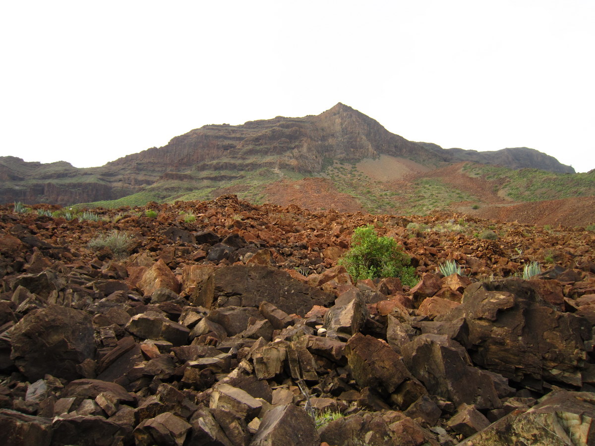
The Artedara Landslide
This is the location of a destructive landslide that hit the valley of Artedara. 300.000 years ago after millions of years of erosion a huge mass of rocks broke away from the valley and slid to the bottom of the valley. This event and following further erosion resulted in a weakening of the rock that resulted in that rock mass eventually fell. The landslide was so great that the valley were carpeted with material that spread across the valley, reaching the other valley wall. At the cache listing you will get a good impression of the great landslide, and the view is really spectacular to behold.
Necropolis
This site is also an important Guanche burial ground that occupies an area of two kilometers in length and one kilometer in width, over a large expanse of basaltic rocks. This burial site of the early Canary Islanders is made up of over a thousand burial mound structures
Cache requirements
Send me the answer to 2 of the 3 following questions:
1) What is the height above sea level at the listing coordinates.
2) Name the two components believed involved in the landslide
3) How old is the geological material out of which the valley is excavated?
Optional: Take a picture of you or your GPS at the observation platform (at the listing coordinates) toward the landslide and post it in your log.
You will find information to answer the questions at the information boards in the area.
When you have sent your answers then you can immediately log the Cache. At inconsistencies I will contact you.

Corrimientos de tierra
Los corrimientos de tierra son flujos de tierra, rocas o escombros en las laderas accionados por la gravedad. Se pueden producir en cualquier terreno, dadas las condiciones de humedad, suelo y ángulo de la pendiente. También se conocen como flujos de escombros, flujos de lodo, fallas, etc. Pueden ser provocados por inundaciones, terremotos, lluvia y otras causas naturales. También se pueden producir por influencia humana, como vibraciones del tráfico, demoliciones o movimientos de tierras que alteran la forma de la pendiente, etc.
El corrimiento de tierra de Artedara
Esta es el lugar en el que se produjo un corrimiento de tierra destructivo que azotó el valle de Artedara. Hace 300.000 años, después de millones de años de erosión, una enorme masa de rocas se separó del valle y se deslizó hasta el fondo del mismo. La caída de rocas, y la consiguiente erosión, conllevó a que la masa de roca debilitada cayera. El corrimiento de tierras fue tan grande que el valle acabó cubierto de material que se distribuyó por todo el valle, alcanzando la ladera del otro valle. En el listado del caché podrá obtener más información sobre el gran deslizamiento de tierra, la vista es realmente espectacular.
Necrópolis
Este lugar es también un importante cementerio Guanche que, sobre una gran extensión de rocas basálticas, ocupa un área de dos kilómetros de longitud y un kilómetro de ancho. Este cementerio de los antiguos habitantes de las islas Canarias se compone de más de un millar de túmulos.
Requisitos de caché
Envíe la respuesta a dos de las tres preguntas siguientes:
1) ¿Cuál es la altura sobre el nivel del mar de las coordenadas que aparecen en el listado?
2) Nombre de los dos componentes que cree que influyen en el deslizamiento de tierras
3) ¿Cuál es la antigüedad del material geológico del cuál se ha excavado el valle?
Datos opcionales: Tome una fotografía con su cámara o con su GPS de la plataforma de observación (en el listado de coordenadas) en dirección al deslizamiento de tierras y publíquelo en su registro.
Encontrará información para contestar a las preguntas en los paneles de información de la zona.

Additional Hints
(No hints available.)