Tämä multikätkö muodostuu kolmesta reittipisteestä sekä kätköstä. Jokaisesta pisteestä saa seuraavan pisteen koordinaatit sekä vihjeen. Tiedot ovat luettavissa sopivalla laitteella. Aitojen yli ei tarvitse kiipeillä.
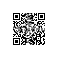
Reittipisteistä löytyy laminoitu lappu, jossa on QR-viivakoodi. Koodin lukemiseksi tarvitset sopivan laitteen, esimerkiksi kamerapuhelimen sekä lukijaohjelmiston. Ohjelmisto löytyy valmiina joistain puhelimista, ja ilmaisia vaihtoehtoja on useita, hakukoneella löytynee avainsanoilla mobile barcode reader.
On myös mahdollista ottaa koodeista valokuvat, joista tiedot saa luettua online-työkalulla, esim. ZXing Decoderilla.
Annettu alkupiste sijaitsee entisen bussilinjan 23 päätepysäkillä. Siellä ei ole mitään kätköön liittyvää, mutta sieltä voi aloittaa reitin. Matkaa reitille tästä pisteestä aloittaen sekä päättäen tulee kokonaisuudessaan vajaa 2 km. Reitti kulkee pääosin kevyen liikenteen väyliä ja katuja pitkin.
Kätkön pisteet ovat erittäin vilkkailla paikoilla, joten yritäthän toimia huomaamattomasti. Pimeään aikaan tarvitset valoa koodien lukemiseksi.
Kätkön esi-reittipiste (reittipiste WP0), josta ensimmäisen reittipisteen tiedot löytyvät, on tässä:
This multicache consists of three waypoints and the cache. Each waypoint contains coordinates for the next waypoint as well as a hint to find it. The information can be read with a suitable device. There is no need to climb.
Each point has a laminated tag with a QR barcode. To read the code you'll need a suitable device, e.g. camera phone with a reader software. Some mobile phones have the reader software built in, and there are several free reader software available, search for them with keywords mobile barcode reader.
It is also possible to take a photo of the codes and use an online tool to decode it, e.g. ZXing Decoder.
The given coordinates point to the final stop of ex city bus route 23. There is nothing to be found there, but it is one possible place to start the route. The entire route is less than 2 km long when starting and ending there. The route mainly follows footpaths and roads.
The waypoints are located in very busy places, so please try to be stealthy. When it's dark, you'll need a torch to read the codes.
Pre-waypoint (WP0), which contains the information needed to find first waypoint, is right here: