Great Swamp Watershed Association, founded in 1981, is dedicated
to protecting and improving water resources in the ten towns that
comprise Great Swamp watershed by monitoring local streams,
advocating for intelligent land use, and educating our communities
about water quality and quantity and their effect on the health and
natural beauty of the local environment. The ten towns are:
Bernardsville, Bernards Township, Chatham Township, Harding
Township, Long Hill Township, Madison Borough, Mendham Borough,
Mendham Township, Morristown and Morris Township.
The Great Swamp Watershed is a 55-square-mile region in Morris
and Somerset Counties of the state of New Jersey, and includes
portions of ten different towns. A watershed is a geographical area
all of whose streams flow into a single body of water. In the Great
Swamp Watershed, five streams – the Upper Passaic River,
Black Brook, Great Brook, Loantaka Brook, and Primrose Brook all
flow into Great Swamp and exit as the Passaic River via Millington
Gorge.
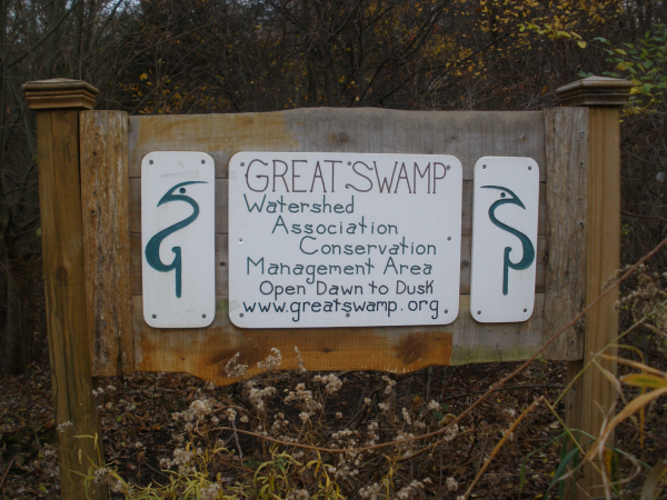
Beginning in 1996, the Great Swamp Watershed Association (GSWA)
gradually acquired 53 acres of property in Harding Township. Known
as the Conservation Management Area (CMA) the site contains
critical wetlands, vernal pools, forested areas, and the Silver
Brook (a feeder stream to the Passaic River), and is home to
several state and federally designated threatened species,
including wood turtle and barred owl.
The First Stage micro cache will have coordinates to the second
stage where you must answer the following questions to obtain the
coordinates to the final cache.
FINAL N 40 45 (A) (B) W 074 29 (C) (D)
( A ) What Color Bird is bottom third from left? White = 6, Blue =
7, Red = 8
( B ) What frog is top third from left? bull = 58, green = 47, tree
=12
( C ) What type of woodpecker do you see? Hairy = 7, Downey = 9,
Red-bellied = 8
( D ) How many furry animals are in the sign? 2 = 60, 3 = 22, 4 =
38
The scenic trails throughout the CMA will cover woodlands and
marshes. There are a variety of boardwalks, but after a rain some
parts of the trails may become wet and then proper footwear is
recommended.
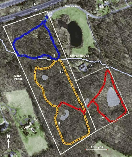 MAP OF THE CMA
For information on the GSWA, and the CMA, please visit
their web site at www.greatswamp.org
The NNJC is about promoting a quality caching experience
in Northern New Jersey.
 NNJC.ORG