Three Sisters - The Barrow (An Bhearú)
The River Barrow has the second longest main river channel in the country and its catchment covers an area of approximately 2983 sq km. This area includes parts of Counties Laois, Offaly, Kildare, Carlow, Kilkenny, Wexford and Wicklow. The Barrow rises in the Slieve Bloom mountains in County Laois approximately 6 km south of Clonaslee. It flows North Easterly until it reaches the Offaly county boundary at Monettia Bog where it turns in a South Easterly direction. From near Mountmellick, it flows in an Easterly direction through Portarlington forming part of the boundary between Laois and Offaly, to Monasterevin. From Monasterevin the river flows in a Southerly direction through Athy, Carlow, Leighlinbridge, Bagenalstown, Grauigenamangh and towards New Ross, to its confluence with the River Suir at Cheekpoint. The Barrow is joined by the Nore approximately 4 km upstream of New Ross and is tidal for another 13 km upstream to St. Mullins. The Barrow in conjunction with stretches of the canal, provides a navigable channel between New Ross and the main Grand Canal system at Athy.
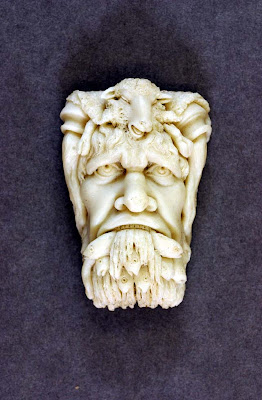
Riverine Head personifying the River Barrow as depicted on
the exterior of the Custom House, Dublin.
The main tributaries joining the left bank (East side) are the Cushina, Figile and Slate which form one tributary at Monasterevin and the Tully, Greese, Lerr, Burren, Mountain and Poulmounty, while on the right bank (West side) it is joined by the Owenass, Triogue, Stradbally, Douglas, Fushogue, Gowran, Powerstown and Duiske tributaries. Most of the main channel of the River Barrow and its main tributaries are part of the Barrow/Nore Special Area of Conservation (SAC) which is designated under the Habitats Directive as having special conservation value because of the presence of listed species and habitats.
There are 23 locks, including the sea lock at St. Mullins. The Barrow Line of the Grand Canal is 46 km long and forms the second part of the navigation carrying 9 locks between Lowtown and the junction of the Barrow at Athy.
Over 300 years before the Christian era, legend has it that a great battle took place to capture the fort of Dinn Righ, a large mound near Leighlinbridge. The presence of such formidable defensive structure indicates the importance of the Barrow as a strategic military highway as well as a highway for commerce since earliest times. Evidence of early Christian and later medieval church establishments can be seen all along the river, notably at or near St. Mullins, Old Leighlin, Carlow, Sleaty, Nurney and Monasterevin.
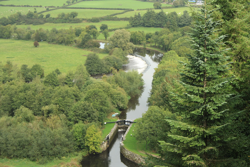
The River Barrow at Clashganny Lock
The Barrow was a significant commercial canalised waterway right up to the 1950's with important river ports at Athy, Carlow, Graignamanagh and New Ross. Barges carried consignments of malting barley to Dublin as raw material for the famous Guinness stout, which was transported back downstream in its finished state. Later, beet-filled barges supplied Ireland's first sugar factory at Carlow. The Barrow is now completely given over to pleasure.
The Cache is placed along a section of the Barrow Way between Graiguenamanagh and St Mullins. The parking area will get you to the cache in about 15 mins, however the walk between the above villages is excellent and very enjoyable and I would recommend this approach if you have the time.