|
This mighty river, before it reaches the sea, supplies water for 8 hydroelectric power stations, and provides cooling water for 1 thermal and 2 geothermal power stations. These 11 power stations provide over 50% of the North Island's electricity needs, equating to 33% of the country's power demands.
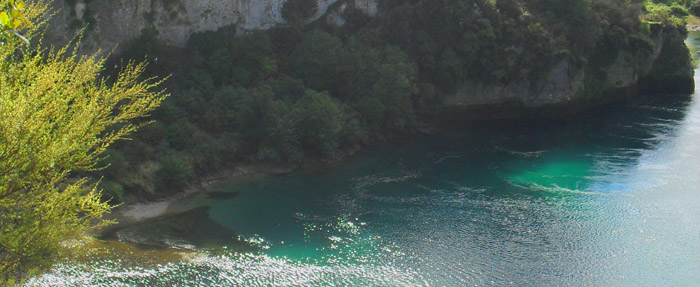
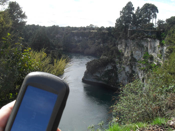
From the published coordinates, you can see this mighty river squeeze between high cliffs, forcing it through a narrow channel. Due to the way the volcanic conglomerate has formed the cliffs and bluffs here, they are highly resistant to erosion. They stand vertical and resist the power of the water due in part to the irregularly sized and shaped, and rough textured volcanic particles that make up the cliffs.
Question 1: From the information panel at the published coordinates, please describe the process by which this rock-like conglomerate formed, which explains why the cliffs are so resistant to erosion.
The level of the Waikato River is controlled by flow control gates built into the bridge where SH1 crosses the river into Taupo township. Typically between 8am and 8pm the gates are opened to allow an increased flow in order to cater for the higher electricity demands during the daytime and the early evening.
Between high and low flow, the river can change in level by 3 metres. The depth of the river below the bungy is approximately 7.5 metres.
Question 2: From the information please answer the following questions:
How deep is the river as it passes through the thin channel to the NE?
How many cubic metres of water flow through this channel at low flow and high flow levels?
There is evidence to suggest that the present course of the Waikato River was cleaned out shortly after the eruption of the Taupo Volcano 1800 years ago. It was almost certainly in existence prior to that event, but perhaps not quite as deep.
Question 3: Describe the colours that you can see in the cliffs on either side of the river here.
The river's striking blue colour is due to the clean, clear water which reflects blue light. The average water temperature here varies between 22 degrees Celsius in summer, and 10 degrees in winter.
Optional Task: Please take a photo of the view from the published coordinates. Include the river, the cliffs, and for extra bonus points, a bungy jumper in mid-jump (see example photo below).
Please send the answers to the questions above to the cache owner, and upload the requested photo with your online log. Do not visit at night as you will not see or learn anything.
You can log this cache straight away after you have emailed your answers to the cache owner, no need to wait for confirmation. Please include the name of this earthcache in the email - you'd be surprised how many people forget. Also, when contacting us with answers, if you want a reply, please include your email address. Any problems with your answers we'll be in touch.
|