

Come on a journey to remember and commemorate
the history and travels of Captain John
Smith!
Over four
hundred years ago, Englishman John Smith and a small crew set out
in an open boat to explore the Chesapeake Bay. Between 1607 and
1609 Smith mapped and documented nearly 3,000 miles of the Bay and
its rivers. Along the way he visited many thriving American Indians
communities and gathered information about this “fruitful and
delightsome land.” In December 2006 the U.S. Congress
designated the routes of Smith’s explorations of the
Chesapeake as a national historic trail—the first national
water trail.
Are you ready
to follow in the wake of Captain John Smith? Visit sites along the
National Historic Trail and learn about the native cultures and the
natural environment of the 17th-century Chesapeake through the
Captain John Smith Chesapeake Geotrail. The Trail provides
opportunities for you to experience the Bay through the routes and
places associated with Smith’s explorations. Caches will be
located in museums, refuges, parks, and towns in Virginia, Maryland
and Delaware along the rivers and creeks that Smith and his crew
explored four centuries
ago.
The Captain
John Smith (CJS) Geotrail launched June 4, 2011 with over 40 caches
within Maryland, Virginia and Delaware. A trackable geo coin will
be awarded to the first 400 geocachers, while supplies last, for
locating at least 15 CJS caches. To be eligible for the coin,
geocachers must download a passport from either the CJS Geotrail or Maryland Geocaching Society website.
Geocachers must find and log at least 15 finds, record the code
word from each cache on their passport and post a picture of
themselve at each cache location. After discovering the 15 required
caches, geocachers may have thier passports validated in person or
via mail at the National Park Service, Chesapeake Bay Office
located at 410 Severn Ave, Suite 314, Annapolis, MD 21403. Please
refer to the passport for complete validation instructions.
Participating in the CJS geotrail is fun and we
hope that many people join in. However, it is not a requirement for
logging your find on this cache once you find the container.
You
are seeking a traditional hide. A lock & Lock container stocked
with a variety of items. This park does have an entrance fee of
$4.00 weekdays and $5.00 on weekends. The park is open 6:00 a.m. to
dusk. Please NO NIGHT CACHING!
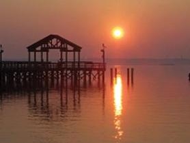
Leesylvania State Park, the ancestral home of the Lee family, sits
along the Potomac River, near Woodbridge, VA. Opened to the public
in 1992, the park offers visitors a range of recreational
activities, features beautiful views of the Potomac River, and has
a long and fascinating history.
Situated on "Freestone Point," referring to the sandstone which
early settlers took from the property for building purposes, the
park lands were once part of Leesylvania Plantation. Henry
“Light Horse Harry” Lee III, a revolutionary war
colonel and father of Robert E. Lee, was born here at what was then
the Leesylvania Plantation. The Lee mansion burned in the 18th
century, but the family gravesite remains, as do the ruins of a
later 19th century house. Visitors with an interest in Civil War
history can see the site of a Confederate gun battery at Freestone
Point. Leesylvannia State Park also features recreational
opportunities on land and in the water. The park has a 300-foot
accessible fishing pier and a popular boat ramp, sailboat hoists,
and ample parking for trailers. A car-top launch area is located on
Powell’s Creek which allows paddlers to explore the smallers
waters of the park in boats such as canoes, kayaks. In addition to
water access, the park has five popular hiking trails that pass
through rich natural and historical features and including scenic
overlooks of the Potomac landscape.
In mid-summer 1608, Captain John Smith and crew explored the Upper
Potomac, yet unfortunately he did not keep a record with as much
detail as during other parts of the Chesapeake voyages. Along this
segment of the river, the explorers received a friendly welcome
from the Tauxenents (which was later Anglicized “Toags”
or “Dogues”) who were supposedly a “fringe part
of Powhatan’s domain.” The name of one Dogue Indian
town, “Mayumps,” survived for centuries as the name of
an island in the Potomac, which has since eroded away.
Most Indian towns were structured very differently from towns as we
think of today. A settlement from the period of the Chesapeake
voyages typically consisted of houses scattered among small fields,
overgrown fields, and groves of older trees. Even after the harvest
much of the town would have vegetated areas interspersed among the
houses.
Similarly, while many of the American Indians in the Chesapeake
region planted and harvested crops, agriculture as part of the
landscape was very different. Agriculture that shallop discovery
crew may have seen practiced by the Dogue Indians during in the
early 1600s was subsistence farming, where small areas of land were
cleared with an axe and hoe and farmed for only a few years and
then left fallow. During this time, less than 20 percent of the
land in the Chesapeake region was in cultivation at anytime.

Thanks to ReedKickBall for helping with this hide and to the
Maryland Geocaching Society for assisting with this
project!