

Come on a journey to remember and commemorate the history and
travels of Captain John
Smith!
Over four
hundred years ago, Englishman John Smith and a small crew set out
in an open boat to explore the Chesapeake Bay. Between 1607 and
1609 Smith mapped and documented nearly 3,000 miles of the Bay and
its rivers. Along the way he visited many thriving American Indians
communities and gathered information about this “fruitful and
delightsome land.” In December 2006 the U.S. Congress
designated the routes of Smith’s explorations of the
Chesapeake as a national historic trail—the first national
water trail.
Are you ready
to follow in the wake of Captain John Smith? Visit sites along the
National Historic Trail and learn about the native cultures and the
natural environment of the 17th-century Chesapeake through the
Captain John Smith Chesapeake Geotrail. The Trail provides
opportunities for you to experience the Bay through the routes and
places associated with Smith’s explorations. Caches will be
located in museums, refuges, parks, and towns in Virginia, Maryland
and Delaware along the rivers and creeks that Smith and his crew
explored four centuries
ago.
The Captain
John Smith (CJS) Geotrail launched June 4, 2011 with over 40 caches
within Maryland, Virginia and Delaware. A trackable geo coin will
be awarded to the first 400 geocachers, while supplies last, for
locating at least 15 CJS caches. To be eligible for the coin,
geocachers must download a passport from either the CJS Geotrail or Maryland Geocaching Society website.
Geocachers must find and log at least 15 finds, record the code
word from each cache on their passport and post a picture of
themselve at each cache location. After discovering the 15 required
caches, geocachers may have thier passports validated in person or
via mail at the National Park Service, Chesapeake Bay Office
located at 410 Severn Ave, Suite 314, Annapolis, MD 21403. Please
refer to the passport for complete validation instructions.
Participating in the CJS geotrail is fun and we hope that many
people join in. However, it is not a requirement for logging your
find on this cache once you find the container.
The listed coordinates will take you to a sign at stage 1.
1. What year was the Citie of Henricus founded?
Take the first two digits, subtract 1, and add to the N
coordinates. Add the 4 digits of the year, multiply by 3, add 3,
and add to the W coordinates. This gives you the Stage 2
Coordinates.
Stage 2. How many nautical miles from the Chesapeake Bay is this
area? Multiply that distance times 3, subtract 15 and subtract from
the N coordinates for Stage 2.
How many beds were in the Mt. Malady hospital? Multiply this number
by 3, add 15 and add to the W coordinates for Stage 2. You now have
the coordinates for the final.
The Henricus area comprises of fee and non fee sections. The
original site, where the cache stages are located, is open to the
public. The restored living history area (http://www.henricus.org/)
charges admission. The Conservation Area
(http://www.chesterfield.gov/content2.aspx?id=5441) has over a
dozen caches and excellent hiking. There is no fee.
WARNING: This park is serious about closing times--as in metal
gate, chain, and lock. Read the sign. If you get locked in, call
the police. The hider of this cache does not have a key!
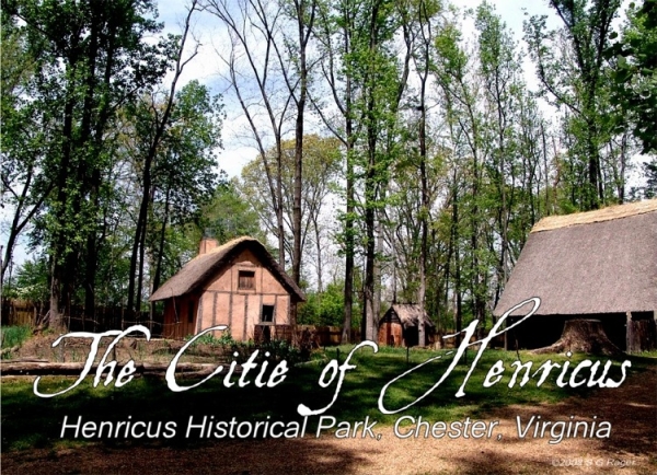
Dutch Gap Conservation Area surrounds the location of Henricus, the
second successful English settlement in Virginia. It consists of
810 acres of woodlands and waterways along the James River, a major
Chesapeake Bay tributary. Visitors to the Conservation Area have
the opportunity to hike or paddle roughly 300 acres of wetlands
surrounding a tidal lagoon, formed when the James River flooded a
sand and gravel mining pit. Wildlife in the Conservation Area
include blue heron, eagles, beavers and muskrats.
The first English colonists passed by the site of what is now Dutch
Gap as they sailed up the James, scouting to see where the river
led, shortly after they settled at Jamestown Island on May 13,
1607. The “Citie of Henricus,” named for King James
I’s son, was established in 1611 by Sir Thomas Dale, in the
hopes that colonists would fare better in the healthier environment
upriver. Dale’s decision to cut a ditch through a narrow neck
of land to create a more direct route upriver gave Dutch Gap its
name, a technique he learned as a soldier in the Low Countries (now
the Netherlands), where he campaigned for Dutch independence from
about 1588 to 1609.
The settlement was destroyed in the 1622 Powhatan uprising, a
series of surprise attacks along the James River, and the survivors
fled back to Jamestown. Led by Opechancanough, chief of the
Powhatan Confederacy, the uprising was an attempt to expel the
English, whose presence on the land had expanded rapidly since the
cultivation of tobacco began in 1614. On March 22, Indian warriors
simultaneously attacked most of the outlying settlements (that is,
most established after and away from Jamestown Island), killing 347
men, women, and children – nearly one-third of the English
population in Virginia. By this time, Dale had already sailed back
to England in 1616, along with Pocahontas, both fated to never to
return to Virginia. The uprising was ultimately unsuccessful
– the English initiated a policy of total war, attacking any
Indians suspected of involvement, destroying their villages, crops,
and tools. In desperation, Opechcancanough sued for peace. At the
peace parley in the fall, the English poisoned two hundred Indians
with a tainted toast and slew another 50 by hand. Opechcancanough
escaped, and hostilities continued almost unabated until 1644, when
the murder of the elderly Opechcancanough led to the capitulation
of the Powhatan
Confederacy.
 Thanks to buffpup for helping with this hide and to the Maryland
Geocaching Society for assisting with this
project!
Thanks to buffpup for helping with this hide and to the Maryland
Geocaching Society for assisting with this
project!