The Kristinartindar are two summits near Skaftafell. The higher
summit (where the cache is located) has an height of 1126m.
On your way to Kristinartindar you'll have absolutly magnificent
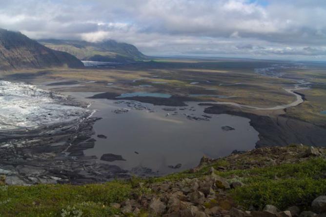
goose bump causing views over the huge Skaftafellsjökull and its
glacier lake. Skaftafellsjökull is a glacier tongue of Vatnajökull,
Europe's greatest glacier. On clear days you might see
Hvannadalshnukur behind Skaftafellsjökull. It's Iceland's highest
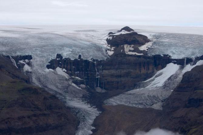
summit with 2110m. On top of Kristinartindar you'll see and maybe
even hear the hollow rumbling of Morsarjökull. Sometimes there are
huge blocks of ice breaking down and you might see waterfalls
coming out of it before they flow into its glacier lake Morsarlon
and later into the quite impressive with mud filled
Morsardalur.
You'll also come across many waterfalls - the most famous one
being Svartifoss (the "Black Waterfall") with its black basalt
columns. Make sure not to miss it!
The hike from Skaftafell to Kristinartindar and back should be
done as a day tour. You'll need about 7-8 hours (maybe more because
there are so many places where you might want to stop to take
photos ;).
The path from Skaftafell to the mountain is well marked and can
be gone even in foggy weather. Only the last part up to the
summit is not marked and has a few steep passages - be careful!
Don't make this your first mountain - there are certainly easier
ones to start with!
There are two paths from Skaftafell to Kristinartindar. You
should take one to go there and the other one to go back. Here you
can download our GPS track - or use the following waypoints:
- Park in Skaftafell on the parking place at N64°01.005
W16°59.008
- Follow the sign to Svartifoss (N64°01.653 W16°58.546)
- Follow the sign (and the marked path) towards
Kristinartindar
- Don't miss the view over Morsardalur at N64°3.512
W16°58.026
- Leave the marked path at N64°3.735 W16°56.314 to the left and
find/follow the steep gravel path up to the summit
- Find the cache on the summit
- Return down to the marked path
- Take the other way back! First follow the path to N64°03.492
W16°55.170
- Follow the path along the glacier back to N64°01.829
W16°56.257
- Return to the parking place in Skaftafell
I hope you'll enjoy this hike as much as we did. It was one of
my greatest experiences in Iceland!
Below is a map and a few photos from our hike:
Map & Altitude Profile


Svartifoss

|
Morsardalur

|
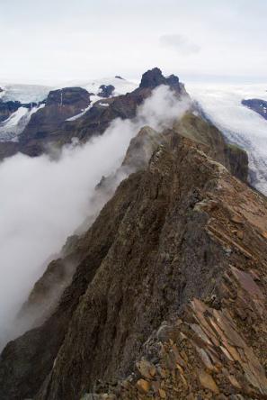
Kristinartindar

|
The unmarked path to the summit

|
The summit
|
Morsarjökull
|
Skaftafellsjökull

|
Skaftafellsjökull's Glacier Lake
|
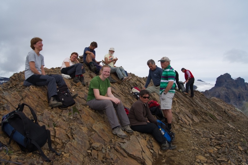
Happy Hikers on Top of Kristinartindar :)
|