[CZ]
V karbonskem obdobi variska orogeneze prerusovala plynulost vyvoje vrstevniho sledu uhlonosnych souvrstvi. Jednim z mala prikladu plynuleho vyvoje sedimentace na hranici karbon-perm je prave permokarbon Boskovicke brazdy. Vychozi souradnice vas zavedou na zacatek naucne stezky Permokarbonem Boskovicke brazdy, ktera vas provede geologickym objektem, ktery je svym charakterem zcela ojedinelym nejen u nas, ale v cele Evrope. Nabizi sledovani vyvoje permokarbonskych sedimentu Boskovicke brazdy na rozhrani mezi karbonem a permem a je uzce spjat take s dolovanim na rosicko-oslavansku, takze se setkate nejen s geologickymi informacemi, ale dostane se vam take zakladnich informaci o historii stratigrafickych vyzkumu v rosicko-oslavanskem reviru. Lze zde sledovat sedimenty, které vznikly priblizne pred 300 miliony let vcetne vychozu uhelnych sloji.
Geologicky objekt "Profil permokarbonem na levem brehu Oslavy v Oslavanech" je soucasti Boskovicke brazdy, zlomoveho pasma polednikoveho smeru pri okraji Ceskeho masivu. Na satelitnich snimcich je povazovan za jeden z nejvyraznejsich fenomenu stredni Evropy. Probiha ve smeru SSV - JJZ od Moravskeho Krumlova pres Ivancice, Rosice, Boskovice k Jevicku. Brazda siroka 4 az 6 km byla zalozena v prekambriu.
Geotektonicky vyvoj nedovolil vzdy plynulost sedimentacniho vyvoje. Timto se stala moznost sledovani plynuleho vyvoje sedimentu pri hranici karbon - perm velmi omezenou. Profil permokarbonem v Oslavanech je vyjimecnym geologickym objektem, na kterem je nepreruseny vyvoj sedimentu na hranici karbon - perm s razem kveteny velmi blizkym kvetene nejvyssi stephanske uhlonosne zony stredni Francie v panvi Saint Etienne v oblasti Massif Central. Hranice je patrna v miste vychozu I. sloje.
Zdroj: naucna stezka
Ukoly pro uznani logu:
Nepouzivejte novy Message Center, ten nectu a otazky budou povazovany za neodpovezene!!! Poslete mi e-mailem pres profil odpovedi na nasledujici otazky:
- Na souradnicich N 49° 07.647 E 016° 20.238 se dozvite, ze rozhrani mezi stephanem (svrchni karbon) a autunem (spodni perm) bylo urceno na zaklade nalezu vudci permske fosilie ve strope nejvyse ulozene I. sloje. Jake je rodove jmeno?
- Co je to stratigrafie?
- Na souradnicich N 49° 07.440 E 016° 20.411 se podivejte nahoru severnim smerem, nezlomte si pritom krk ;-) a napiste mi, z ceho se sklada svrchni cervene souvrstvi? Pokud nevite rovnou, dozvite se to na informacni tabuli.
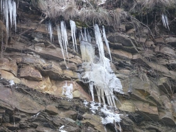
Prilozte prosim k logu foto nejakeho pekneho vychozu, ktery najdete na trase.
[EN]
The starting coordinates will bring you to the start point of an educational nature foot trail. The Variscan Orogenezy (a geologic mountain-building event) did not allow continuousness of sedimentation which limits the observation of sediments between Carboniferous and Permian periods. The geolocial object shown on the foot trail with continuous development of the Carboniferous - Permian sediments is unique not only in our country but in the Europe.
The term furrow is applied to markedly alongate, narrow and tectonically predisposed depression trending with the meridians. In the origin and age of their fills these basin resemble the Grand Sillon Houiller of the Massif Central in France.
The best known furrows of the Bohemian Massif are the Boskovice and Blanice furrows. They belong to the structural systems trending N-S through the European epi-Variscan platform. They came into existence after the "Asturian" phase of the Variscan folding. Sedimentation in the furrows began in the late Stephanian times and it continued without interruption into the early Autunian and locally, even the late Autunian.
Information source: the nature foot trail info-boards
To log the cache
Send me answers to the following questions by e-mail via my profile:
- Go to N 49° 07.627 E 016° 20.267 and you will find the main English info-board about the Boskovice furrow and this geological section. The line between Upper Stephanian (Carbon) age and Lower Autunian (Perm) is determined on finds of Permian fossils in ceiling of Seam No. I. One fossil is shown on the picture. What is the genus of this species?
- What is Stratigraphy?
- At coordinates N 49° 07.440 E 016° 20.411 look up to the north, don't break your neck ;-) and send me what are the upper red sediments. If you don't know, you will find the answer on the info-board here.
There are many outcrops along the foot trail. It would be very nice if you attach an optional picture of one of them to your log.
Listing seen since 12-07-2010:  times.