CAUTION: The terrain is not difficult (paved walkways and
stairs), but please stay on the marked trails and walkways. The
falls are dangerous; the mist from the waterfalls can create very
slippery conditions in any season.
The Athabasca Falls are part of the Athabasca River, a major
Canadian river system with its headwaters located about 70km south
at the Columbia Icefield. The Columbia Icefield is renowned for
containing a hydrological apex or triple continental divide, where
the waters flow to the Pacific, Atlantic and Arctic oceans. The
Athabasca River, which flows to the Arctic Ocean, starts from
Columbia Glacier which is on the Northwest side of the Columbia
Icefield.
The Athabasca River flows for 1,538 km through central and
northern Alberta and the Northwest Territories, passing through the
towns of Jasper, Hinton, Whitecourt, Athabasca and Fort McMurray.
Its waters flow into Lake Athabasca, down the Slave River into
Great Slave Lake, and ultimately through the Mackenzie River to the
Arctic Ocean. Historically, this area was used for hunting and
fishing by the Sekani, Shuswap, Kootenay, Salish, Stoney and Cree
tribes, and the upper valley of the Athabasca River played a major
role in the fur trade in the 1800s. The section of the river
located within Jasper National Park has been nominated as a
Canadian Heritage River for natural beauty and historical
significance.
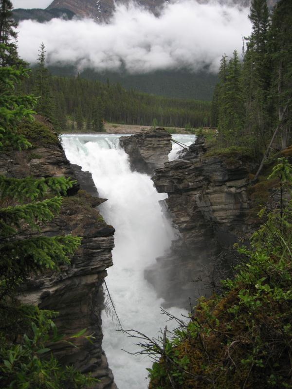
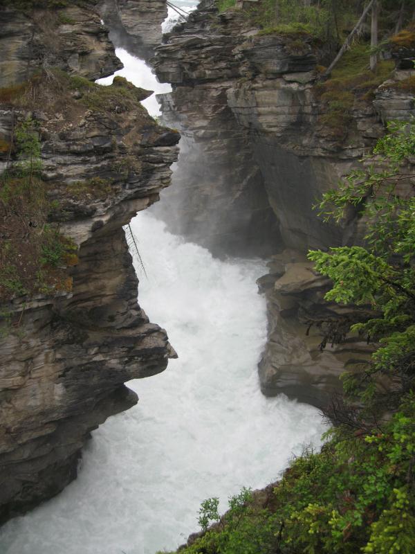
The Athabasca Falls are a class 5 cascade waterfall, with a drop
of 23m and a width of 18m. While not the tallest or the largest
waterfalls in the Rockies, they are renowned for their
aggressiveness and power, as well as their impact on the landscape.
The cap-rock of the falls is composed of hard gog quartzite, which
has allowed the falls to carve out a dramatic gorge and a number of
potholes from the softer limestone and sandstone. The Falls have
been a popular attraction for over a century; before the completion
of the Icefields Parkway in 1940, visitors came via horseback to
see the spectacular display.
In order to log this cache please email the cache owner the
answers to the following questions, and post a photo of yourself
and/or your GPSr and the falls in the background. All the answers
can be found on the signs along the walkways, without going down
into the canyon itself.
1) How much colder can the canyon be relative to the observation
area?
2) Approximately how much of the rock continues to be eroded
every year?
3) What colour was the river water when you were there? What
caused this colour to appear?
4) Other than the water, what material is needed to create the
potholes?
5) Remember to post your photo!