Kinnekulle Earthcache
| I would be very thankful if you could write you email and
log in English. Nevertheless also Swedish email/logs are
welcome. |
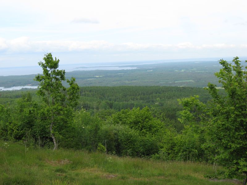
This earthcache would like to bring you to the top of
Kinnekulle. Kinnekulle is a hill or ridge in the province of
Västergötland, Sweden, It is located on the eastern shore of lake
Vänern. Its highest point is 306 metres above sea
level.
Click for enlargement
From a geological standpoint you could say that Kinnekulle is
one of the plateau mountains in Västergötland that is composed of
several layers of different types of rock. In the past, it was
thought that Kinnekulle was an old volcano, but that is not the
case. The skittle shape of the mountain has instead been sculpted
by ice, wind and water since the last Ice Age.
The rock layers of Kinnekulle are actually made up of the ancient
sea bed. The mountain was created some 520 to 400 million years
ago, when the land mass that is now Sweden was under the sea.
Enormous amounts of sand, clay, sludge and dead plants and animals
fell down and gathered on the sea bed. Over a period of millions of
years, this material was then compressed and eventually hardened to
become stone.
The most important rock layers in Kinnekulle are sandstone,
alum-shale, lime-stone, clay slate and diabase. This earthcache
would like to set its focus on diabase, the rock that forms the
summit of Kinnekulle.

Click for enlargement
So
why is Kinnekulle’s geology different from the geology in the
landscape round about? In the past, the sedimentary rock types
– sandstone, alum-shale, limestone and clay slate –
were far more dominant. They have, however, eroded everywhere apart
from Kinnekulle and the other table mountains in Västergötland. The
reason for this is that, at the very top, the table mountains have
a layer of solidified magma, otherwise known as diabase. Diabase or
Dolerite is a mafic, holocrystalline, subvolcanic rock equivalent
to volcanic basalt or plutonic gabbro which forced its way out of
the earth’s core some 280 million years ago. In North
American usage, the term diabase refers to the fresh rock, whilst
elsewhere the term dolerite is used for the fresh rock and diabase
refers to altered material. Diabase dikes and sills are typically
shallow intrusive bodies and often exhibit fine grained to
aphanitic chilled margins which may contain tachylite (dark mafic
glass). It is extremely hard and it has therefore protected the
underlying layers of rock from being eroded by wind and
weather.

Click for enlargement
To
log this earthcache, perform the following
tasks:
- Start your walk at N58° 35.870 E13° 24.891. There you find
several information boards. Use the to answer the following
questions:
- Which rock layer do you find at
Blomberg?
- Which rock layer has got the largest
spread?
- Go
to above coordinates. Here you find a great viewpoint as well as
additional information about the area. Please take optional a
photo of you or your GPS at the top of the
viewpoint. In the case the viewpoint is closed go to N58° 36.109
E13° 24.463 and take a photo there.
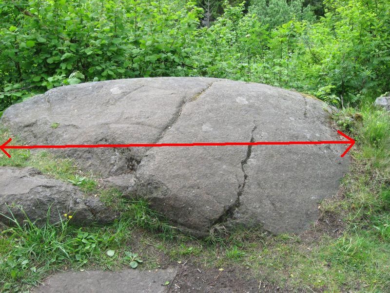
- Go
to N58° 35.998 E13° 24.296. There you have a nice view as well and
you find the following big diabase. Measure the width of the
stone!
Click
for enlargement