
Geologisch liegt Coesfeld an der Grenze zwischen nährstoffarmem
Sand- (westlich) und nährstoffreichem Lehm- und Kleiboden
(östlich).
Hier am Brink befindet sich eine ehemalige Tongrube. Diese Tongrube
ist etwa drei Meter tief und mit rund drei Hektar Größe bildet sie
heute das Herzstück eines Naturschutzgebietes.
Ton bezeichnet ein natürlich vorkommendes Material, das sich
überwiegend aus feinkörnigen Mineralen zusammensetzt und variable
Mengen an Wasser enthalten kann. In der Geologie und der Bodenkunde
gilt für Ton eine Partikelgröße von < X µm. Bei entsprechenden
Wassergehalten ist Ton plastisch. Beim Trocknen oder Brennen härtet
Ton aus.
Die Verwendung von Ton als Rohstoff für Töpferwaren und Keramik
ist bis in das Jungpaläolithikum hinein belegt. Schon rund 24.000
Jahre v.Chr. fertigten Mammutjäger Tonfiguren.
Ton ist einer der Hauptbestandteile von Lehm und wird seit rund
10.000 Jahren in Form von luftgetrockneten Lehmziegeln und Lehmputz
als Baumaterial verwendet.
Zwischen 3100 bis 2900 v. Chr. wurde erstmals in großem Umfang
gebrannter Ton in Ziegelform verwendet. Spätestens seit dieser Zeit
ist Ton einer der bedeutendsten Baustoffe der Menschheit.
Das Gebiet dieser ehemaligen Tongrube diente der Ziegelei Kuhfuß
bis Ende der 70er Jahre zur Tonabgrabung, und erst nach der
Nutzungsaufgabe wurde es dem Naturschutz überlassen (1984) und gilt
daher heute als ein Feuchtbiotopkomplex "aus zweiter Hand".
Besonders bedeutend ist eines der größten Vorkommen des
gefährdeten Laubfroschs in NRW, und auch floristische Raritäten
machen die Tongrube einzigartig.
Eigentümerin ist die NRW-Stiftung, und das Naturschutzgebiet
wird durch den NABU Coesfeld e.V betreut.
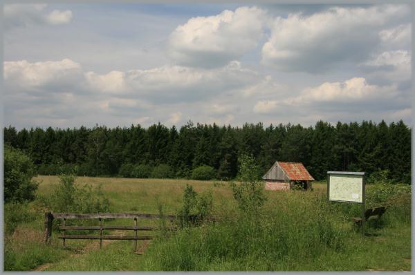
Die Tongrube ist für den Besucher von drei Standorten aus
einsehbar. Der NABU Coesfeld e.V. hat dort Bänke aufgestellt, die
zum Verweilen und Lauschen einladen.
Deine Aufgabe:
Begib Dich zu den oben angegebenen Koordinaten und mache dort
bitte ein Foto von Dir oder Deinem GPS an der Info-Tafel. Stelle
dieses Bild nach der Logfreigabe in Dein Log.
Beantworte folgende Fragen und schicke die Antworten per
email. Sind sie korrekt, erhältst Du die Logerlaubnis!
a) Wie groß ist das gesamte Naturschutzgebiet?
b) Welche floristischen Raritäten kommen hier vor?
c) Wie viele der heimischen Libellenarten wurden hier
nachgewiesen?
d) Welche Partikelgröße hat Ton (ersetze den Wert X)?

Geologically Coesfeld borders on nutrient-poor sand in the west
and nutrient-rich loamy ground and clay soil in the east.
Here at the Brink is located a former clay pit, which is about
three metres deep and today with about three hectares of size it
centers a nature reserve.
Clay is a naturally occurring material. Predominantly it
consists of fine-grained minerals and can contain variable
quantities of water. Geologists and soil scientists usually
consider the separation to occur at a particle size of X µm. With
appropriate water contents clay is plastic. When drying or burning
clay hardens out.
The use of clay as raw material for potteries and ceramics is
proved until into the Upper Paleolithic. Already about 24,000 years
before Christ, mamoth hunters manufactured clay figures.
Clay is one of the main parts of loam. Since about 10,000 years
it is used als building material, for example as air-dried loam
bricks and loam plasters.
For the first time burned clay in bricked form was used in large
extend between 3100 to 2900 before Christ. At least since this
time, clay is one of the most important building materials of
mankind.
The area of this former clay pit served at first the purposes of
brickyard Kuhfuss. After giving up clay digging, this area was left
to nature protection (1984). Therefore it is classified as a damp
biotope complex “second hand”.
One of the largest occurrences in North-Rhine/Westphalia of the
endangered tree frogs is particularly important, but also floristic
rare pieces make the clay pit singular.
Owner is the North-Rhine/Westphalia donation. NABU Coesfeld e.V
takes care of the protected area.
The clay pit is observable for the visitor from three locations.
The NABU Coesfeld e.V. arranged seats there, which invite for
staying and listening.
Your task:
Go to the header coordinates and please take a picture of you
or your GPS at the info board and add this picture in your log
after log permission.
Answer the following questions and send the answers by email.
If they are correct, you receive log permission!
a) How large is the entire protected area?
b) Which rare plants occur here?
c) How many of the domestic kinds of odonata are proven
here?
d) Which particle size has tone (substitutes for the value
X)?