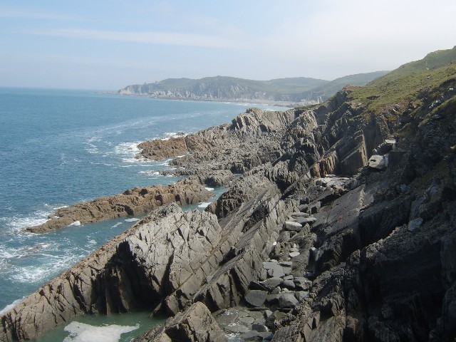
Morte Point
North Devon Geology
North Devon’s coast is geology laid bare, it’s cliffs and beaches are wonderfully accessible by hiking the South West Coast Path. Experiencedevon’s bespoke itinerary planning will lead you off the beaten track to explore the best of the local ancient landscape.
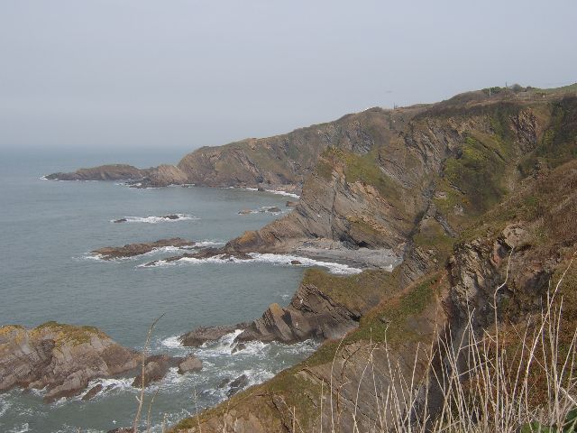
Devon has representations of every major geological period except for the most ancient ones, a span of 400 million years. North Devon, the domain of experienceDevon, has some of the best examples of the Devonian Period formed under tropical seas 395-345 million years ago. It is the only British county to have a geological system, known all over the world, named after it. This geological period can be easily understood by hiking the coastal path from the Exmoor Coast in the north east, and heading south west. You’ll start with the oldest rock strata, the Lynton Beds, and from here, you’ll experience Combe Martin, Ilfracombe and Morte Slates, followed by the Pickwell Down Sandstones, Baggy Sandstones and finish with Pilton Shale. Identification is relatively easy as these are also all place names.

Hele Bay
Travelling further south west, along the coast, brings you to the Carboniferous period, 345-280 million years old. Hartland, or Hercules Promontory as Ptolemy referred to it, is a prime example of this strata formed by successions of sandstones, mudstones and shales laid down in what was then a brackish sea. This rock, known as the Crackington Formation is often seen twisted, turned and bent double; these folds were made through incredible pressure of the tectonic plate collision in the ancient past.
From 1.5 million years ago and up to 18,000 years ago, ice ages have had a major influence on North Devon. The massive ice shelves, of up to a mile high, never engulfed this region but occasionally came to rest in Bideford Bay. Their action displaced rivers leaving dry valleys, and left others entering the sea as waterfalls from the top of 300ft cliffs. There were also huge changes in sea level through this climate change and you’ll be able to see examples of a raised beach, now the bedrock to a seaside town and evidence of an ancient forest in the peat and clay beds seen at low tide at Westward Ho!. There is also evident of displacement by ice, the most famous of which is the Saunton Pink Granite, weighing more than 12 tonnes, and thought to have travelled on the ice shelf from the far North West of Scotland.

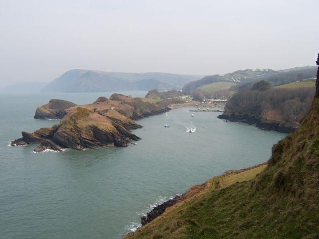
Watermouth Harbour
The last few thousand years have seen the continued forming of Braunton and Northam burrows. These are huge accumulation of sand dunes flanking the estuary of the rivers Taw and Torridge. The highest dune, Flagpole hill in Braunton Burrows, is 100 feet high. This estuary has examples of two spits as it enters the sea; Crow point on the Northern side is made up of sand from Braunton Burrows and the Pebble Ridge at Westward Ho! a fine example of a 2½ mile curving bank of boulders carried from the cliffs of Hartland, through long shore drift.
Source: http://www.northdevon-aonb.org.uk/, http://en.wikipedia.org/wiki/North_Devon_Coast, http://www.experiencedevon.com
Coordinates given for cache are for Widmouth Head. It is on the top of the cliff on coastal path over Watermouth Bay. Take coastal path from the parking area and walk towards Watermouth. You can see some spectacular views on North Devon Coastline.
There is free car park at the Hagginton Point - parking area (PA) and there is also information board, viewpoint and some picnic tables nearby. From this viewpoint you can see cliffs around Ilfracombe.
To claim this cache you need to email me (via the link to my profile at the top of the page or via this link) with the answers to the following questions:
- What is the altitude at the Widmouth Head nearby coordinates given?
- What is the lowest altitude of the coastal path between parking area and the Widmouth Head?
- How many million years ago was North Devon Coast formed (number from Information Board at the parking area, not from listing) ?
- How were Ilfracombe Bets formed ?
Optional task: Please, take a photo of you with a GPS (or your GPS only) and the Watermouth Bay in the background.
Feel free to log this cache. You may not wait for permission to log.
If your answers are not correct, incomplete, without picture etc., i will contact you by e-mail. But if your e-mail is not comming to me without 3 days, I will delete your log without notice.