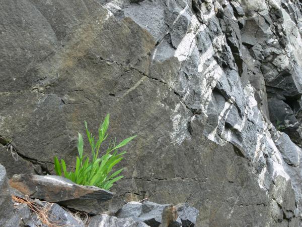
Gneiss (pronounced nice) is a coarse
grained metamorphic rock. Heat as well as pressure is involved in
its formation and this is the most metamorphic rock known. Often it
is impossible to tell what the original rock
was.
The most obvious structural feature of gneiss is the
banding of the minerals.The bands of minerals is often referred to
as "MARBLING".
Each mineral has separated
out into a discreet layer-foliation- and these layers have been
greatly twisted and contorted by the pressures that formed the
rock.
Sometimes a layer of mineral
will have been pulled out into a series of lenses.
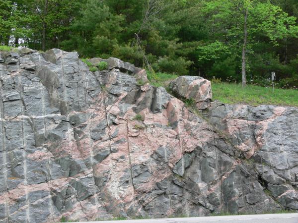
Part of the rock may have melted into
granite, and the molten material may have been squeezed into cracks
throughout the outcrop. This would give veins of quartz and/or a
complex mess of metamorphic and igneous rock-migmatite (mixed
rock).
A quartz
vein so formed is very sinuous, like an aerial photograph of a
meandering river.
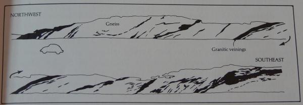
The photo below
illustrates the Popple Hill roadcut showing the granitic
veining.
To log a find to this earthcache you will have a few
questions to submit to me via email
Firstly: What colour is Popple Hill gneiss?
Secondly: Which general direction does the
marbling(mixture of rock and colour) occur and is this consistent
with the cleavage? Note:Cleavage, in structural geology describes
the tendency of a rock to break along preferred planes of
weakness.
Some amateur geologists refer to cleavage as foliation.
In gneiss the foliation is more typically represented by the
banding due to segregation of mineral phases.In this rock cut the
banding is visually observed in colour and line
directionality.
Thirdly:Go to N44.17.382 W075 23.956. You will see drill
marks. What difference is noted regarding this specific drill mark
to the ones along the opposite side of the road and WHY?. Explain
your answer as it relates to the rock geology.
Lastly...to receive a smiley, you are expected to take a
photo of your favourite rock feature of this rock cut and upload to
the earthcache gallery. Include your GPS in the photo.
While there may be ample parking along the side of the
road of Route 58( there is a wide paved pullover section for the
entire earthcache) and while the location by GPS coordinates may
suggest to stop here, the Popple Hill road is highly suggested for
parking because it has much less traffic and offers more security
for your car stop. As with any geocaching/earthcaching pullovers
along a busy roadway, safety is a priority and common sense
awareness of traffic prevails for the visit.
Thank you to the saged "info" from the CCC- some revisons have been
made to the earthcache requirements. Please feel free to submit any
photos you would enjoy sharing with others- particularly
interesting photos of the marbling or the veins in the gneiss that
you believe conjure imaginative "perceptual" shapes that might be
enjoyed by viewers. Thank you.