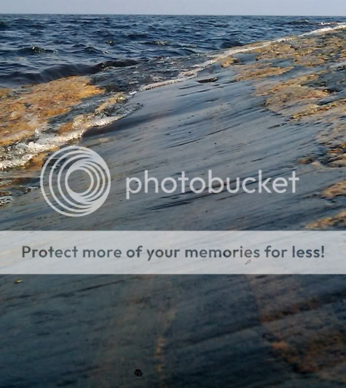
Isräfflor maj-10
Glacial Striation May-10
En lättåtkomlig earthcache på en vacker plats. Parkera vid
föreslagen plats och följ stigen ned till stranden och sedan vidare
ut på halvön. Stigen går ej ända fram, men terrägen är
lättgången.Ta med kompass. Ej tillgänglig på vintern, kan vara
olämplig i hårt väder.
Denna earthcache handlar om isräfflor, ett till synes obetydligt
geologiskt fynd som trots det vittnar om ett dramatiskt
händelseförlopp som ägde rum under den senaste istiden som slutade
för ca 10 000 år sedan. Då var detta område täckt av tjock
inlandsis som likt en glaciär sakta rörde sig. På isens undersida
drogs stenblock med i rörelsen och dessa skrapade som ett
gigantiskt sandpapper mot berggrunden. När de stenar som fördes med
isen var av ett hårdare material än berggrunden bildades långa
repor i berggrunden, s.k. isräfflor.
Längst ute på Rypskär finns det ett relativt stort område med
plana, släta hällar som passar bra för att studera detta. Isräfflor
ser helt annorlunda ut än sprickor i berget. Sprickorna har vassa
kanter, och ofta oregelbunden form. De leder ofta i olika
riktningar. Isräfflorna kan vara lite svårare att se. Det är grunda
repor som har avrundade kanter och är mer "slitna". Oftast leder de
alla i samma riktning.
Ibland är de lättare att se isräfflorna om klippan är våt. Solens
riktning och från vilken vinkel man tittar påverkar också. Om man
stryker handen över klippan i rät vinkel över räfflorna känns de.
som mjuka vågor.
När man skall bestämma riktningen för isens rörelse är det viktigt
att se på hur den underliggande klippan ser ut. När isen gled över
berggrunden slipades den sida som den först träffade av och blev
svagt sluttande. Den motsatta läsidan längre fram efter isens
rörelseriktning kallas "plocksida" och där lossande bitar av
klippan. Den sidan är därför kantigare och brantare. Om du jämför
stranden på hällarnas ena sida med den motsatta stranden så ser du
tydligt vilken sida som är den brantare och ojämnare "plocksidan".
Då kan du också bestämma isens rörelseriktning.
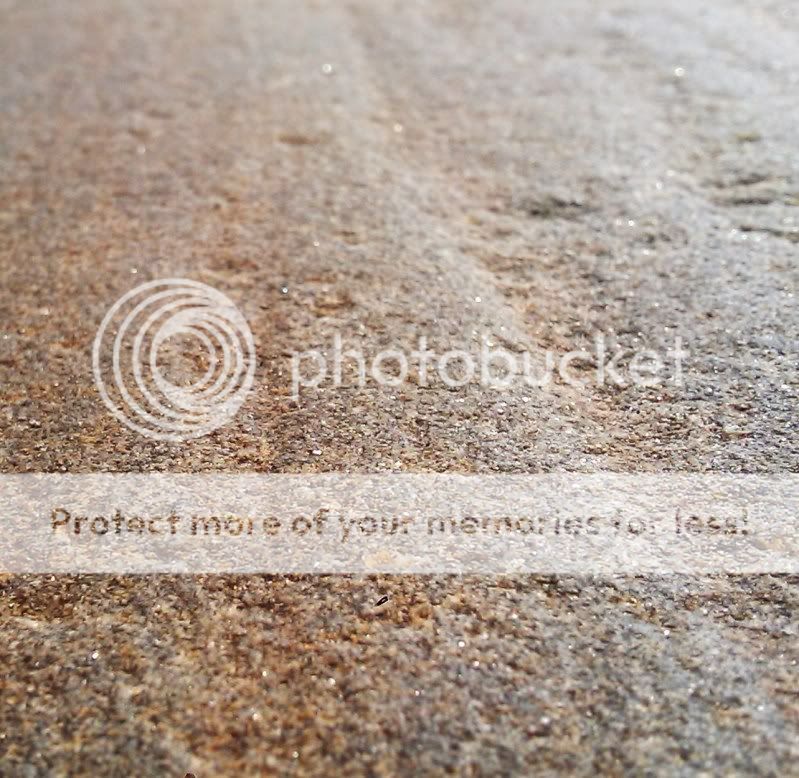
Närbild på isräfflor Maj-10
Closeup of glacial striation May-10
Frågor
1. I vilken kompassriktning rörde sig isen över hällarna på
Rypskär?
2. Hällarna består av stenarter som är olika hårda. Beskriv hur
färgen på den mjukaste stenarten där räfflorna syns tydligast
skiljer sig från färgen på de övriga stenarterna.
Isräfflorna är synliga fläckvis på ett ganska stort område, du
behöver inte leta efter exakt position.
Maila svaret på frågorna till mig, om du är en av de första att
besöka cachen, maila också vilken tidpunkt du var där så det går
att fastställa FTF.
English
A easy earthcace at a beautiful place. Bring a compass. Not
suitable in winter, can be dangerous in heavy weather. Park at
designated area and follow path close to the beach. The trail
disappears but it is an easy walk to the cache site.
This earthcache is about glacial striation, in this case a
easily overlooked geological site that tells a dramatic story of
something that happened during the last ice age that ended about 10
000 years ago. This are was covered with thick glacial ice that
moved slowly. On the bottom , rocks moved with the ice and were
dragged along. These rocks worked like a sand paper aginst the
bedrock, if the material in the rocks were harder than the material
in the bedrock long scratches were formed on the bedrock.
On the peninsula Rypskär there is a relatively large area of flat
rock very suitable to study glacial striation. Glacial striation
and the usual cracks in the rock have some notable differences.
Cracks are deep and have sharp edges while scratches made by
glacial striation are more shallow and have a rounder profile.
often the scratches are in the same direction, but there are
exceptions
Sometimes glacial striation is easier to spot if the rock is wet.
The angle of the sun also affect visibiliy. If you move your hand
across the rck the scratches feel like soft waves. When the
direction of the movement of the ice is to be determined watch the
bedrock closely. When the ice moved over the bedrock the side it
hit first is smooth and less steep. As the ice continued, pieces of
the other side of the rock broke loose and that is why the opposite
side of the rock is steeper and less smooth. If you keep this in
mind while you check the shoreline on either side of the flat area
at the end of the peninsula you will see which direction the ice
moved.The scratches are visible here and there in a rather large
area, no need to try to find the exact position of the
coordinates.
Questions
1 Which direction did the ice move over Rypskär?
2. The bedrock consists of rock of different hardness. Describe the
colour of softest rock where the scratches are most visible
Send me a mail with th answers of these questions and if nobody
logged yet include the time of your visit so FTF can be
determined.