
Ao contrário do que se possa pensar este troço não foi obra da Natureza mas sim humana:
“Antes deste canal ser aberto, o Vouga, no Murçaínho, tomava o sinuoso caminho do chamado Rio Velho até desaguar na antiga foz, já em terras marinhoas, no chamado Bico da Murtosa.
Em épocas de grandes cheias (…) o Rio Velho não tinha cava suficiente para dar rápida vazão às grandes enxurradas vindas da serra e dos rios que afluem ao Vouga na última etapa. A Barra, por seu lado, (…) obrigava a encerramentos temporários da Ria, com a natural e consequente retenção de lixos e putrefacção das águas.
Esta situação originava, cíclica ou esporadicamente, epidemias que desbastavam as populações ribeirinhas (…)
(…)em 1802 o princípe D. João tomou finalmente a decisão de entregar o Projecto da Nova Barra aos engenheiros militares Reinaldo Oudinot e Luis Gomes de Carvalho.
A Nova Barra foi finalmente aberta em 1808 (…).
(…) ora se o mal já não era tão gravemente desastroso, ainda assim proporcionava a que muitas enxurradas, pelo seu volume, continuassem a desbastar o campo agrícola (…) . Essa situação (…) estará na origem de uma ordem superior, dada em 1813, com o fim de melhorar a navegação (''rectificação e canalização'') dos rios Vouga, Cértima e Águeda. Finalmente nesse ano (…) foram iniciados os trabalhos de abertura do canal que ficou historicamente conhecido por Rio Novo do Princípe, nome que pretende homenagear o princípe D. João.
As obras foram orientadas pelo mesmo engenheiro hidráulico que abriu a Barra, e dadas por prontas em Dezembro de 1815, no que se gastou a importância de 12.468$604 réis.”
Em, “Rio Novo do Príncipe – causas e benefícios da sua construção em 1815”
Da abertura do canal resultou um melhor aproveitamento dos campos do Baixo-Vouga, com o natural incremento da criação de gado de trabalho – vacum e cavalar – de que a região se tornou farta e famosa, e um bom aumento na produção hortícola, no milho, feijão, abóboras, melões e melancias, com grande relevância no sector orizícola.
O percurso:
O percurso pode ser feito a pé, de bicicleta ou de jeep. Tem uma extensão total de cerca de 8 km. Em algumas épocas do inverno alguns troços podem ficar intransitáveis.
Embora não sejam pontos obrigatórios para a conclusão da cache, aconselho a visita dos Waypoints 1 e 2, onde se pode ter uma visão diferente da cidade de Aveiro. No caso de visitar qualquer um destes waypoints tenha atenção às marés do rio uma vez que o percurso pode ser transitável no trajecto de ida mas a maré poderá surpreende-lo e, para regressar, ter que molhar os pés. A visita destes dois waypoints adiciona cerca de 5 Km ao percurso e atenção, estes waypoints não são acessiveis por jeep.
Vá até às coordenadas iniciais. Aí encontrará uma placa inaugurativa da antiga Ponte do Outeiro que, agora desactivada e substítuida por uma nova apenas alguns metros a montante, serviu durante muitos anos de acesso a uma área agrícola bastante importante em Cacia. Na placa encontrará uma data, qual o ano dessa data? (A).
Avance agora, ao longo da margem do rio onde se encontra, para o segundo ponto da cache situado em:
N40º 41.(A – 1276)' W 8º 37.496'
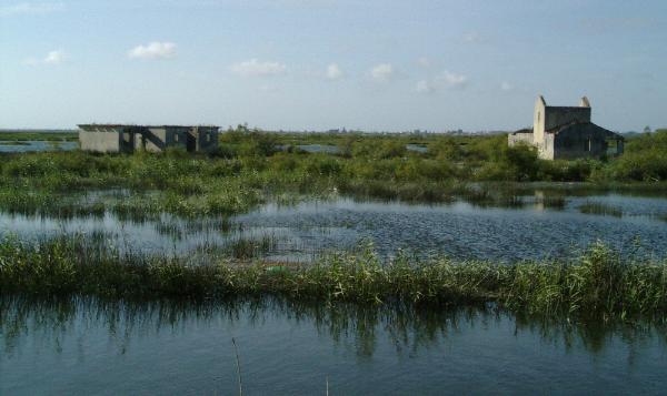
No seu caminho passará pelo pavilhão da Colectividade Popular de Cacia que possui um grande historial na prática de remo, contando com diversos títulos nacionais. O Rio Novo do Príncipe é a pista ideal para a prática deste desporto devido às suas condições climáticas e de correntes.
O local onde chegará é o que resta da Ponte de Vilarinho, um outro acesso que ligava Cacia aos campos agrícolas da zona do Baixo Vouga. A ponte foi destruída pelas cheias do inverno do início de 2014. É possível observar os restos de um velho batelão eléctrico que fazia a ligação entre as duas margens quando não existia qualquer ponte. Os animais e máquinas agrícolas eram transportadas nele. Qual o ano da data que consta na placa inaugurativa da ponte (que já não existe)? (B).
Agora faça o percurso de volta até à ponte do Outeiro para atravessar o rio para a outra margem. Depois dirija-se às coordenadas:
N40º 41.(B – 1175)' W 8º 36.689'
Encontra-se agora na ponte que atravessa o Rio Velho, era este canal que o rio Vouga seguia antes da abertura do Rio Novo do Príncipe, em 1815. Quantos pilares sustentam a ponte? (C)
Possui agora toda a informação para chegar às coordenadas finais. Aconselho seguir pela margem do rio onde se encontra:
N 40º 41.(C x 360 + 1)' W 8º 35.970'
Por favor, tenha algum cuidado na remoção e colocação da caixa.

Contrary to what one might think this channel was not the work of nature but instead of humans:
"Before this channel is opened, the Vouga, in Murçaínho, took the twisting path called the Rio Velho (Old River) until flowing into the former mouth, already on land near the coast, in the called “Bico da Murtosa”.
In times of major floods (...) the Rio Velho (Old River) had not enough discharge capacity to great floods coming from the mountains and the rivers leading into the Vouga in the last step.
The Barra, also (...) forced temporary closures of Ria, with the natural and consequent retention of garbage and whater rotting. This situation brough into being, cyclically or sporadicaly epidemics which reduced coastal communities (...)
(...) In 1802 the Prince D. João finally took the decision to entrust the project of the Nova Barra to military engineers Reinaldo Oudinot and Luis Gomes de Carvalho. The Nova Barra was finally opened in 1808 (...).
(...) the problem was not so seriously disastrous, but still it provided that many floods, by its volume, continuing to reduce the agricultural field (...). This situation (...) will result in a higher order, given in 1813, in order to improve navigation (''correct and plumbing”) of the rivers Vouga, Cértima and Águeda.
Finally that year (...)the opening works of the channel began and that was historically known as the Rio Novo do Principe (The Prince's New River), this name was given to it to honor the prince D. João. The works were directed by the same hydraulic engineer who opened the Barra, and were finished in December 1815, where it was spent 12.468 $ 604 réis (réis – portuguese money in 1815). "
In,"Rio Novo do Príncipe (The Prince’s New River) - causes and benefits of its construction in 1815”
The opening of the channel resulted in a better utilization of the fields of the Baixo-Vouga, with the natural increase in livestock work and a good increase in production of corn , beans, pumpkins, melons and rise.
The route:
The route can be done on foot, bicycle or jeep. It has a total length of about 8 km. In some seasons of winter some sections may become blocked by water.
I recommend the visit to Waypoints 1 and 2, although points are not required for the completion of the cache, but there you can have a different view of the city of Aveiro. In case you visit them pay attention to the tides of the river since the route can be passable in the outward journey but the tide may surprise you, and to return can be need to wet the feet. The visit to these 2 waypoints adds about 5 km in length to the journey. Please, pay attention, they are not accessible by jeep.
Go to the initial coordinates. You will find a plaque inaugurating the old Outeiro bridge. It is now disabled and was replaced by a new one just a few meters upstream but served for many years as an access to a very important agricultural area in Cacia. What is the year of the date on it? (A).
Go now to the second point of the cache located at:
N 40º 41.(A – 1276)' W 8º 37.496'
This is what remains from the Vilarinho bridge, that also connects Cacia to the farmland area of the Baixo-Vouga. You can see the remains of an old electric barge that was making the connection between the two sides of the river when there was no bridge. The animals and farm machinery were transported on it. What is the year of the date on the inaugurating plaque of the bridge? (B).
Using the same side of the river, go back to Outeiro bridge and cross the river. Than go to:
N40º 41.(B – 1175)' W 8º 36.689'
You are now on the bridge that crosses the Rio Velho (old river). Vouga river followed this channel before the opening of the Rio Novo do Príncipe, in 1815. How much pillars support the bridge? (B)
Now, you have all information to arrive to the final coordinates (use the side of the river where you are):
N 40º 41.(C x 360 + 1)' W 8º 35.970'
Please take some care in removing and replacing the box.