Welcome
The coordinates for this earthcache will take you to a point along the shore of Lake Lansing at Lake Lansing Park South in Haslett, MI. The entrance to the park (waypoint below) is on Pike St, just east of Marsh Rd. The park currently opens one half hour before sunrise for pedestrian access and 8:00am for vehicle access. The park currently closes one half hour after sunset, unless otherwise posted. There may be a fee for vehicles to enter the park, depending on whether the booth is staffed when you arrive. Pedestrians and bicycles can enter the park for free.
There is NO physical container located at the cache coordinates. This is an earthcache where you will make some observations and answer some questions via email to earn credit for finding the geocache.
We have attempted to make this earthcache wheelchair accessible. The parking lot is not currently paved, but there are drop-off points and there is a concrete sidewalk from the parking area to the cache location.
Lake Lansing
Lake Lansing is a 453-acre lake located in Haslett, MI. It is known to have served as a hunting and fishing ground for Indian tribes for centuries (burial mounds have been found around the lake that pre-date the Chippewa Indians). Early white settlers in the 1800s named the lake Pine Lake (the north and east part of the shoreline was surrounded by yellow pine, the only sizeable tract in Ingham County). The lake was described by early writers as being clear, and well stocked with various kinds of fish. The first dam at the outlet was constructed around 1909, at which time the lake was raised approximately three feet. The name of the lake was changed from Pine Lake to Lake Lansing in 1927. In the late 19th and early 20th century, the lake became a fashionable summer location. Over the following decades, the impacts of the various human activities in the watershed took their toll on the lake, and by the late 1960’s the lake had filled with silt and weeds. In 1978, the lake was dredged. Through careful management of the lake since the dredging, the lake has become a fairly popular recreational attraction once again.
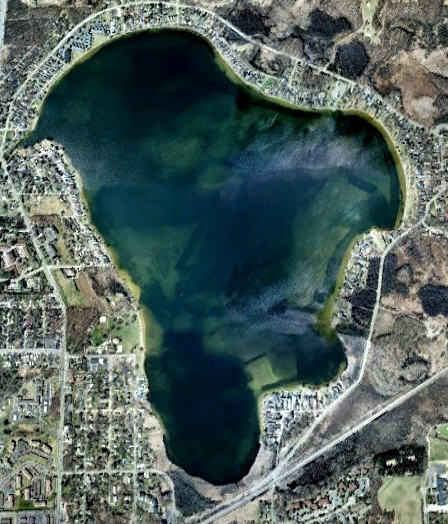
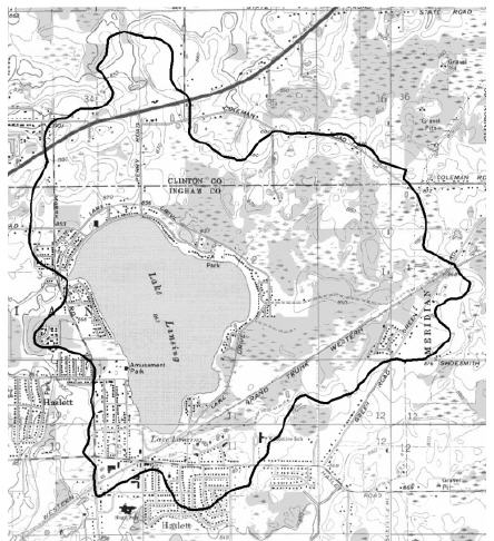
Lake Lansing is a relatively shallow lake today. The maximum depth is approximately 35 feet, but the mean depth of the lake is only around 9 feet. The current lake shoreline is 3.8 miles. The elevation of the lake is approximately 852 feet above sea level. The watershed area is a little over 2000 acres, and is shown in the following map.
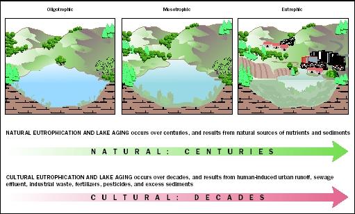
Lakes can be categorized on the basis of their richness in nutrients, which typically affect plant growth. Oligotrophic lakes are nutrient-poor lakes that are generally clear and have a low concentration of plant life. Mesotrophic lakes have an average level of nutrients and generally have good water clarity with some beds of submerged aquatic plant life. Eutrophic lakes are enriched with nutrients, resulting in extensive plant growth and algal blooms, and significantly reduced water clarity. The process by which a lake moves through these categories as it ages is called Eutrophication. The Eutrophication process can be greatly accelerated by human activity in and around the lake.
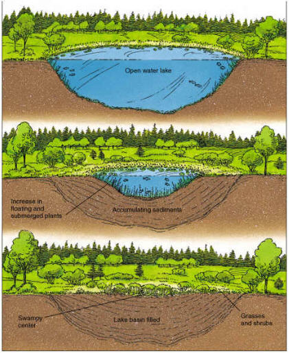
All lakes are temporary in terms of geologic time scales. Over time, a lake will fill with sediment and dead plant material until there is no longer any standing water. This process is called Lake Succession. The process starts with vegetation growing around the shoreline which eventually decomposes to form peat soils that fill the shallows, which in turn become habitat for other types of plants. The process continues as concentric rings of different vegetative types establish themselves, slowly filling in the lake and forming a wetland. In the final stages of succession, as the area becomes dry land, trees can grow in, turning the area into a forest.
The Logging Requirements for This Earthcache:
1) Post a photo of yourself, a member of your team, or your GPS at the cache location with the lake in the background along with your found log (example photo below).
If you are unwilling or unable to post a photo, as an alternative, email us the text on the Historical Marker located at roughly N 42° 45.264 W 084° 24.346 (do NOT include the text from the sign in your log).
2) Email us the answers to the following questions via our profile (do NOT include any answers in your log):
- Take a close look at the water (if it helps, take a sample in a clear container). Desribe what you see in the water. Based on what you see in the sample and in the lake here, would you say that the lake is Oligotrophic, Mesotrophic, or Eutrophic, and why?
- Based on the surface area and average depth of the lake given in the text above, approximately how many gallons of water does the lake contain? (note: 1 acre foot = 325,851 gallons) Does this surprise you?
- If there were no intervention (such as dredging), what would the future hold for this lake?
Note: If you visit in a wheelchair, please feel free to make your observations of the lake and take your photo anywhere along the sidewalk that runs along the shoreline.
Note: Logs indicating caching after park hours will be promptly deleted, and may result in our archiving this earthcache, as the County does not want geocachers in the park after hours.
Note: "The lake was frozen" is not an adequate response to the logging requirements. There is water under the ice, and tools available to access that water (just ask the ice fisherman on the lake). If you do not have the necessary tools, please come back when the lake is not frozen. Or, if you ask an ice fisherman nicely, they may let you take a water sample from their hole. (If you choose to go out on the ice, do so with caution - the ice is not always safe to walk upon.)
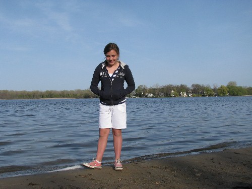
One of the little Allen Cachers at the beach
Many thanks to Ingham County Parks for allowing this earthcache.
We hope you enjoyed your visit to Lake Lansing!