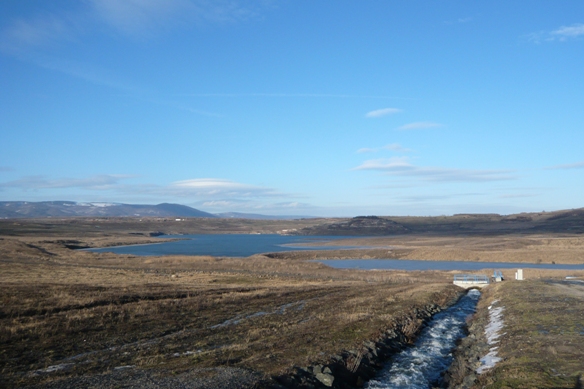
 Dne 24.10.2008 bylo zahájeno napouštení zbytkové jámy lomu
Most - Ležáky, jejímž zatopením vznikne jezero Most, jako
výsledek schváleného rešení zahlazování následku hornické
cinnosti lomu. Po ukoncení hydrické rekultivace zbytkové jámy tak
bude vytvorena vodní plocha o výmere 311 ha, maximální hloubka
jezera bude 75 m. Celkový objem vody v jezere dosáhne 68,9 mil. m3
pri kóte provozní hladiny 199 m.n.m. Hlavním zdrojem vody od
zahájení napouštení je voda z reky Ohre, privádena do jezera
v množství 0,6 - 1,2 m3/s z Nechranické prehrady na
Chomutovsku privadecem z prumyslového vodovodu Nechranice o celkové
délce 4,9 km. Napouštení by melo být ukonceno v roce 2011.
Vzniklé jezero má být využito k rekreaci, na brehu má
vzniknout nová mestská ctvrt a také zmenšené modely
významných budov puvodního starého Mostu.
Dne 24.10.2008 bylo zahájeno napouštení zbytkové jámy lomu
Most - Ležáky, jejímž zatopením vznikne jezero Most, jako
výsledek schváleného rešení zahlazování následku hornické
cinnosti lomu. Po ukoncení hydrické rekultivace zbytkové jámy tak
bude vytvorena vodní plocha o výmere 311 ha, maximální hloubka
jezera bude 75 m. Celkový objem vody v jezere dosáhne 68,9 mil. m3
pri kóte provozní hladiny 199 m.n.m. Hlavním zdrojem vody od
zahájení napouštení je voda z reky Ohre, privádena do jezera
v množství 0,6 - 1,2 m3/s z Nechranické prehrady na
Chomutovsku privadecem z prumyslového vodovodu Nechranice o celkové
délce 4,9 km. Napouštení by melo být ukonceno v roce 2011.
Vzniklé jezero má být využito k rekreaci, na brehu má
vzniknout nová mestská ctvrt a také zmenšené modely
významných budov puvodního starého Mostu.
 Since 24.10.2008 was started residual filling the pit quarry Most -
Ležáky, which created Lake Most flooding as a result of the
approved solutions smoothing effect of mining activities quarry.
After finishing hydric recultivation of residual hole will be
created on the water surface area of 311 ha, maximum depth of the
lake will be 75 m. The total volume of water in the lake reaches
68.9 million m3 while the kitten running 199 meters above sea
level. The main source of water from the start filling it with
water from the river Ohre, fed into the lake in the amount of 0.6
to 1.2 m3/s from Nechranické dam in the Chomutov industrial water
supply conduit Nechranice a total length of 4.9 kilometers. Filling
should be completed in 2011. The lake will be used for recreation,
on the lakeside will be build up a new town district, and also a
miniature park with important buildings from the original old town
Most will be there.
Since 24.10.2008 was started residual filling the pit quarry Most -
Ležáky, which created Lake Most flooding as a result of the
approved solutions smoothing effect of mining activities quarry.
After finishing hydric recultivation of residual hole will be
created on the water surface area of 311 ha, maximum depth of the
lake will be 75 m. The total volume of water in the lake reaches
68.9 million m3 while the kitten running 199 meters above sea
level. The main source of water from the start filling it with
water from the river Ohre, fed into the lake in the amount of 0.6
to 1.2 m3/s from Nechranické dam in the Chomutov industrial water
supply conduit Nechranice a total length of 4.9 kilometers. Filling
should be completed in 2011. The lake will be used for recreation,
on the lakeside will be build up a new town district, and also a
miniature park with important buildings from the original old town
Most will be there.
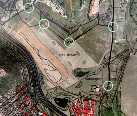
01.06.2009 byla verejnosti zprístupnena dosud uzavrená prístupová
cesta, která byla doplnena 5 informacními panely, a vznikla tak
zajimavá naucná trasa, která vás zavede až k samotnému
privadeci.
The access road, which was initially closed for public, was
supplemented by five information panels and since 01/06/2009 is
opened for public as popular nature trail which will takes you
close to the water supply conduit.
Vaším úkolem je absolvovat tuto naucnou stezku, a zjistit
odpovedi na otázky. Délka trasy je cca. 2,5 km, pocet zastávek
5.
Pro uznání vaseho logu mi zašlete pres profil
odpovedi na následující otázky:
1) Kterí zpevní ptáci se vyskytují v oblasti vznikajícího
jezera?
2) Kolik tun uhlí byla max. težba v dole Lom Most?
3) Jakým zpusobem je dotesneno dno jezera?
4) Jak byly rekultivovány jižní svahy jezera?
5) Kolik metru merí privadec vody z Ohre?
K logu prosim prilozte fotku sebe s jezerem v pozadi viz.
spoiler.
Your task is to complete the nature trail, and find answers to
educational questions. The length of the route is approx. 2,5 km,
with five educational stops.
If you want to log this cache, please send me answers for
this questions via profile:
1) What kind of songbirds could be found in the lake area?
2) How many tons of coal was up mining in the mine of Lom
Most?
3) How is a bottom of the lake seal?
4) How were recultivated southern slopes?
5) How long is the delivery conduit of water from Ohre?
Also please attach a photo of yourself, with the lake in the
background to your log - see spoiler.