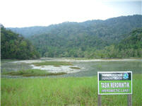
"The Meromictic
Lake" can be found in the Penang National Park which is located at the
North-East corner of Penang and fronts the Straits of
Malacca. It is about 30km from Georgetown (45 minutes by bus from KOMTAR to
Teluk Bahang), which is located approximately 400km from Kuala
Lumpur, Malaysia.
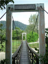
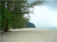
There are two main paths/trails in NP Penang: 1st to Muka
Head with 'worth-to-see' Muka Head lighthouse (path via beautiful Monkey
Beach) and 2nd to Teluk Kampi (via Meromictic Lake). From Main
Entrance in Teluk Bahang, where you should register yourself and
obtain entry permits (during year 2009 was entrance
FREE!), it takes cca 1 hour trek to get to the
Meromictic lake...
A meromictic lake
is a lake that contains a partially mixed or wholly unmixed water
layer that combines with the main water source during a given
cycle. This process is known as a Meromixts. At Pantai Kerachut,
the lake is comprised of both fresh and salt water. The term
Monimolimnion refers to the calm and current less state of the
water layer in the lakebed while the term Mixolimnion refers to the
free flow state of the meromictic lake's upper layer of water. The
margin between the two layers is known as the Chemocline.
The Meromictic lake in Pantai Kerachut is essentially a lagoon. It
is the only lake with meromictic characteristics in Malaysia and
its total area is estimated to be approximately 2.77 square
km. The lake receives its water supply from 5 river tributaries
that flow into it as well as from seasonal inundations of
seawater.
The lake also alternaly drains and fills at specific periods each
year. This phenomenon occurs in April and May each year when the
inter-monsoon period, a transitional phase between the North East
monsoon (November to March) and the South East Monsoon (May to
September), is in effect. This period is characterized by strong
winds and powerful waves accompanied by heavy rains. The winds and
the strong waves cause sea water to inundate the lake while,
simultaneously, blocking the outflow of the lake's waters into the
sea via sand deposition.
Consequently, the lake is inundated by both salt and fresh water
leading to the formation of 2 layers of water with differing
temperatures i.e., the upper layer comprising cool fresh water and
the bottom layer made up of warm salt water. The separation of the
2 layers is also attributable to density differences i.e., salt
water having a higher density than freshwater.
The lake's subsequent desiccation is attributable to several
factors. Among them, is the reoccurrence of the inter-monsoon
period, that signals the transition from the South West Monsoon
(May to September) to the North East Monsoon (November to March),
in October each year. This period often causes the occurence of
strong winds and waves which erode the sand deposits that block the
flow of water from the lake into the sea and this subsequently
drains the lake. Other factors include an overflow of lake water
that erodes the aforementioned sand deposits thus causing the lake
to be voided. In Malaysia, the meromictic lake is found only on
Pantai Kerachut within the Penang National Park.

Conditions for confirmation:
1) Picture of you or your GPS (near the lake) attached to
your log
Send me via email answers for these questions:
2) Maximum depth of the lake /in feet/
3) Who firstly used word Meromictic?
NOTE: Do not wait for my
confirmation, if you believe you have successfully completed all
Earth Cache goals and have already sent answers as requested,
please, feel free to log it as FOUND. I will verify your answers
later and, if necessary, contact you directly in order to make
corrections to your log...
PENANG National Park
********************
Land: 1181.949 ha
Sea: 1381.014 ha
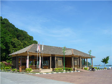
A) The main entrance to the park is located in Teluk Bahang.
Visitors should register themselves and obtain their entry permits
at the Penang National Park counter in Teluk Bahang.
B) The second entrance to the park is located at the Kuala
Sungai Pinang estuary in Balik Pulau. Visitors from Balik Pulau can
gain access to the Penang NP via the Kuala Sungai Pinang estuary.
To enter the park, visitors should board the tourist boats berthed
at the estuary. The Kuala Sungai Pinang estuary consists of a
mangrove forest and is an ideal location for bird watching as it is
a roosting area for numerous bird spices (among the birds commonly
sighted include Brahminy Kite, the common Sandpiper, the lesser
Heron and the White-Bellied Sea Eagle).
Useful links:
Map
of Penang
Transportation
(RAPID Penang)
Department of
Wildlife and National Parks (Malaysia)