Buitendijkse Zandplaten EarthCache
-
Difficulty:
-

-
Terrain:
-
Size:  (other)
Please note Use of geocaching.com services is subject to the terms and conditions
in our disclaimer.
Korte wandeling en klein trapje naar info paneel. Short walk and little stairs to info sign.
Het aardkundig monument bestaat uit de zandplaten Balgzand, Breehorn en Noorderhaaks. Alle drie zijn zij nog volop in beweging als gevolg van de getijbeweging in het Marsdiep. Het fraaie gebied waar u op uitkijkt is het Balgzand, het meest westelijke deel van de Waddenzee.
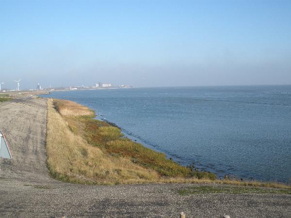
Dit gebied is constant onderhevig aan veranderingen door de aanvoer van zand en klei. Bij laagwater is het prachtige lijnenspel van de verschillende zandplaten te zien.
This geological monument exists of the sandbanks Balgzand, Breehorn and Noorderhaaks. All three are in movement because of the tide move in the Marsdiep. The beautiful area you see is the Balgzand, the most western part of the Waddenzee. This area is in constant change because of the supply of earth and clay. At low tide you can see the beautiful lines of the various sand banks
.
Het Balgzand is geologisch gezien een erg jong gebied, dat in korte tijd aan grote veranderingen heeft blootgestaan. In de Romeinse Tijd was er hier van wadden en kwelders nog geen sprake. Waar nu het Balgzand ligt, lag toen een uitgestrekt veengebied dat zich vanaf circa 5000 jaar geleden achter strandwallen langs de Noordzeekust had ontwikkeld. De bovenkant van het veen reikte in de Romeinse Tijd zelfs tot meerdere meters boven NAP. Via veenriviertjes, als het Oude Veer, werd dit veengebied naar het noorden ontwaterd.
The Balgzand is, as seen in a geological view, a very young area, that changed a lot in a short time. In the Roman days there were no salt marshes at all. At the area of the Balgzand was a stretched out peat area, that was developed from about 5000 years ago behind barrier beaches along the North Sea Coast. The top of the peat was a couple of meters above NAP in the Roman days. Through peat rivers, like the Oude Veer, this peat area was drained to the North.
Door inbraken van de Noordzee wordt de kust tussen 800 en 1300 na Chr. open gebroken, waarbij de zeegaten Zijpe, Heersdiep en Marsdiep ontstonden. Als gevolg hiervan werd een groot deel van het veen weggeslagen en veranderde het Balgzand in een gebied met wadden en kwelders. Dat kwam enerzijds door de stijging van de zeespiegel en toename van stormactiviteiten, maar vooral ook omdat het veen door landbouw en ontwatering was geoxideerd en gezakt. Wateraanvoer in het Balgzandgebied vond nu plaats vanuit het Marsdiep, vandaar de richting van de aanvoer en afvoer geulen. Vanuit het Marsdiep werd ook zand en klei aangevoerd, waardoor het waddengebied langzaam weer werd opgehoogd.
Because of various breakthroughs from the Noordzee the coast broke open between 800 and 1300 after Chr. and then the sea holes Zijpe, Heersdiep and Marsdiep were created. Because of this a great part of the peat was hit away and changed the Balgzand in an area with wads and salt marshes. Partly this was the cause of the rising of the sealevel and the build-up of the storm activities, but specially, because the peat was oxidated and lowered by the agriculture and the draining. The supply of water in the Balgzand area now came from the Marsdiep and this explains the direction of the ditches. From the Marsdiep sand and clay was supplied and so the Waddensea was slowly raised.
Maak een foto van jezelf met GPS bij het informatiepaneel, dit is nu natuurlijk niet meer verplicht, maar wel leuk en stuur een e-mail naar ons met de antwoorden op onderstaande vragen.
Make a picture of yourself with GPS by the info sign, this is no longer mandatory but nice and send an email to us with the answers on the questions, mentioned underneath.
LET OP : Een van de borden is verdwenen, dus tijdelijk 2 andere vragen !!!!!!!!!!!!!!
One of the signs is gone, so temporarily two diffferent questions !!!!!!!!!!!!!!
1. hoeveel water kunnen de voortstuwers per minuut afvoeren
1. how much water can the propagulators drain per minute
2. Wanneer is de spuisluis Oostoever gebouwd ??
2. When was the "Spuisluis Oostoever build?
3. Welke vogels staan er op het informatiebord beneden bij de trap getoond ?
3. Which birds are shown on the info sign underneath the stairs ?
4. Hoe is de richting van de geulen ontstaan ?
4. How can you explain the direction of the ditches ?
Additional Hints
(No hints available.)