Fairfax Stone Traditional Geocache
-
Difficulty:
-

-
Terrain:
-
Size:  (small)
Please note Use of geocaching.com services is subject to the terms and conditions
in our disclaimer.
The following is taken directly from Wikipedia:
Fairfax Stone Historical Monument State Park is a West Virginia
state park commemorating the Fairfax Stone, a surveyor's marker and
boundary stone at the source of the North Branch Potomac River in
West Virginia. The original stone was placed in 1746 to settle a
boundary dispute between Thomas Fairfax, 6th Lord Fairfax of
Cameron and the English Privy Council concerning the Northern Neck
of the Virginia. It determined the proprietorship and boundaries of
a large tract of mostly unsurveyed land in the English colonies of
Maryland and Virginia.
The exact boundaries of the "Northern Neck land grant" (later
called the "Fairfax Grant") had been undetermined since it was
first contrived in 1649 by the then exiled King Charles II. John
Savage and his survey party had located the site of the source of
the North Branch Potomac River (the northern boundary of the tract)
in 1736, but had made no attempt to establish the western
boundaries. A 1746 survey by Colonel Peter Jefferson and Thomas
Lewis resulted in both the placement of the Fairfax Stone as well
as the establishment of a line of demarcation known as the "Fairfax
Line", extending from the Stone to the south-east and ending at the
source of the Rappahannock River, a distance of 77 miles (124
km).
Because of bends in the North Branch Potomac River, the Stone is
only a county corner of West Virginia counties rather than part of
the border with Maryland. This issue was only resolved when the
Supreme Court ruled against Maryland in determining that Maryland
would only go up the Potomac far enough to meet a point where a
North line from the Fairfax Stone would cross the branch of the
Potomac. Without the ruling, the boundary of Maryland was
indeterminate. West Virginia counties—Tucker County and Preston
County— share the boundary marked by the Fairfax Stone (West
Virginia having seceded from Virginia during the American Civil
War).
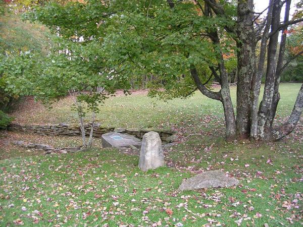
The original Fairfax Stone, in accordance with common surveying
practices of the era, was most likely simply a natural, unmarked
rock selected from among the outcroppings in the area. Legal
boundary disputes between Maryland and Virginia caused the latter
to relocate the stone in 1833 after the site had been lost to
memory. The stone was still intact in 1859 when one Lieutenant
Melcher found it again and ran the "Fairfax Line" on behalf of the
two States. The Stone was gone by 1909, however, having been
carried away by vandals. The present Fairfax Stone is a
replica.
Additional Hints
(No hints available.)