Tides are the result of the gravitational pull of the sun and moon on the oceans. The highest and lowest tides occur approximately two days after the new and full moon. These tides, referred to as spring tides, take place around midday - very convenient for rock pool enthusiasts! Following spring tides, the tidal range decreases until approximately one week later when the smallest tidal ranges occur - neap tides. Be sure to check the local paper for times of high and low water before going out on the beach.
So, when we are thinking about how such a small island can have such a large tide, we must remember its location in the English Channel. Consider, a massive bulge of water moving backwards and forwards twice each day and when it reaches the corner of the English Channel that Jersey lies in, this bulge of water really hasn’t got anywhere to go. Hence the huge high tides.
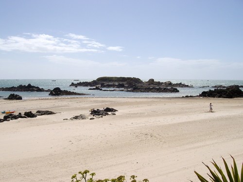
This beach area is all known as Green Island, but to claim this Earthcache you are interested in the island of rocks which lie on the SSW edge of the beach. To claim this cache you must do two things.
1) Look carefully at the tide line on Green Island which should be visible from the published co-ordinates. Estimate the height of the island above sea level and then estimate the height of the part that remains untouched by the high tide. Email your answers to us.
2) Post the tide times for the day of your visit in your log and email them to us saying whether they are neap tides or spring tides.
3) We would appreciate it if cachers could continue to post images of themselves or their gps device at the published co-ordinates, showing the rocks or Green island. This is optional.