The 'Parc National du Mercantour' was founded in 1979 and so it is the youngest of the seven french nationalparks. The second most important site of the Alps is located inside the Mercantour with the Vallée des Merveilles around the Mont Bégo.
Geography
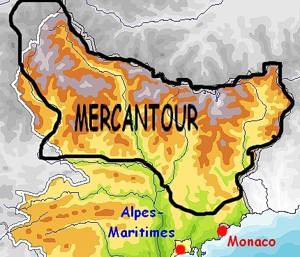
From the southeast of France (Provence-Alpes-Côte d'Azur/ PACA), the Mercantour extends from the Département Alpes-de-Haute-Provence in the west alongside he Italian border particularily over the Département Alpes-Maritimes and the northern parts of Vallée de L’Ubaye, Vallée de la Tinée, Vallée du Cians, Vallée de la Vésubie and Vallée de la Roya. The Mercantour nationalpark is divided up into two zones: The inner core of 68.500 ha and the surrounding zone of 146.000ha. The highest peak is the one of the Cime du Gélas (3.143m). There are also six more peaks higher than 3.000m, one of them is the Mont Clapier (3.045m), the most southern peak over 3.000m of the whole Alps.
History
The nationalpark was originally part of the Italian royal hunting grounds 'Valderi-Entraque', to which the northern part of the nationalpark still belonged until 1947.
After that the protectorate has benn constantly extened by France and has been declared a nationalpark in 1979. They cooperate closely with the Parco Naturale delle Alpi Marittime, which has even been fixed by a contract in 1987. Both administrations work together to build an 'European Nationalpark'.
Sights
Vallée des Merveilles 39.000 pictograms from the Bronze Age can be found in a height of 2.000 to 2.800m at the Mont Bégo, which are called Vallée de merveilles. It is the second largest site of the Alps for prehistoric engravings.
The most famous findings are 'Le Christ' and 'La Voie Sacrée'.
Musée des Merveilles, splendid Museum in Tede.
Sanctuaire de la Madone de Fenestre
Mont Mounier The symbolic mountain of the Département Alpes-Maritimes can be seen from far off with it's height of 2.817m. It is predestined for a one-day trip.
Lac d’Allos Located in 2.200m altitude, the Lac d'Allos is often described as the largest natural lake in such a height (le plus grand lac naturel d'Europe à cette altitude) .
Hiking
The regional and supraregional footpathes are very dense and in a good condition. Besides the legendary 'Sentier de la Grande Randonée GR5, which leads on it's way from the Genfer lake to Nizza directly through the Parc National du Mercantour, the GR52 and the GR52A 'Le Sentier Panoramique du Mercantour' particularily have to be mentioned. The Via Alpina, a newly built hiking way that links Germany, France, Italy, Liechtenstein, Monaco, Austria, Switzerland and Slovenia, leads through the Mercantour.
 |
 |
 |
|
Parc National de Mercantour
|
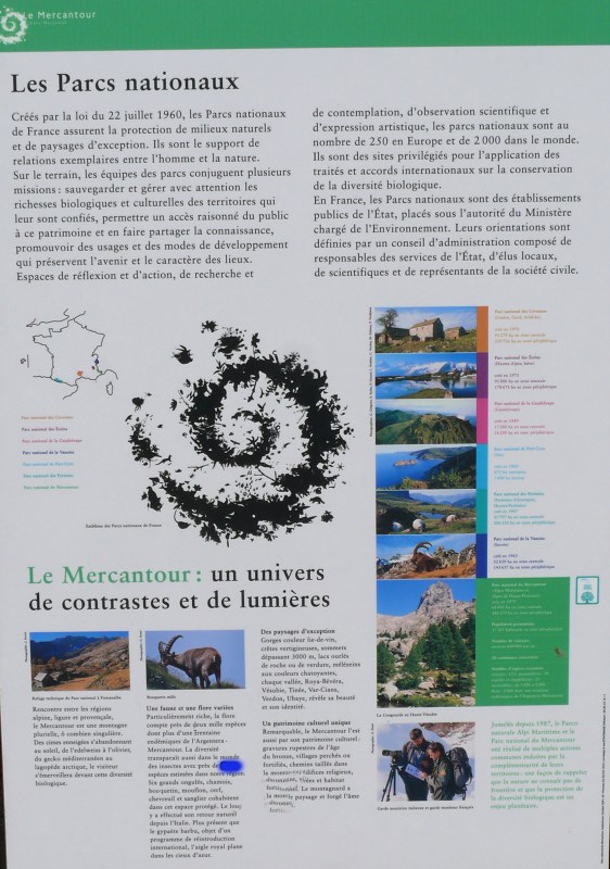
Infoboard
|
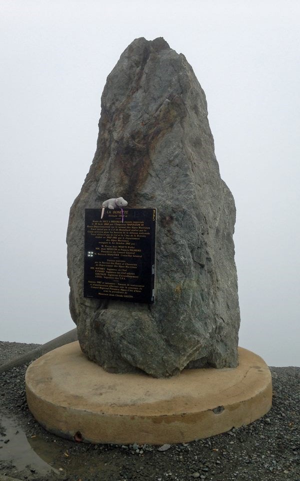
The menhir
|
How to log this EarthCache?
Send me your answers via my profile on www.geocaching.com
Find the information board near the given cache coordinates. Now find the sentence "La diversite transparalt aussie dans le monde des insectes avec pres de "X" especes estimees dans notre region" - and send me the number "X" written on the board.
What is the altitude of the information board at the Listing-Point in front of the menhir? Send me the height.
Take a photo of yourself in front of the menhir and add it to the log.
You can take a short walk to the top of the mountain for a even better view. Any photos of the surrounding area are appreciated, but are NOT a log requirment. Feel free to log after you send me the answers, I´ll contact you if anything is wrong.