|
De Bronnen
|
 |
|
| |
|
|
Het Springendal in Twente staat bekend als de ‘Tuin van Nederland’. Het water van de heuvels stroomt via beekjes en kleine watervalletjes naar schilderachtige kwelvijvers. Bos, hooiland, heide, akkers, heuvels, watermolens, historisch boerderijen en pittoreske dorpjes wisselen elkaar af.
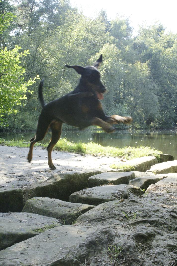
Zeldzame planten als de drijvende waterweegbree, vlottende bies en de gevlekte, breedbladige orchis gedijen op de vochtige bodem evenals watereppe, zeldzame goudveil en prachtige orchideeën. Het is een van de weinige gebieden waar de beekprik nog in de stroompjes zwemt. Er leven reeën, eekhoorns, konijnen en de ijsvogel is er te zien evenals de grote gele kwikstaart, spechten, uilen en diverse roofvogels.
|
 |
|
Het dal kent een lange ontstaansgeschiedenis. Twente was enkele miljoenen jaren geleden een ondiepe zee. Later kwamen de ijstijden, die een belangrijk stempel drukten op het landschap. Enorme ijsmassa's schoven zand, leem, en grind voor zich uit. Zo ontstonden de stuwwalcomplexen van Ootmarsum en Vasse.
De vorming door de jaren heen ging als volgt.
- 300.000 jaar geleden legden rivieren een laag van zand, leem en grind neer.
- 180.000 jaar geleden. Enorme ijsmassa’s stuwen dikke pakken met bodemlagen op.
- 110.000 jaar geleden. Oerloofbos bedekt Twente. Het klimaat is warmer dan nu.
- 60.000 jaar geleden. IJskoude stormen jagen veel zand op tot duinen.
- 5.000 jaar geleden. Oerloofbos en veen bedekken twente.
- 1.000 jaar geleden. Veel bos wordt gekapt voor landbouw.
Na de ijstijden werd het klimaat milder en het gebied werd door de mens beetje bij beetje in cultuur gebracht. Dat ging niet eenvoudig, want er waren veel natte plaatsen in het dal. De weinige droge plaatsen werden gebruikt om te wonen en om gewassen als rogge en spelt te verbouwen. Op deze manier ontstond een fijnmazig patroon van dorpen, landbouwgronden, houtwallen, heidevelden en natte hooilanden.
De bronnen ontstaan omdat het hemelwater zakt tot een dichte leemlaag, vormt ondergrondse stroompjes en komt weer als bron naar boven om de weg omlaag te vervolgen door meanderende beekjes.
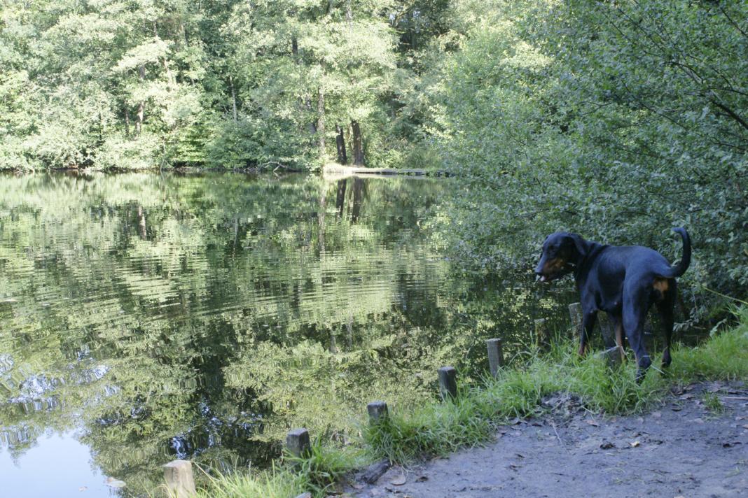
Het Springendal in gemeente Tubbergen is een erosiedal in de stuwwal van Ootmarsum (uit het Saalien) en een door Staatsbosbeheer beheerd natuurgebied. Het ligt ten noorden van Ootmarsum en ten oosten van Vasse, beslaat ongeveer 335 hectare. Het gebied staat bekend om zijn bronnen, beken, heuvels en grafheuvels.
In het natuurgebied ontspringt bronwater op drie plaatsen. Deze plaatsen zijn te herkennen aan de bosmeertjes die in het Springendal te vinden zijn. Eén meer is via de reguliere bospaden goed te vinden. De twee andere meertjes zijn minder bekend.
|
| |
|
De cache: Om deze cache te loggen moet je het volgende doen.
1. Maak een foto van jezelf en/of je team als bewijs dat je er echt geweest bent.
2. Voeg de foto toe bij je log. (indien de foto niet binnen 24 uur toegevoegd wordt, wordt het log zonder bericht verwijderd)
3. Stuur mij een persoonlijk bericht met het antwoord op de volgende vraag naar Bronnen@geoclub.nl.
Hoe diep is het water van de bron. (aan de waterkant kun je redelijk de diepte zien)
|
| |
|
|
The Springs
|
 |
|
| |
|
|
|
Het Springendal in Twente is known as “The garden of the Netherlands”. The water from the hills flow thru streams and small waterfalls to painting like ponds. Forest, meadowland, moor, fields, hills, watermills, historic farms and pittoresk villages change the scenery constantly.
Rare plants like the floating club-rush and others do well on the moist bottom even like beautiful orchids. It is one of the few places that even rare fish still swim in the streams. In the forest you can find deer, squirrels, rabbits en the kingfisher even like the grey wagtail, woodpeckers, owls, and various birds of prey.
|
|
The valley knows a long legislative history. Twente was several miljons of years ago a shallow sea. Later came the ice-ages, that left an important impression on the scenery. Enormous icepacks shoved sand, clay, and gravel in front of itself.
The shaping thru the years was as followed
- About 300.00 years ago rivers laid down a layer of sand, clay and gravel.
- 180.00 years ago enormous icepacks pushed up thick layers of ground.
- 110.000 years ago. Loaf forests covered Twente. The climate is warmer than it is now.
- 60.000 years ago. Ice cold storms blow up the sand and form dunes.
- 5.000 years ago. Loaf forests and turf cover Twente.
- years ago. Many forest are beeing cut down for acriculture.
After the ice ages the climate becam milder and the area was slowly brought in to culture by the humans. This was not easy, because of the many wet places in the valley. The few dry places were being used to live and grow crops on. This way the patern of the villages, farmlands, heathlands and wet meadowlands took form.
The springs exist because rainwater sank down to a tight mud lair, forms underground streams and comes up as a spring to continue its way down again true the small streams.
Het Springendal in the local authority Tubbergen is a weatheringvalley in the area of Ootmarsum en is a by Staatsbosbeheer (Govermental forest authotity) controlled national reserve. It lies north of Ootmarsum and east of Vasse and covers about 335 hectare. The area is known for its springs, streams, hills and barrows.
In this nature reserve the springs arise from 3 different places. These places can be recognized by the forest lakes that can be found in the Springendal. One lake can be found by the forest paths. The other two lakes are lesser known.
|
| |
|
The cache: To log this cache you must do the following.
1. Take a photograph of yourself and/or your team as proof that you have been there.
2. Add the photo to the log. (if the photo is not added to the log within 24 ours, the log will be deleted without a warning)
3. Answer me the next question in a e-mail to Bronnen@geoclub.nl.
How deep is the water of the spring. (if you stand close to the waterside you can see the bottom)
|