This is a cache for you who likes a walk in beautiful nature, in an area with a sports cabin and many trails marked for winter and summer. The walk is about 5.5 km each way and takes a little over an hour. Some of it can be cycled, but it is really a walking or ski tour. The route is marked with blue paint. The route also crosses "Olavsleden" - a footpath from Tistedal to Vamma on the Swedish border. 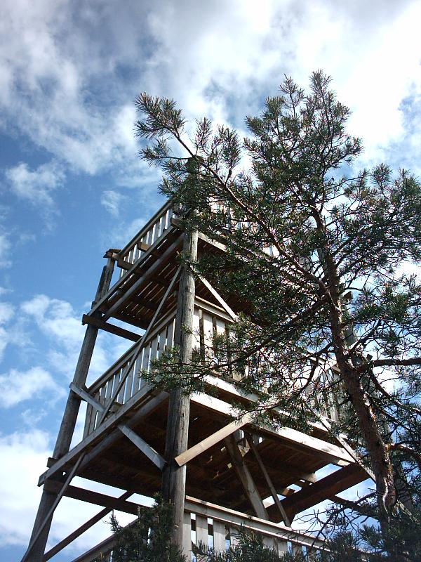
Turn off the main road onto a forest road signposted to "Sportshytta". I suggest you park by the waterworks and area with artificial snow cannons at the car-park for the country cabin called "Ertehytta". The trail starts here and is initially a forest road with a barrier to cars. Later, it becomes a footpath, at times difficult to follow with a bicycle.
The cache is a few meters from a newish unmanned wooden lookout tower that is four levels high and gives an excellent view. It is safe for children. The hill is about 220 meters. Nearby is a shelter where one sees signs of barbecues and fires. It is a good rest-place and shelter from weather.
The cache could be covered by snow, but it is in a sheltered place. On the way back, you can make a detour to the cabin, which is usually open to about 3 pm on weekends. Check this beforehand if you think you will need hot chocolate and a waffle :)
Alt route by Frodet: Park your vehicle at alt coord - room for 2-3 normal sized cars :) - at 127 m height. Follow path across railway, then the blue marked path to the right (Olavsleden/Ankersporet) for 2.5km one way.