O cerro de São Domingos é uma elevação com 381m de altitude, situada no Alentejo Litoral perto da aldeia de S.Luís, Odemira. Confina a Este com a bacia do Sado e a Oeste com a planície litoral originando solos formados por xisto, areia, arenito e cascalheira.
O uso do solo foi em tempos dominado por montado de sobro com pastagens, nas zonas de menor declive. Na parte mais elevada da serra predominam as matas plantadas pelo homem, o eucalipto pois claro. O sobreiral predomina na escarpa.
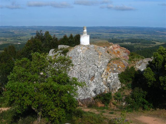
Neste local existiu em tempos uma ermida, restando ainda alguns vestígios sobre o afloramento rochoso do alto do monte. Houve alguma actividade mineira na serra, sobretudo de ferro.
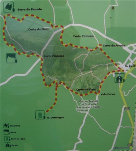
Para acederem à cache basta seguirem as indicações do percurso pedestre de S.Domingos que começa e acaba no largo da igreja, mesmo no centro da vila de São Luís.
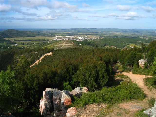
Do alto poderão ter uma vista magnífica sobre a serra de Monchique, Milfontes, Porto Covo, Sines e acompanhar parte do serpentear encantado do rio Mira por montes e vales até à sua foz.
Façam bem o trabalho de casa pois no acesso final ao Cerro de S.Domingos não aconselhamos o uso de viaturas ligeiras, estudem o melhor acesso e divirtam-se, o local foi recentemente limpo e é particularmente calmo e pacífico.
Esta cache também é uma homenagem aos meus compadres que escolheram esta pacata vila para viverem. Uma opção que nem todas as pessoas que conheço seriam capazes de tomar, depois de viverem 30 anos numa grande cidade. Se passarem muito depressa junto ao terreno dele a levantar PÓ, vão acabar por conhecê-lo, será o tipo que vai aparecer a gritar brandindo uma caçadeira :) !
[EN]The hill of São Domingos is an elevation of 381m in altitude, located in the Alentejo coast near the village of São Luis, Odemira. Confining East with the Sado river planes and west with the coastal plain soils formed from shale, sand and sandstone.
The use of the land was once dominated by "montado" with pastures in areas of lower slopes. In the highest part of the mountain forests planted by man, eucalyptus of course. The cork oaks predominates in escarpment.
In this place there was once a chapel, still are some traces on the rocky outcrop on the top of the hill. There was some mining activity in the hills, especially iron.
To access the cache simply follow the directions of the pedestrian route from São Domingos which begins and ends in the church square, in the center of the village of São Luís.
From the top you may have a magnificent view over the mountain of Monchique, Milfontes, Porto Covo, Sines and monitor the snake charmed path of the Mira river, througout valleys and hills until the end of his journey in the Atlantic Ocean.
Do well your homework because in the final access to S.Domingos Hill we do not recommend use of normal cars, find the better trail, have fun, the site was recently cleaned and the area is particularly calm and peaceful.