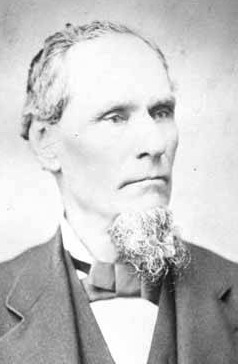
 The community of Longmire, in Mount Rainier National Park, is named after James Longmire, who is credited with discovering the mineral springs here in 1883. These springs are an important part of the history, geology, and ecology of this interesting area, so it might seem surprising to give this Earthcache such an irreverent name. But if Mr. Longmire were still around to tell the story, I think he would approve, knowing from personal experience that a good tale is good for business.
Mr. Longmire's tale might go like this:
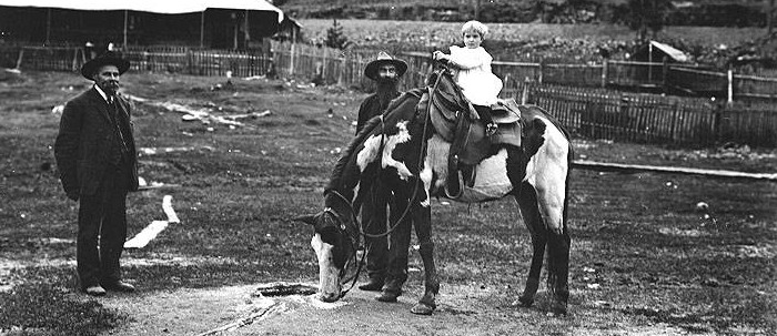
"I'd like to take credit for discovering this grand place, but I can't. That credit has got to go to my horse, Old Spot. I was comin' back from climbin' to the top of the mountain with Mr. Bailey and Mr. Van Drumpf, back in 1883. We were headin' back to Yelm, my winter home and where our pack train had started. Well, we had camped out over by the river not too far from here. Old Spot turned up missin'. I went lookin' for him, started followin' a deer path, and sure enough that path led right to the meadow beyond the trees here and there was Old Spot drinkin' from a bubblin' spring! Now I got kind of excited because I got an idea right then of the potential that this place held. As soon as I got back to Yelm I sent a sample of the water all the way to Chicago for testin'!"
James Longmire and his family returned to the springs in 1884 to build "Longmire's Mineral Springs" resort. Within a few years he had bath houses, plunge pools, and a rustic hotel. John Muir passed through on his own ascent to the summit in 1888, and wrote that Longmire told him to "drink at these springs and they will do you good. Every one's got medicine in 'em. A doctor said so – no matter what ails you." Our own studies show mostly a mix of soda, magnesium, iron, and sodium chloride, with traces of other minerals including arsenic. Don't drink the water!

Along the Trail of the Shadows, which begins at the marked location of this cache, you'll learn all about mineral springs and how they form, the local natural ecosystem, and the Longmire family and its role in the early history of Mount Rainier National Park.
To claim this Earthcache, you must do three things:
- Walk the Trail of the Shadows and take temperature measurements at three places: "Soda Spring," "Iron Mike," and, for comparison, the unnamed stream between Iron Mike and the Longmire Cabin. See details in the waypoint descriptions below. You may use your own thermometer, or borrow one from the Longmire Museum. After you make your measurements, record them in the logbook at the museum or, if the museum is closed, e-mail them to the cache owner.
NOTE: Soda Spring is wheelchair-accessible, Iron Mike is marginally so, and the stream is not at all. Visitors with mobility challenges may complete as much of the requirements as they are able to do, for full credit.
- (Optional) Post a photo either of a member of your team taking measurements, OR, like James Longmire, of your own unique discovery along the trail.
- Along with your photo, comment on your temperature measurements. Were the mineral springs warmer or colder than the stream, and by how much? Why do you think that was the case?
Waypoints:
- Longmire Museum
N 46° 44.992 W 121° 48.736
The Longmire Museum is open from 9:00 a.m. to 4:30 p.m. year-round. At the desk, identify yourself as a geocacher and ask to borrow the dictionary (trust me!) — in it, you’ll find a notebook for recording your data and a digital thermometer or two that you can borrow. (If the museum is closed, you can use your own thermometer and send your data to the cache owner by e-mail.) While you're there, browse the exhibits and learn about the geological, natural, and human history of Mount Rainier. You can also ask the ranger for help with the answers to the questions in the Sunshine Point Earthcache.
- Trailhead
N 46° 45.003 W 121° 48.790
The full loop trail is 0.7 miles long, and will take you past several mineral springs, wayside exhibits, a beaver pond, and remnants of the early history of Mount Rainier National Park. The first third going counter-clockwise, including Soda Spring (below), is wheelchair-accessible. Please stay on the trail to protect the natural environment.
- Soda Spring: ________° F (or °C)
N 46° 45.048 W 121° 48.775
Water from melting snow and rain, seeping into the ground on the slopes above you, is infused by hot gases rising from the volcano below you. This mineral-saturated water then flows downslope through the groundwater and resurfaces, releasing dissolved carbon dioxide as bubbles in the same manner as a carbonated soft drink. "Soda Spring," at this waypoint, sits next to the site of a log inn built by James Longmire in the mid 1880s. The Inn was gradually enlarged and improved over the years, and supplemented with bath houses and cedar tubs for soaking scattered throughout the meadow. The masonry around this spring was built about 1920. Take your first temperature measurement in this spring.
- Iron Mike: ________°F (or °C)
N 46° 45.173 W 121° 48.783
This spring was called "Iron Mike" because iron-rich minerals in the water stained the rocks around it a reddish color. The nearby cabin was built by Elcaine Longmire, James's son, as housing for hired help in about 1888. Elcaine took over the mineral springs enterprise in 1897 when James died, but continued to promote the springs as a medical wonder; a newspaper ad of the early 1900s claims cures for "rheumatic pains, catarrah, piles and other affliction that have been pronounced incurable." Take your second temperature measurement at this spring. The spring is marginally accessible to those with mobility challenges.
Stream: ________°F (or °C)
The stream that flows next to Iron Mike is not a mineral spring, and is fed by groundwater charged by snowmelt. Elcaine Longmire built a cold-house (no longer present) over this stream for storing meat and other provisions. Take your third temperature measurement in this stream. (Those with mobility challenges may skip this step.)
- Travertine Mound
N 46° 45.038 W 121° 48.911
Continue around the rest of the loop to learn more about the wetland and forest ecosystems around the meadow. You'll also pass a boardwalk leading to another mineral spring, called Travertine Mound. Here, you'll see deposits of calcium carbonate minerals, chiefly calcite and aragonite, that have precipitated out of the water along with iron and other minerals. To preserve the pristine quality of the springs, a temperature measurement is not required at this location, though you may take one carefully if you're curious. Looking across the meadow, you'll see that the Longmire family's hotels and plunge pools are gone. With the construction of the competing National Park Inn in 1906, the Longmire enterprise faded away. Elcaine died in 1915, and the family sold out its interest the following year. Today the area is preserved for its geological significance, natural environment, and human history.
Return your thermometer to the Longmire Museum, log your findings (or e-mail them to the cache owner), and then post your log entry and photo when you return home.
Oh, and if you happen to see Mr. Longmire's horse—let the rangers know at the museum!
New! The first year of data has been collected! Click here for a graph of the results!

2016 was the 100th anniversary of the National Park Service, and to celebrate, Visit Rainier and the Washington State Geocaching Association (WSGA) hosted the Visit Rainier Centennial GeoTour - 100 caches placed in and around Mount Rainier National Park. The geocaches highlighted the rich history, scenic wonders, quaint communities, and hidden gems of the Rainier region. The caches were released in four series of 25 caches each during 2015 and 2016.