Devil's Tower Traditional Geocache
-
Difficulty:
-

-
Terrain:
-

Size:  (regular)
Please note Use of geocaching.com services is subject to the terms and conditions
in our disclaimer.
We try to do a Kayak and Rafting trip each Spring on the Owyhee River is South Eastern Oregon. We love this place!
This year's trip started out in cold weather at the end of March. It was wonderful to have the place to ourselves. We did not see another human after we left Rome until we reached Birch Creek. It was a great trip - we even ended up having fine weather for most of it.
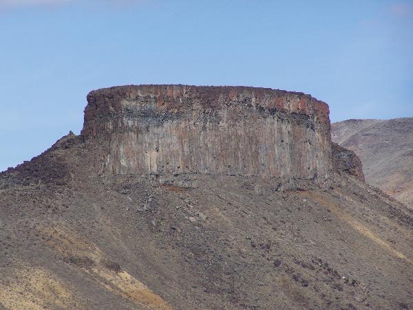
The camp at the hot springs across from the old Greeley Ranch is our second favorite campsite. The hotsprings is appreciated. I have been eying the formation known as"Devil's Tower" for some time and I was determined to put a cache there this year. Most of the crew decided to come along. It is about a 3 mile round trip and a 600 foot elevation gain from the camp. There are probably several ways to approach it but we had a relatively easy hike up to the saddle to the North East of the peak and then to the top.
The cache is in a 50 Caliber Ammo Can hidden in one of the larger sage bushes a little ways from the edge. There are some dead branches on it. It should be an easy find once you figure out how to get there. Please feel free to take another reading and post your coordinates.
This one is well worth the effort to get to. The view is unsurpassed.
Additional Hints
(No hints available.)