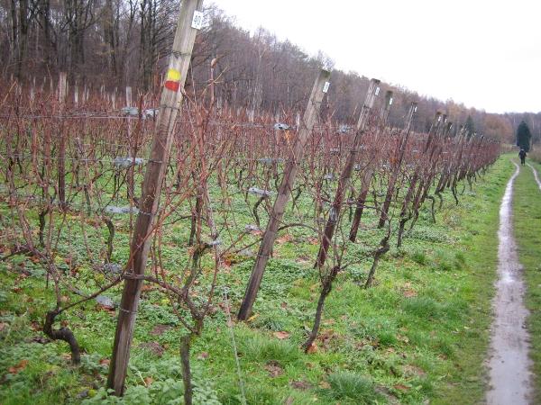
[ENG] The “wijnmuur” is a unique stonewall in Flanders of more then 1.5 km length on the crest of the “Wijngaardberg” in the village of Wezemaal, part of the municipality of Rotselaar. The wall was erected in 1814, to protect the vineyards on top of the hill against the cold northern winds. The region, known as “het Hageland”, is well known as one of the important regions of wine-growing in Belgium. There were already in the Middle Ages some vineyards on this hill, in spite of the northern position (latitude > N50°). Since March, 9th of 1995, the wall has been protected as monument. On your hiking tour, you’ll find on the southern slopes several new vineyards, as you can find them everywhere in France, an exception in Flanders.
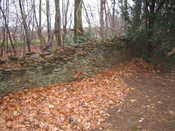
The “wijnmuur” or “stenen muur” (stonewall) was built with “ijzerstandsteen”, locally found.
To log this cache you’ll have to fulfill next charges:
1. All these stones, composing the wall, have a typical name, which points to their form (. . . . . . . . ijzerzandsteen). Use my geocaching profile to send me the answer.
2. Take a picture of you at one of the stones and post this one with your log after log permission of course.
You can leave your car at WP N50°56.850 – E004°45.921 nearby the chapel on a parking place.
--------------
NED] De “wijnmuur” is een unieke stenen muur in Vlaanderen, van meer dan 1.5 km lengte, op de kam van de “Wijngaardberg” in de deelgemeente Wezemaal, deel van de gemeente Rotselaar. De muur werd gebouwd in 1814, om de wijngaarden op de top van de berg te beschermen tegen de koude noordenwinden. De streek, gekend als “het Hageland”, is genoegzaam bekend als één van de belangrijke streken in België waar aan wijnbouw word gedaan. Reeds in de Middeleeuwen werden er wijnstokken verbouwd, ondanks de noordelijke ligging (meer dan 50 ° noorderbreedte). Sedert 9 maart 1995 werd de muur als monument beschermd. Tijdens je wandeling zal je meerdere nieuwe wijnaanplantingen terugvinden op de zuiderse hellingen, zoals je die overal in Frankrijk kan vinden, uitzonderlijk hier in Vlaanderen.
De “wijnmuur” of “stenen” muur werd gebouwd met ter plaatse gevonden ijzerzandsteen.
Om deze cache te kunnen loggen, de volgende opdrachten :
1. Welke specifieke benaming wordt gebruikt om de stenen waaruit de muur is opgetrokken te benoemen – duidt op de vorm van de stenen. ( . . . . . . . . ijzerzandsteen). Gebruik mijn geocaching profiel om het antwoord over te maken.
2. Neem een foto van je zelf, voor de muur, en publiceer na toestemming deze foto bij je logging.
Parkeren kan op WP N50°56.850 – E004°45.921, op een parking vlak bij de kapel.