It is possible to climb the volcano and for the fit and experienced
mountaineer the 3 day hike is a wonderful and exhilarating
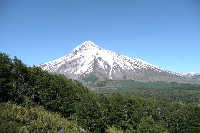
experience. However for the purpose of the earth cache we will
settle for a less challenging climb. There is a viewpoint at
39°34.972'S, 71°26.079'W near the Chilean border at Paso Tromen
(aka Paso Mamuil Malal) with great views of the volcano. The trail
starts at 39°35.320'S, 71°25.957'W and a moderately steep path
leads up the hill to the viewpoint.
Es posible escalar el volcán, y para los
experimentados montañeros y en buena condición física, la escalada
de 3 días es una maravillosa y emocionante experiencia. Sin
embargo, para el propósito del archivo de la tierra, empezaremos
por una menos desafiante ascensión. Hay un mirador en 39º 34.972'S
71º 26.079'W, cerca de la frontera chilena en el Paso Tromen
(conocido también como Mamuil Malal), con unas muy buenas vistas
del volcán. El camino empieza en 39º 35.320'S 71º 25.957'W, y con
una senda algo empinada nos lleva a la cumbre al mirador.

Lanín
is geologically one of the youngest volcanoes and is now extinct.
It is a stratovolcano, meaning it is tall, conical and composed of
many layers of hardened lava and volcanic ash. This is the result
of many periodic, explosive eruptions. The lava is viscous and
cools down relatively quickly so it doesn’t get the chance to
spread out but builds up high instead. Stratovolcanos are sometimes
called composite volcanoes referring to their layered structure
which is the result of many periodic outbreaks and following
inactive periods.
Stratovolcanoes typically occur at the edges of tectonic plates,
boundaries where oceanic crust is subsumed under continental crust.
Magma rises when water from hydrated minerals or porous basalt rock
is released into mantle rock above the sinking oceanic slab. The
water lowers the melting point of the overlying mantle rock, which
partially melts and rises due to its lower density relative to the
surrounding mantle rock. On its way through the crust the magma
incorporates silica rich crystal rock, leading to its final
composition.
One feature that distinguishes Lanín from other volcanoes in the
Andes is the colour of its volcanic rocks. In addition to the
typical grey gravel you will find rocks and pebbles of a different
colour. To log this earth cache, please mail the colour of the
rocks and, if you know, the type. Please post a picture of yourself
at the viewpoint with the volcano in the background.
Una característica que distingue Lanín de
los otros volcanes en los Andes es el color de las rocas
volcánicas. Además de la típica grava gris encontraremos rocas y
guijarros de diferentes colores. Para rellenar este archivo de la
tierra, por favor enviar vía email el color de las rocas, y si es
posible, el tipo. Por favor, enviar una fotografía vuestra en el
mirador con el volcán al fondo.
I am grateful to
José-Antonio for the Spanish translation.
