Le signal de la mère boitier

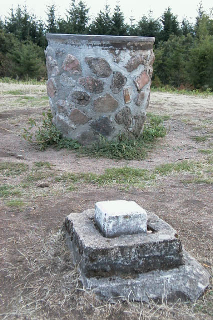
Table d’orientation et borne IGN
Le Signal de la Mère Boitier est un sommet situé sur la commune de Tramayes en Saône-et-Loire, dans la Bourgogne du sud. Du haut de ses 758 mètres, il est le point culminant des monts du Mâconnais, eux-mêmes situés sur la bordure orientale du Massif Central.
The Signal de la Mère Boitieris a high mountain located in the town of Tramayes in Saone-et-Loire, in southern Burgundy. From its 758 meters, it is the culmination of the mountains of Mâconnais themselves situated on the eastern edge of the Massif Central.
Depuis la table d'orientation, qu'on atteint par un sentier assez raide, on découvre un panorama étendu sur la Bresse, le Beaujolais et les monts du Mâconnais, avec leurs talus abrupts tournés à l'ouest et leurs flancs en pente douce orientés à l'est.
from the orientation table, we reached a path quite steep, we discover a panorama lying on the Bresse, Beaujolais and Mâconnais Mountains, with their steep slope turned to the west and steep slopes Fresh oriented to the east.
Ce sommet surplombe la région sur un rayon minimum de 6 kilomètres, distance à laquelle on rencontre un sommet plus élevé (759 m) appartenant aux monts du Beaujolais (commune de Saint-Jacques-des-Arrêts).
This summit overlooks the region on a minimum radius of 6 km, distance at which there is a higher peak (759 m) owned mountains of Beaujolais (region of Saint-Jacques-des-Arrêts).
Garez-vous sur le parking aux coordonnées N46°18.313 E004°37.908
Park on coordinates N46°18.313 E004°37.908
Rejoignez la table d’orientation aux coordonnées N46°18.151 E004°37.932 puis dirigez vous vers la cache qui est une boite de bonbons pouvant recevoir de petits objets
Join the orientation table coordinates N46 ° 18,151 E004 ° 37,932 and then go to the cache that is a box of candy can accommodate small items