[FRANCAIS]
Cette balade de 2 à 3 heures vous fera découvrir une source captée depuis 1896 pour alimenter Vallon Pont d'Arc.
Vous pourrez ensuite redescendre si vous le voulez en longeant ou dans le lit de la rivière (qui ne présente que quelques résurgences en été).
Partir du petit village de Chames (DC) (vous pouvez prendre de l'eau à la fontaine) et suivre le sentier (prendre à gauche à la première bifurcation) qui vous mènera en 1h à la source au fond du cirque (en plein soleil, prévoir de l'eau et un chapeau quand il faut chaud).
Pour profitez au maximum du paysage descendez le long du lit de la rivière.
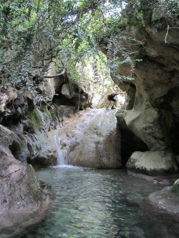
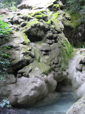
L'eau chargée a déposé son calcaire sur les roches, les arbres, les feuilles créant une atmosphère de grotte à ciel ouvert.
Admirez au passage : La cascade (CA), le bassin (BA), la grotte, les ruines du Moulins (MO -
GC1N3GQ). Si dans le bas du parcours vous passez par une ferme (le chemin passe à travers), faites vous discret, les personnes âgées qui y vivent ne sont pas toujours aimables.
Rejoignez ensuite la route à proximité de la confluence avec l'Ardèche.
[ENGLISH]
In this walk of 2 or 3 hours you will discover a spring exploited since 1896 for Vallon Pont d'Arc.
If you want, you can come back along the river bed (which has only a few re-emerge in summer).
Starting from the small village of Chames (DC) (you can take water from the drinking fountain) and follow the path (take the left way on the first junction).
It will last 1 hour to the spring at the end of the cirque (in full sun, provide water and a hat when it comes to hot).
For more pleasure, get back by the riverbed.
The water had left limestone on rocks, trees, leaves creating an atmosphere of open cave.
Admire during the trip: The waterfall (CA), the basin with it’s spring (BA), the cave, the ruins of mill (MO -
GC1N3GQ).
If at the bottom of the trail you pass by a farm (the road passes through), be quiet, the elderly who live there are not always kind.
Then join the road near the confluence with the Ardèche.