This is the valuable Greensand Ridge with its woodlands, valleys
and hills gently sweeping through the countryside. There is a
narrow escarpment formed of Lower Greensand, with a distinct scarp
slope to the north-west and a dip slope to the south-east. Some of
the hills have been covered with conifers as humankind made their
impression on the landscape but with its uncharacteristic soil of
the region it holds a diversity of flora and fauna supported by its
distinct geological consistency. The ridge holds sand which creates
an acidic belt of land where heathland, acid grassland and ancient
woodland flourish. The more common fauna of the coastal sand
settings can be found here with the adder and common lizard. The
nightjar, woodpecker, buzzard, muntjac deer (which is the symbol
for the Greensand Ridge Walk), green tiger beetle, small-leaved
lime, bluebells and lily-of-the-valley are found in the woodlands.
>
The Greensand Ridge was formed about 145 million years ago and
is the outcrop of the Cretaceous period that runs through the
middle of Bedfordshire. Greensand sandstone is unique in the area
with its content including an iron bearing mineral causing a green
tint. The geology of the ridge consists of the Lower Greensand and
this comprises of a series of sands, often stained yellow, orange
or brown due to the presence of iron. In the east of Bedfordshire
these sands are known as the Potton Sands and further west, towards
Buckinghamshire, as the Woburn Sands. The sandstone is made up of
layers of sand, clay and chalk which were deposited in a shallow
sea during the Lower Cretaceous Period 120 million years ago and
hardened over time. Beds of decomposed volcanic ash, known locally
as “Fullers’ Earth”, are found at some locations
in the Lower Greensand succession. The movement of the earth caused
the layers to crease and buckle into the ridge itself then as the
glaciers retreated 12,000 years ago the valleys were gorged out.
These glacial valleys are mainly dry but the Ivel valley in Sandy
is an example of a wet habitat interrupting the ridge.
>
The River Flit and Ouzel are the major water sources in the
Greensand Ridge adding moisture to the valleys. The flood meadows
and mires which occur near the rivers provide natural habitat for
willow, black poplar, sphagnum moss and water rail. Heather and
gorse are common plants found on the ridge, a shocking contrast
when approached from the clay surrounds, where these plants just
will not grow. The sand enriched land has long been quarried to
provide building material for the local region. An example of a
distinct sandstone building in the region is Northill church. Many
of these quarries have been excavated to their limits and then left
to nature, creating new, natural habitats with lakes, sandy shores
and gravely beds.
>
Following the Greensand Ridge is the walk which hugs the brow of
the crest. The Greensand Ridge Walk traverses 40 miles from
Leighton Buzzard in the west to Gamlingay in the east, passing
through the villages of Heath and Reach, Woburn town, Eversholt,
Millbrook, the edge of Ampthill and Maulden, Clophill, Haynes,
Northill, Sandy and Everton. There are well maintained paths
passing through kissing gates, over footbridges and along the small
country roads. There are a number of historic parklands and
estates, including Woburn, Haynes, Shuttleworth, Sandy Lodge and
Southill along the route. The walk was first created in 1976 to
enable the population to explore the wealth of heritage and
wildlife on the ridge. In 12 months, 50 stiles, 12 small sleeper
footbridges, 10 gates, 4 sets of steps, 130 waymark posts, 2
five-metre bridges and 110 walk signs were erected, costing a total
of £30,000, half of which went on building a new footbridge
over the Ouzel. It was a conjunction of co-operation between the
Bedford Rambling Club and Bedfordshire County Council and after
several years of waymarking the walk it was officially opened on
19th October 1986 by Sir Derek Barber, then Chairman of The
Countryside Commission, in the grounds of Woburn Abbey. In 2004 the
walk was updated and improved as Bedfordshire County Council worked
in partnership with the Greensand Trust, the Ivel and Ouse
Countryside Project, Mid Beds District Council, the Long Distance
Walkers association, Ramblers Association and Bedfordshire Rural
Communities Charity. The relaunch was held in Ampthill Park,
adjacent to Katherine's Cross. This long belt of land was once part
of Henry VIII’s hunting ground and excellent views over the
valleys can be enjoyed. Walking on the Greensand Ridge is one of
the only areas in Bedfordshire to walk without becoming 6 inches
taller from the clay stuck to your shoes!
To claim this Earth Cache you must complete a short walk
taking you through the edge of Haynes village; the middle part of
the Greensand Ridge. Complete the activities below and ensure you
post the pictures on the cache page and send us an email with the
correct answers. Please don’t mention the answers in your
logs as they will be deleted if they give the game
away.
Park at N52 03.515 W000 23.660
This is the junction of the Greensand Ridge Walk as it climbs
into the village. There are good views across the landscape in
which to see the distinct escarpment. Walk up the hill to N52
03.740 W000 23.672.
1. What is the Elevation of the ground at this point?
2. Where is the highest point of the Greensand Ridge
Walk?
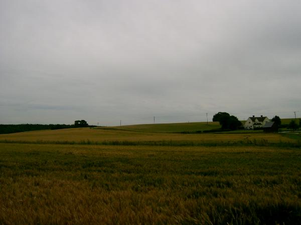
Take a photograph of yourself (or your GPS if on your own)
with Hill Farm house in the background (Style 1 in the
gallery).
The second location is at N52 03.561 W000 23.204. Continue up
the hill and along Northwood End Road to find the kissing gate.
This area is known locally as the ‘Sandpit’ and the
short walk takes you from Northwood End Road to Appley Corner.
Though not part of the Greensand Ridge Walk it shows the Greensand
Ridge consistency here as there is a big hole in the ground!
Take a photograph of yourself (or your GPS if on your own)
with the big oak trees in the background (Style 2 in the
gallery). These old trees include a striking dead one in the
middle of the small copse and views of the ridge in the
background.
3. What are the main types of slope which occur on the
Greensand Ridge, which orientation do they occur on and what do
these terms mean?
4. The views of the ‘Sandpit’ are best at N52
03.586 W000 23.173. Which notable animal now calls the
‘Sandpit’ its home?
Now continue back to your car by walking along the road via N52
03.432 W000 23.306. This takes you past Appley Corner where the
Greensand Ridge Walk continues up the hill along the side of
Chicksands Wood. Continue past here along the road and grass verge
path to return to your car.
We hope you have enjoyed this Earthcache and have learnt
some valuable information about the area.
FIRST TO FIND:
WELL DONE ELEPHANT HUNTER!
>