Ausgangspunkt für eine schöne Burgentour im Allgäu ist Eisenberg. Die angegeben Koordinaten sind "fiktiv", aber liegen doch sehr in der Nähe der richtigen noch zu ermittelnden Werte.Parken kann man dort beim Fremdenverkehrsamt.Von dort aus ist der Weg zu den zwei Burgruinen EISENBERG und HOHENFREYBERG ausgeschildert. Man nimmt ab dort den steilen Anstieg, der hinter dem Verkehrsamt beginnt. Der Weg geht bergan durch Wald. Vor dem Erklimmen der Burgen - oder auch danach - kann man auf einer Alpe Rast machen. Als Rückweg wird der Fahrweg empfohlen, der genau zum Verkehrsverein zurückführt, das letzte Stück allerdings entlang der Strasse. In dem nebenan gelegenen Restaurant kann man die Tour hervorragend mit "Speis und Trank" beenden.
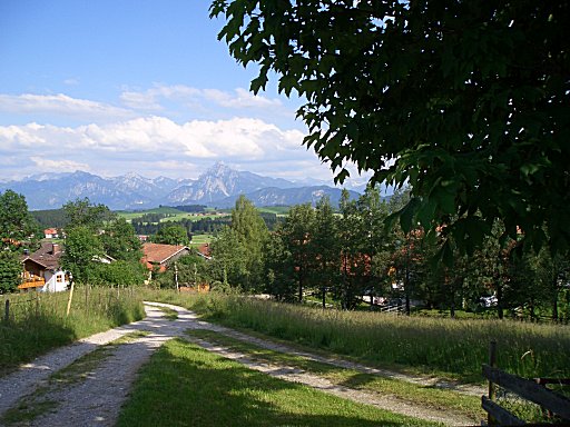
Die Listingkoordinate liegt auf dem Aufstiegsweg an einer Stelle, von der man einen wunderschönen Blick auf Ludwigs Schlösser und die umliegenden Berge hat. Er liegt SEHR NAHE - ca. 250 m - von den angegebenen Koordinaten entfernt und kann mit dem Hint schon so gefunden werden. Um die exakten Koordinaten zu ermitteln, müssen die letzten drei Stellen der N - und E - Koordinate aus dem Binärsystem ins Dezimalsystem "übersetzt" werden.
N 47º 36.II0II0000I
E 10º 35.IIII0III00
Als zusätzliche und freiwillige(aber bisher gern erfüllte  ) Logbedingung zum obligatorischen Logbucheintrag soll ein Bild mit dem Cacher – vor einer der beiden Burgen - hochgeladen werden.
Auf Muggels sollte man achten.
) Logbedingung zum obligatorischen Logbucheintrag soll ein Bild mit dem Cacher – vor einer der beiden Burgen - hochgeladen werden.
Auf Muggels sollte man achten.
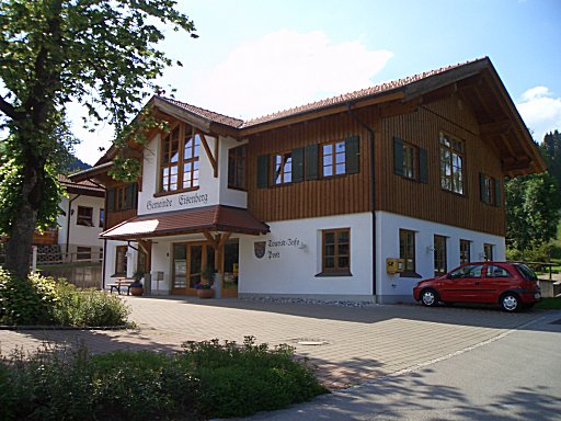
Starting point for a nice castle tour in the Allgäu is Eisenberg. The coordinates are given "dummy", but they are very near the right values to be determined.You can park there at the tourist information office. From there the way is signposted to two castle ruins EISENBERG and HOHENFREYBERG. Please take the way which begins behind the information office. The way goes uphill by wood. Before climbing up to the castles - or also afterwards - you can make a comfortable rest at an "alm". For the way back I recommend the long way down, although cars are driving there. In the restaurant situated next door to the tourist information office you can finish the tour with a refreshing drink and excellent food.
The Listingkoords are to find on the rise way at a place from which you have a wonderful look at Ludwig's castles and the surrounding mountains.The position is very close - 250 m -to the given coordinates and you can find it - looking to the hint - without your GPS
To determine exact coordinates, the last three digits of the N - E - Coordinate have to be “translated” from binary to decimal system.
N 47º 36.II0II0000I
E 10º 35.IIII0III00
As an additional and voluntarily logging condition (till nowadays with pleasure fulfilled  )load up a picture of the finder in front of one of the castles
One should pay attention to Muggels.
)load up a picture of the finder in front of one of the castles
One should pay attention to Muggels.
 Logbar auch unter: http://www.opencaching.de/viewcache.php?wp=OC5E5D