Mittåkläppen Traditional Geocache
-
Difficulty:
-

-
Terrain:
-

Size:  (small)
Please note Use of geocaching.com services is subject to the terms and conditions
in our disclaimer.
Mittåkläppen, 1212 meter över havet / above sea level.
Denna karakteristiska topp med sin branta östsida brukar ofta utgöra motiv på vykort och användas i andra sammanhang för att ge en bild av västra Härjedalen. Hit kommer man lättast genom att vandra upp söderifrån från Djupdalsvallen, som man i sin tur kommer till via väg från Bruksvallen. Notera att denna väg sköts privat och kostar 40:- att använda. Avgiften betalas med kort i en automat och ger en biljett som används för att öppna bommen.
Cachen ligger på betryggande avstånd ca 10-15 meter ifrån branten. Man behöver alltså INTE klättra för att nå den!
This very distinctively shaped peak with its steep eastern side is often used on postcards and in other contexts for symbolising western Härjedalen. The most common way of getting here is to hike up from Djupdalsvallen. To get to Djupdalsvallen, take the road from Bruksvallarna. Note that the road is privately held, and there's a fee of 40 SEK to use it. The fee is paid by card in a machine and you will receive a ticket to open the road barrier.
The cache container is located about 10-15 meters from the edge. Climbing is NOT necessary to reach the cache!
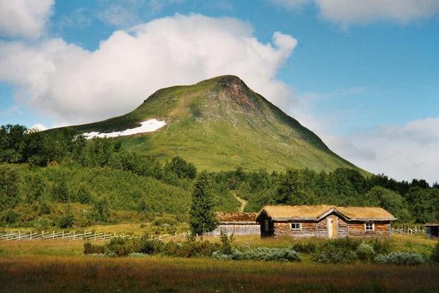
Mittåkläppen. Photo by Elsy Hammarlund.
Additional Hints
(Decrypt)
[SWE] V ra uåyvturg haqre iäafgen xnagra (seåa oenagra frgg) ni ra pn 1,5z oerq fgra.
[ENG] Va n perivpr gb gur yrsg (ivrjrq sebz gur iretr) haqre na nccebkvzngryl 1,5z jvqr ebpx.