This cache brings you to the area where Lemuel Bolles erected
the first commercial flour mill in the Minnesota country. The only
thing that remains from the mill is the nice creek that runs
nearby. There’s also a nice bike and hiking trail.
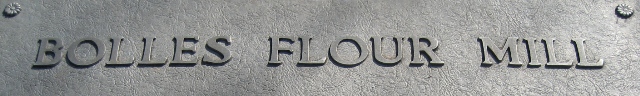
Coordinates above will bring you to a historical marker which
tells briefly about Lemuel Bolle’s mill. To get to the final
cache, read the plaque which will give you the data you need.
Final is located at:
N44 54.A B C
W092 46.D E F
Where:
A = Fourth digit of the year Lemuel Bolles died
B = Second digit of the year Lemuel Bolles died
C = six
D = Second digit of the year Lemuel Bolles erected on this creek
the first commercial flour mill in the Minnesota country
E = zero
F = Fourth digit of the year the sign was erected by the
Washington County Historical Society in cooperation with the MN
Highway department
Cache is a small lock-n-lock container and is located just a few
feet off the main bike trail. Once you decipher the final
coordinates enjoy the short walk on the nice path to the final
(please rehide as you find it). If you have a few extra minutes,
take a walk down to the small bridge crossing the creek. Enjoy your
visit!