CABO GIRÃO EARTHCACHE - M9

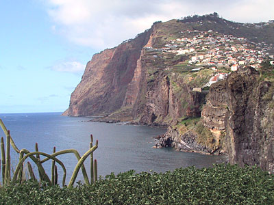
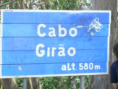
According to locals, at 580 metres high Cabo Girão is the highest sea cliff in Europe and the 2nd highest in the world so it is an obvious place for Madeira's 2nd earthcache.
 Most lists put the Norwegian cliff at Preikestolen higher with a 604 m drop so Girao may only be the 2nd highest in Europe. .
Then again, Cape Enniberg in the Faroes is quoted at 750m high and cliffs at Table Mountain and some in Hawaii fall over 1000 metres into the sea according to Wikipedia.
However, the highest sea cliff in the world that I have found reference to is in Torssukatak Fjord (Southern Greenland) where there is a vertical rock wall of over 1500m which falls directly into the sea and, yes, it has been climbed!
The high sea cliffs found around 80% of the coast of Madeira result from the sea erosion to which the island, which was created by volcanic eruptions between 20 and 1.7 million years ago, is permanently subject. Sometimes this causes sections of a cliff to collapse, creating flat fan shaped pieces of land at the base, known as ‘fajãs’ which are often cultivated.
Just to the west of the old fishing village of Camera de Lobos (which became a city in 1996!) is the huge cliff of Cabo Girãu. At 580 metres high it is one of the highest sea cliff in Europe and indeed the world. Lots of bus tours visit the viewing point at the top of the cliff and you might have to fight your way past other tourists and trinket-sellers to get to the railings to view the huge drop but it is worth it! Far below you can see the cultivated terraces (‘poios’) where vegetables and other crops such as bananas and sugar cane are grown.
The EarthCache:
1) To log a found in this EC, observed (very carefully) how many "fajãs" you can see at the base of the clif in the given coordinates and send me the answers to the mail.
2) A photo on your site (optional), with your GPS in hand, would be welcome..
After sending the answers by e-mail you can log the Earthcache. If there is any doubt regarding the answers you will be contacted to clarify it.
NOTE “FAJÃS” are flat, fan or triangular shaped pieces of land at the foot of cliffs and are the result of part of the cliff collapsing. They should not be confused with “poios” which are the rectangular cultivated plots of land often found on “fajas”. In the photo below ONE faja / landslip is circled.
 The most exciting way to learn about the Earth and its processes is to get into the outdoors and experience it first-hand. Visiting an Earthcache is a great outdoor activity the whole family can enjoy. An Earthcache is a special place that people can visit to learn about a unique geoscience feature or aspect of our Earth. Earthcaches include a set of educational notes and the details about where to find the location (latitude and longitude). Visitors to Earthcaches can see how our planet has been shaped by geological processes, how we manage the resources and how scientists gather evidence to learn about the Earth. To find out more click HERE.

 Um ponto obrigatório de turismo na ilha da Madeira é o Cabo Girão que se eleva a 580 m acima do nível do mar.
A EarthCache:
1) Para poderem logar um found nesta EC, observem (com muito cuidado) Quantas fajãs estão na base da arriba e enviem-me a resposta para o mail.
2) Uma foto tua no local (facultativa), com o teu GPS na mao, seria bem vinda.
Depois de enviar as respostas pode fazer o log, caso exista alguma duvida em relação ás respostas dadas serão contactados para esclarecer.