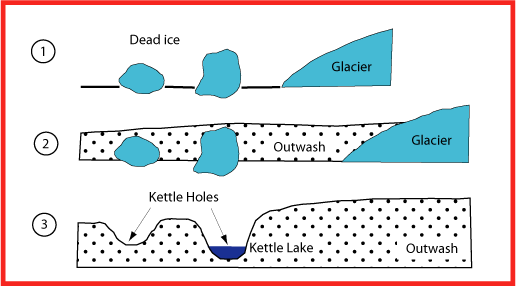
Many glaciers advanced and retreated during the Ice Age, with the last advance in our area referred to as the Vashon glaciation. As the Vashon glacier moved across Whidbey Island it left large chunks of ice. The melting chunks left behind large indentations in the landscape called kettle holes. A kettle (or kettle hole) is a fluvioglacial landform occurring as the result of blocks of ice calving from the front of a receding glacier and becoming partially to wholly buried by glacial outwash. When the development of numerous kettle holes disrupt sandur surfaces, a jumbled assemblage of ridges and mounds form, resembling kame and kettle topography. A kame is a geological feature, an irregularly shaped hill or mound composed of sorted or stratified sand and gravel that is deposited in contact with the glacial ice. It can have an irregular shape. Kames are often associated with kettles. When ground water seeps into kettles, ponds or lakes are formed.

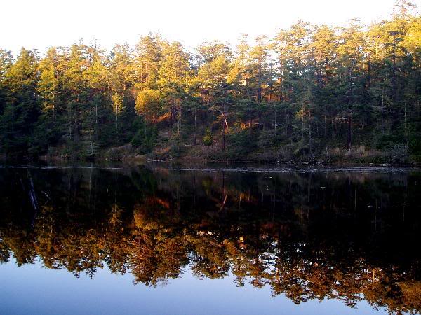
This region inside and near Fort Ebey State Park is known for its kettles and kame topography. Between the State Park and the nearby Kettles property, there are 30 kettles. With the aid of a satellite equipped with LIDAR (Light Detection and Ranging), it is possible to see all 30 kettles in the system. The deepest depression and largest kettle happens to be Lake Pondilla. It is the only Kettle pond in existence in the area and is located in the center of Fort Ebey State Park. It is a small, spring fed lake that migrating birds use on their way south and north. Its steep sides and fresh water distinguish it from the brackish lakes and lagoons in other parts of the park, which were formed as a result of coastal processes. Interestingly enough, only 2/3rds of the lake is owned by the state, with the remaining 1/3 privately owned. River otters also make their home here and have been seen cavorting and playing in and around the lake.

As proof of your visit:
1) Since this is a spring fed pond, please take a picture at the pond edge closest to the provided coordinates, taking the temperature of the pond using a thermometer. Attach this to your found log, noting the temperature.
Pick up a trail map at the park office for Fort Ebey State Park and the Kettles Park trails. It will make it easier to find the cache and others in the area in case you want to do additional exploring of the Kettles area and pick up another cache or two!
FTF and Photo honors goes to tsunami_KNUW, Congrats!

|
- The geocache may be placed on Washington State Parks and Recreation Commission managed property only by written permission from the Washington State Parks and Recreation Commission.
- The following items shall not be placed in the geocache: Food items; illegal substances; medications; personal hygiene products, pornographic materials; inappropriate, offensive, or hazardous materials or weapons of any type. Log books are required for each cache and are to be provided by the owner of the cache.
- It is the visitor’s responsibility to orient themselves with policies and rules pertaining to State Parks areas.
- Report any incident, problem, or violation to State Parks staff.
|
 |
Warning: Earthcaches come with a unique set of rules and activities that must be met
before successfully logging. Failure to comply will result in a log deletion.
|
|