To log this earthcache you will visit the Meola Reef, which is the result of a lava flow from the Three Kings eruption. This is the longest lava flow in the Auckland region, extending from Three Kings into the harbour a total of about 10kms.
The lava flow from the Three Kings Volcano also created lava tunnels, some of which still exist, supplying water to the Western Springs Lake. Most of these lava tunnels have collapsed but sections of them form caves that can be accessed in various locations along the lava flow.
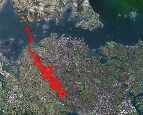
The Three Kings Volcano lava flow (shown in red)
Meola Reef is also known as Te Tokaroa, or "The Long Rock".
In the Auckland area, between Takapuna in the North and Manurewa in the South, there are about 50 volcanoes. It is widely accepted that further volcanic activity in the Auckland Volcanic Field is possible in the future. While the size of a new volcano is likely to be small, there are over 1 million people residing in the affected region so the effects would be devastating. A network of 5 seismometers located across the Auckland region monitor activity in order to predict the onset of any new volcanic activity.
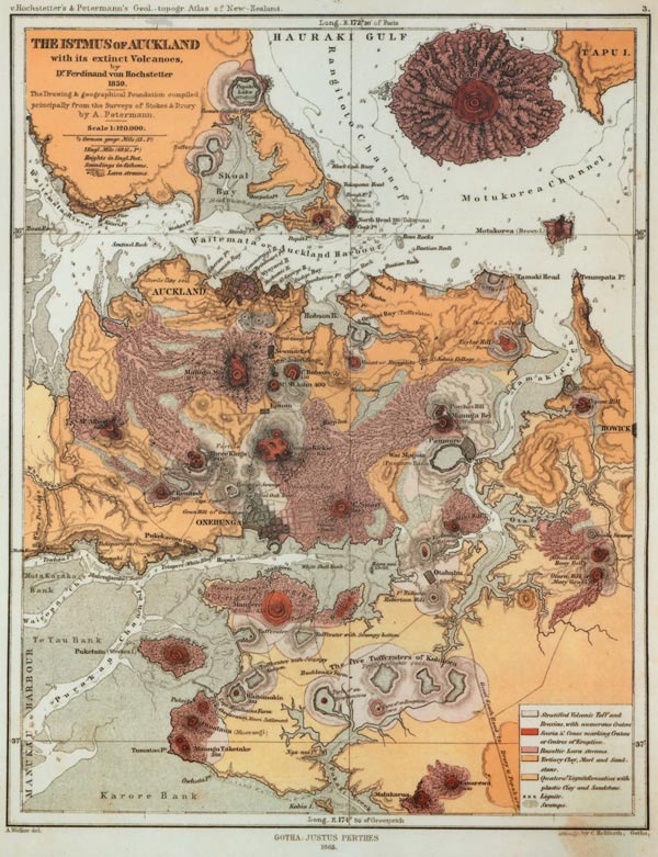
Map of the Auckland Volcanic Field by Ferdinand von Hochstetter, 1859. Originally published in Geologisch-topographischer Atlas von Neu-Seeland (Hochstetter and Petermann, 1863), and republished in English in 1864
You should park at S36 51.542 E174 42.889 as you will find some useful information very nearby.
Don't visit at night as you won't see anything. Logs that do not meet the requirements will be deleted.
| To prove you have visited and learned something please do the following: |
| 1. |
Email the cache owner the number of kilometres into the harbour the lava flow extends. |
| 2. |
Email the cache owner the number of seats in the round lookout area located at S36 51.335 E174 42.620. |
| 3. |
Take a photo at the cache's published coordinates showing clearly yourself, your GPS screen, and the lava flow in the background - post this with your log. |
| 4. |
Fairly nearby to the published coordinates, at S 36 51.285 E 174 42.582, is a sign. Email the cache owner the third word on the second line of the sign. |
| 5. |
Please email the cache owner and describe the distinctive change in terrain at the published coordinates. |
| Do not include these answers in your log entry - only the photo please. |
You can log this cache straight away after you have emailed your answers to the cache owner, no need to wait for confirmation. Please include the name of this earthcache in the email - you'd be surprised how many people forget. Also, when contacting us with answers, if you want a reply, please include your email address. Any problems with your answers we'll be in touch.
Happy Earthcaching!
 Surgez