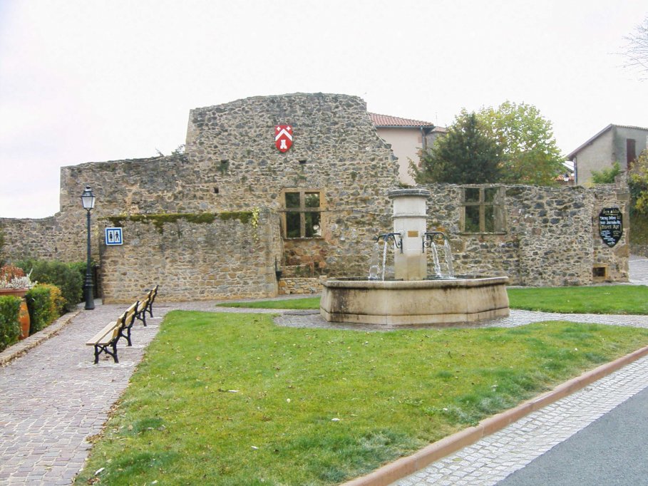
Vous pouvez garer votre voiture sur le parking extérieur de Ternand en N 45°56.736 - E 004°31.652. Dirigez-vous ensuite vers les coordonnées indiquées. Vous faites face aux restes de l'ancien donjon. Une plaque est apposée sur le mur, elle raconte son histoire. Notez :
- La date de construction : ABCD
- La hauteur d'origine : EF
- La hauteur actuelle : GH
Dirigez-vous maintenant vers la deuxième étape à N 45°56.(ABCD/2)+(BD) - E 004°31.(G+H)D(B+E), vous trouverez une table d'orientation.
Attention, en chemin veillez bien à relever :
- L'année d'élévation du mur d'enceinte du vieux château : IJKL
- L'anniversaire du concours de maisons (prenez le chemin de ronde et cherchez une plaque sur votre gauche): MN
Après avoir admiré le paysage, regardez derrière vous sur le mur de la maison : une plaque représente un heaume.
- Date portée sur la plaque : OPQR
Finissez le chemin de ronde tout en admirant le paysage et reprenez ensuite votre véhicule.
Prenez la route qui monte au col de la Croix du Thel pour rejoindre la cache située à N 45°57.(IJKL/2)-((MNx2)-Q) - E 004°28.(Q+R)(P-O)R. Cherchez une boîte en plastique transparente gris clair.
Vous trouverez un parking à proximité, utilisez-le.
ATTENTION: Surveillez vos enfants à proximité de la cache, le terrain peut être glissant.
There is a car park outside of Ternand. Please, use it to N 45°53.736 - E 004°31.652. Then go to the co-ordinates provided. You are in front of the remnants of the former dungeon. A plaque was affixed to the wall, it tells its story. Note:
- The date of building : ABCD
- The height at the origin : EF
- The current height : RI
Go now to the second stage to N 45°56.(ABCD/2)+(BD) - E 004°31.(G+H)D(B+E), you will find a table of orientation.
Attention, on the way sure to raise:
- The year of the elevation of surrounding wall of the old castle : IJKL
- The anniversary of the houses contest (take the circular road and search a plaque on the left): MN
After admiring the landscape, look behind you on the wall of the house : a plaque represents a helmet.
- Date scope on the plate: OPQR
Finish the circular road and admiring the landscape and then pick your vehicle. Take the road that goes up to the "col de la Croix du Thel" to join the cache located at N 45°57.(IJKL/2)-((MNx2)-Q) - E 004°28.(Q+R)(P-O)R. Look for a white plastic box and transparently.
You can find a car park nearby, use it.
CAUTION: Keep your children close to the cache, the ground can be slippery.