Raba Stan Multi-cache
-
Difficulty:
-

-
Terrain:
-

Size:  (regular)
Please note Use of geocaching.com services is subject to the terms and conditions
in our disclaimer.
|
Raba
Stan |
|
|
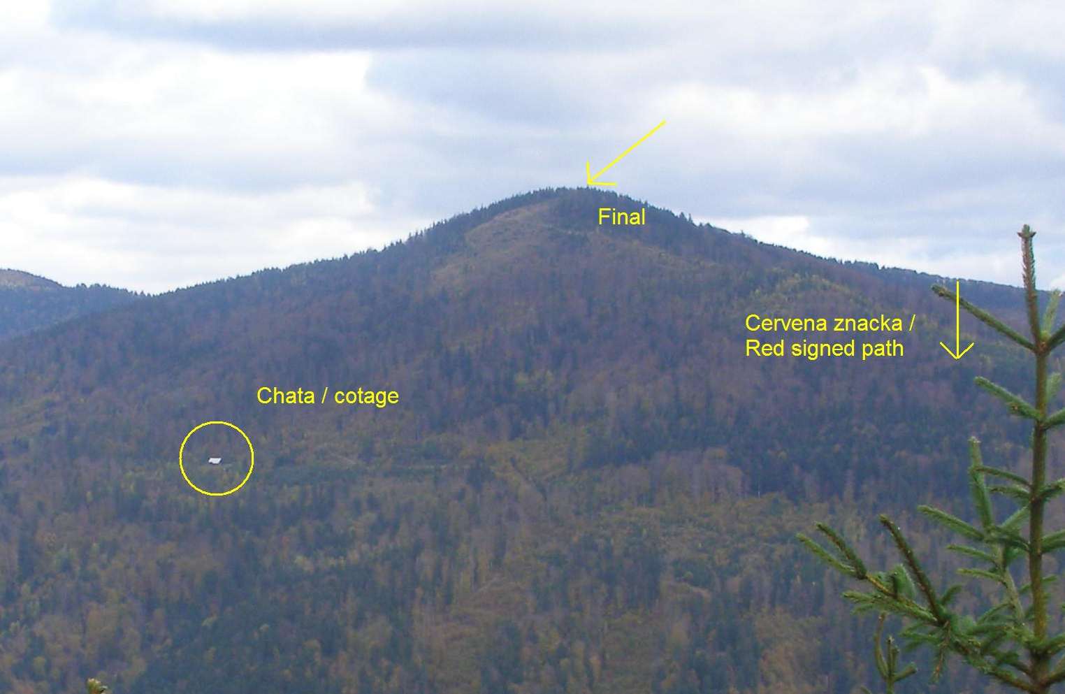
SK: Horsky
hreben medzi Smolnickou dolinou a dolinou riecky Bodva sa vypina do
1000 m vysky. V nedavnej minulosti po viacerych veternych
kalamitach sa odkryli vyhlady do vsetkych stran. Uz je tu niekolko
umiestnenych skrys. Jednu som este pridal. Tato Vas zaroven
privedie na miesto spojene s minulostou.
Skrysu najdete nedaleko vrcholu, podla ktoreho
je pomenovana aj jedna chata, ktoru najdete na
suradniciach: |
|
N 48° 45.895 E 020° 49.970 |
|
|
|
|
Dostanete sa k nej bud zo Smolnickej pily alebo
mozete odbocit z cervenej znacky na suradniciach: |
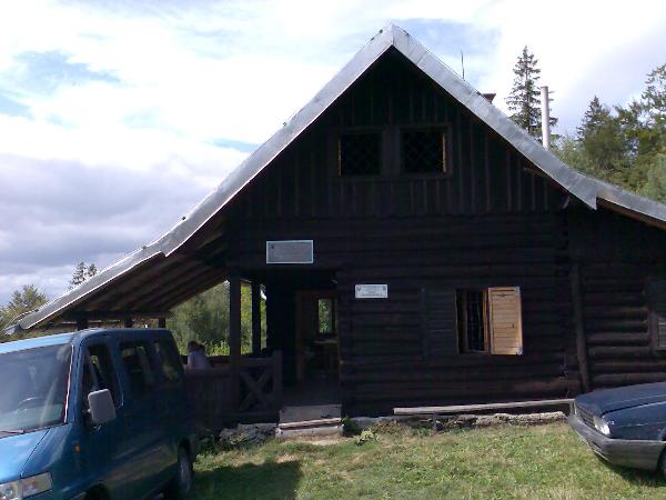
Chata / Cotage
|
|
N 48° 45.494 E 020° 50.350 |
|
Na tejto chate najdete pamätnu tabulu ktora,
spomina udalost, co sa tu udiala. Cislo mesiaca a posledne
dvojcislie roku, ktore su na tejto tabuli spominane medzi sebou
vynasobte a dostanete cislo K. Pomocou tohto cisla ziskate
suradnice skryse: |
|
N 48°
46.K-294 E 020° 50.K+165 |
|
Pri
chate si to v klude spocitajte, posilnite sa pred vystupom, ktory
nebude lahky. Vyhlad, ktory sa Vam zhora naskytne, ale stoji za to.
Najpohodlnejsi pristup na hreben je tak, ze sa vratite na
cervenu na vyssie uvedenych suradniciach a odtial pokracujete po
hrebeni.
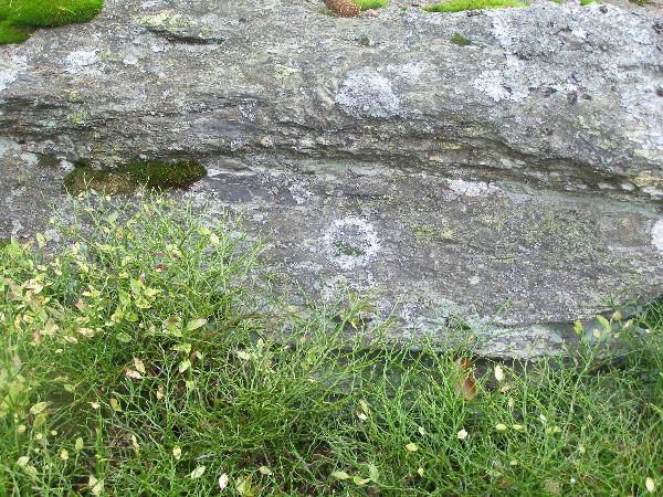
Keska je ukryta pod velkym balvanom medzi
cucoriedkami. |
Spoiler
|
|
|
|
|
EN: Range between Smolnik
valey and valey of Bodva creek is rising up to 1000 m. Recently
after wind storms there are many openings with nice panoramatic
view. You can find there some other caches and I put there another
one, which will bring you to one place conected with history.
Cache is hidden near
the top of the hill which gives the name to the cotage you find at
coordinates: |
|
N 48° 45.895 E 020° 49.970 |
|
|
You can get to it
from vilage Smolnicka Pila or from red signed path at
coordinates: |
|
N 48° 45.494 E 020° 50.350 |
|
|
There is one memorial tablet on this cotage, which is noticed
historical event at this place. There is a month and year. Multiply
last two ciphers of the year and the month, you got number
K. The coordinates of the cache are: |
|
N 48°
46.K-294 E 020° 50.K+165 |
|
|
The cache is uphill,
and not very close to the cotage, but view is very nice. The best
way to got there is to got to the red signed path at the last
mentioned coordinates and then follow the red sign to the top of
the hill. The cache is hidden not far from there under the large
stone between blueberries. |
Additional Hints
(Decrypt)
xnzra f xehmxbz
ebpx jvgu pvepyr