Van Der Lijn Reservaat EarthCache
-
Difficulty:
-

-
Terrain:
-
Size:  (other)
Please note Use of geocaching.com services is subject to the terms and conditions
in our disclaimer.
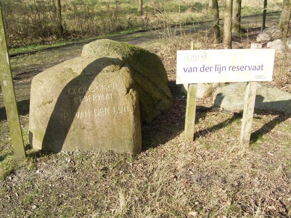
Geologisch Reservaat P. van der Lijn
°°°°°°°°°°°°°°°°°°°°°°°°°°°°°°°°°°°°°°°°°
Nederlands Na het droogvallen van de Noordoostpolder in 1942 kwam hier bij Urk een gaaf keienveld boven water. De basis voor het keienveld is gelegd door de voorlaatste ijstijd, het Saalien. Het landijs voerde uit het noorden grote hoeveelheden klei, zand, grind en stenen mee. Waar het landijs halt hield en smolt, ontstonden afhankelijk van de afstand vanaf de ijsrand hopen keien, steengruis, zand en slib. Onder het ijs zelf werd dit materiaal vermalen tot leem, de grondmorene. Dit mengsel wordt keileem genoemd, en is vaak taai en slecht doorlatend voor water.
Erosie door de zee
==================
Na het landijs namen de zeeën de regie over. Zowel de Eemzee als de Zuiderzee hebben na elkaar over de grondmorene gespoeld. Een tot twee meter zand en slib zijn weggespoeld, de stenen bleven liggen. Zo werd het gehalte aan stenen veel hoger dan in de grondmorene het geval was. In de Zuiderzeeperiode lag het keienveld aan de kust. Eb en vloed hebben de stenen als het ware gesorteerd: de grote dicht bij de waterlijn en de kleine hoger op het strand. Hoger op het strand is zo een soort straatje, een plaveisel van kleine stenen ontstaan. Het Van der Lijn reservaat kunt u vinden in het Urkerbos.
Parkeren kun je op: N 52 40.479 E005 36.333. Vanaf hier is het een kleine wandeling naar het reservaat.
English
After the Noordoostpolder dried up in 1942 a perfect field of boulders came above the waterline. The foundation for this field is laid in the for last ice age named the, Saale-glaciaal. Land ice transported from the north large quantities of clay, sand, gravel and stones. On the surface where the land ice stopped and the ice melted, developed independent of the distance from the ice curve areas of clay, sand, rock gravel and silt. Beneath the ice this material was crushed and became loam. This mixture is known as rock loam and is tough and keeps water from pouring through.
Erosion by the sea
==================
After the land ice the sea took over. The Eemsea and the Zuidersea flushed after each other the rock loam away. One till two meter of sand and silt are flushed away, and the rocks stayed behind. So the amount of rocks became much higher in density then in the rock loam. In the Zuidersea period the rock field was near the coast. Ebb tide and flood tide sorted out the rocks, next to the waterline lay the large ones and the smaller ones higher on the beach. Higher on the beach developed a small path, a pavement of little rocks.
To log this Earth cache: 
Nederlands:
(1) Maak op het coördinaat dat bovenaan deze pagina staat een foto van jezelf met je GPS bij dit bord. (2) Opdracht: Als voorwaarde om deze earthcache te mogen loggen moet je een email sturen aan de beheerder van deze cache met het antwoord op de volgende informatie: welk mos en kruid groeit hier in dit kwetsbare gebied. (3) En tot bij welk "land" is de grens van het landijs gekomen. Stuur de antwoorden per email naar ons toe. "Indien de email niet goedgekeurd is, wordt de log verwijderd".
English:
(1) Picture: Go to the coordinates on top of this page and take a photo of yourself with your GPS next to this information sign. (2) Send an email to us with the information about a type of moss and herb what grows in this vulnerable area. (3) At what place did the land ice stopped? If an e-mail is found to be incorrect the log will be deleted. You can find the P.Van der Lijn reservation in the Urker forrest.
You can park your car at this coordinates N 52 40.479 E005 36.333. From this place it is a short walk.
Additional Hints
(No hints available.)