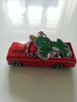
 67 Chevy C10
| Trackable Options |
 Found this item? Log in.
 |
 Printable information sheet to attach to 67 Chevy C10
Print Info Sheet
Printable information sheet to attach to 67 Chevy C10
Print Info Sheet |
|
-
Owner:
-
Schwarze_Hand_Ms
Message this owner
-
Released:
-
Sunday, October 20, 2013
-
Origin:
-
Nordrhein-Westfalen, Germany
-
Recently Spotted:
-
Unknown Location
This is not collectible.
Use TB53GWW to reference this item.
First time logging a Trackable? Click here.
Dies ist ein Rennen mit Nesaja01.
Wer in einem Jahr die meisten Kilometer macht hat gewonnen. Also helft mir sie zu schlagen und last meinen Chevy weit in der Welt reisen. Je mehr Kilometer desto besser.
Mein Chevy würde gerne diealte Route 66 befahren ;)
Sieger ist, wer am 25 Oktober 2014 die meisten Kilometer geschafft hat.
Zur Info:Die Route 66 galt ab 1926, abgesehen vom Lincoln Highway, als eine der ersten durchgehend befestigten Straßenverbindungen zur US-amerikanischen Westküste. Heute sind die verbliebenen Teilstücke der einst 2.448 Meilen (3.939,67 Kilometer) langen Strecke von Chicago (Illinois) nach Santa Monica (Kalifornien), auch Mother Road oder America’s Mainstreet genannt, ein Anziehungspunkt für Touristen und Nostalgiker. Sie wird jedoch nicht mehr einheitlich als Route 66 bezeichnet und ist nicht mehr durchgehend befahrbar.
Quelle: Wikipedia
This is a Race with Nesaja01.
The Winner is, who maneged it to travel the most miles.Please help me to beat her and let my Chevy travel around the World. The more miles the merrier.
My Chevy just wants to travell on the old Route 66 ;)
U.S. Route 66 (US 66 or Route 66), also known as the Will Rogers Highway and colloquially known as the Main Street of America or the Mother Road, was one of the original highways within the U.S. Highway System. Route 66 was established on November 11, 1926—with road signs erected the following year.[2] The highway, which became one of the most famous roads in America, originally ran from Chicago, Illinois, through Missouri, Kansas, Oklahoma, Texas, New Mexico, and Arizona before ending at Santa Monica, California, covering a total of 2,448 miles (3,940 km).[3] It was recognized in popular culture by both the hit song "(Get Your Kicks on) Route 66" and the Route 66 television show in the 1960s.
Source Wikipedia
Gallery Images related to 67 Chevy C10
View All 10 Gallery Images
Tracking History (279.7mi) View Map