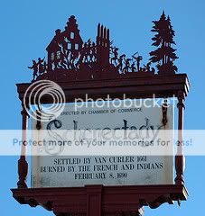
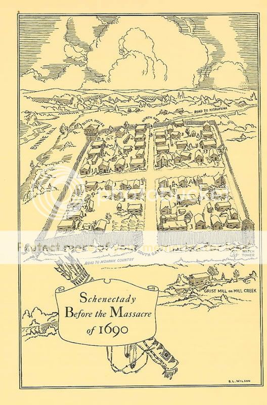
Massacre and Burning of Schenectady
Park your car at the I.P. and enjoy a walk through the Stockade.
You probably have already been brought here for
”A Colonial Cache” or from gathering information for a portion
of my
HITM Cache. If you haven’t, then here’s your chance to do two
multi-caches and gather that information you need to work on the
HITM Schenectady Cache. Bring your camera and your imagination
and prepare yourselves to learn just a bit more about the Stockade
that you may not have known about. If any of this piques your
interest, then how about signing up for one of the walking tours
that is offered here or stopping by the Schenectady County
Historical Society’s Museum which is located very close to the
I.P.?
From the I.P., and subsequent locations, you will be projecting
a waypoint. I am the first to say that I too like to cheat on these
projections by entering the information (distance and bearing) into
the GPS and let it do the work for me so that in some cases I can
do multiple projections and locate the final without even reaching
each of the spots leading up to it. Knowing this, I have
incorporated information that you will find at each of the
locations that you will use to alter the written projection
information to obtain the next stage of the cache. The alterations
will only be made to the distance NOT the bearing.
Here we go!
From the I.P./parking area, project the first waypoint 190.8°
True at a distance of 334’. Proceed to this projected waypoint and
follow the subsequent directions.
From the first projected waypoint, project the next waypoint
88.9° True at a distance of 1023’ MINUS the distance noted in the
first sentence of the plaque located here. This is waypoint
two.
From the second waypoint, project the next waypoint 184.6° True
at a distance of 802’ PLUS the number of words (for our sake ‘a’
and ‘of’ and ‘at’ will be considered words) on this second plaque
(first paragraph only-same theme as prior plaque) TIMES THREE. (3x
+ 813 = distance). This is waypoint three.
From the third waypoint, project the next waypoint 265.5° True
at a distance of 531’ PLUS (Number of persons killed times number
of persons taken prisoner times number of feet from present
location this item was located). This is waypoint four.
From the fourth waypoint, project the next waypoint 360° True at
a distance of 1246’ PLUS the SUM of: the two distances noted,
number of persons killed as well as the number of prisoners taken
here. This is the final location.

Pictures taken from “The Story of the Schenectady Massacre”
produced under the auspices of the Schenectady County Historical
Society
Disclaimer: You, and all members of your party must read and
agree to the www.geocaching.com disclaimer. In addition, you all
must agree to hold the cache owner, www.geocaching.com, and the
land owners harmless from any and all causes for action. You and
all other members of your party must individually and collectively
determine your/their physical fitness and outdoors/hiking skill
levels, decide whether or not to visit the various cache locations,
and whether or not it is safe and prudent to do so under the
conditions that will be encountered. Cache seekers assume all risks
involved in seeking these cache locations.