Höpukrac Multi-cache
ufabra: Auf einer schönen Runde durch Mützenich haben wir heute die Dose vom Steling abgeholt.
-
Difficulty:
-

-
Terrain:
-

Size:  (regular)
Please note Use of geocaching.com services is subject to the terms and conditions
in our disclaimer.
Eine ca. 8,5 km lange Wanderung durch Feld, Wald und Venn über Bretter-, Schotter-, Wald- und Asphaltwege, für die ihr ca. 2,5 Stunden einplanen solltet. Am Ende gibt's eine schöne Aussicht. Fahrräder sind auf Teilen der Strecke leider verboten. Für Kinderwagen dürften die Bretterwege zu schmal und einige Wege auch zu matschig sein.
Parken könnt ihr in Mützenich bei N 50° 34.139 E 006° 12.769.
Vom Parkplatz aus geht's los Richtung Kaiser Karls Bettstatt. An der Weggabelung links ab zum WP1.
WP1 = N 50° 34.257 E 006° 12.274
Hier findet ihr einen deutsch-belgischen Grenzstein. Notiert die Nummer des Grenzsteins:
- ABC = Nummer des Grenzsteins.
Folgt dem Pfad zu einem weiteren Grenzstein bei WP2.
WP2 = N 50° 34.(A-4)(B+2)(A) E 006° 12.(2*B)(B+1)(C/2)
Links von diesem Grenzstein findet ihr ein blaues Schild mit 3 weißen Ziffern.
Von hier aus geht es schnurstracks zu WP3.
WP3 = N 50° 34.(B+D)(E-4)(D) E 006° 11.(E)(F)(2*D)
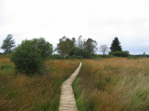
Hier geht ein Bretterweg los, der Euch durch das Venn führen wird. In wievielen Sprachen wird der rote Wimpel erklärt? Wieviele Spitzen hat das Tor, mit dem der Weg gesperrt werden kann?
- G = Anzahl der Sprachen
- H = Anzahl der Torspitzen (falls das Tor weg ist, dann gilt H=G
 )
)
Jetzt müsst ihr irgendwie zu WP4 kommen. Wir empfehlen natürlich den wunderschönen Bretterweg, den ihr aber nur gehen dürft, wenn die Fahnen nicht wehen und ihr keinen Hund dabei habt. Wenn der Bretterweg nicht möglich ist, dann geht einfach den bisherigen Weg weiter. Hinweis: Unter http://www.hautesfagnes.be/accesmarsjuinde.htm könnt Ihr schon zu Hause nachsehen, ob im Venn die roten Fahnen gehisst sind. Danke an Captain Cook für den Tipp!
WP4 = N 50° 34.(D+G)(D+H)(A-1) E 006° 10.(G+H)(C)(B+D)
Ihr müsstet jetzt an einem kleinen Schild mit einem "M" und einem "E" stehen. Welche Farbe hat das Kreuz?
- I = 3, wenn das Kreuz rot ist
- I = 5, wenn das Kreuz grün ist
- I = 7, wenn das Kreuz blau ist
Folgt dem Weg in Richtung "E" zu WP5.
WP5 = N 50° 35.(I-B)(B)(A) E 006° 12.(I-D)(I)(D)
Macht hier an der Hütte eine kleine Pause und rechnet die Cachekoordinaten aus.
- J = Quersumme der Höhe + 2
Der Cache liegt bei N 50° 34.(J-B)(G-I)(H-I) E 006° 12.(J)(G+B)(J).
Nachdem ihr Cache und Aussicht genossen habt, könnt ihr auf dem Rückweg zum Auto noch einen Miniabstecher zu GCJ3RR Kaiser Karls Bettstatt machen.
English:
A hike of about 8,5 km through meadows, forest and moor over several types of paths. You'll need about 2,5 hours. At the final there's a nice view. Bikes are not allowed. For strollers the paths through the moor are probably too narrow and some other paths could be too muddy.
You can park your car in Mützenich at N 50° 34.139 E 006° 12.769.
From the parking area start walking towards direction "Kaiser Karls Bettstatt". At the fork turn to the left to WP1.
WP1 = N 50° 34.257 E 006° 12.274
Here you'll find a German/Belgian boundary stone. Look for the number of the stone.
- ABC = Number of the boundary stone.
Follow the path to another boundary stone at WP2.
WP2 = N 50° 34.(A-4)(B+2)(A) E 006° 12.(2*B)(B+1)(C/2)
Left of the boundary stone you should find a small blue sign with three white digits on it.
From here walk straightway to WP3.
WP3 = N 50° 34.(B+D)(E-4)(D) E 006° 11.(E)(F)(2*D)
Here a small woodway starts leading you through the moor. How many languages are used to explain the meaning of the red flag? The path can be closed with a fence. How many peaks has it?
- G = number of languages
- H = number of peaks (if the fence is gone, then use H=G )
Now you have to reach WP4 anyhow. We suggest of course the wonderful woodway, but this way is only allowed if no red flags are flying and if you don't have a dog with you. If the woodway is not possible to you then go on walking the previous way. Remark: Whether the red flags are flying you can check on http://www.hautesfagnes.be/accesmarsjuinde.htm. Thanks to Captain Cook for this hint!
WP4 = N 50° 34.(D+G)(D+H)(A-1) E 006° 10.(G+H)(C)(B+D)
You should see a small sign with a "M" and an "E". Which color is the cross?
- I = 3, if the cross is red
- I = 5, if the cross is green
- I = 7, if the cross is blue
Follow the road in the direction of "E" to WP5.
WP5 = N 50° 35.(I-B)(B)(A) E 006° 12.(I-D)(I)(D)
At the hut make a small rest and calculate the cache coordinates.
- J = cross sum of altitude + 2
The cache is hidden at N 50° 34.(J-B)(G-I)(H-I) E 006° 12.(J)(G+B)(J).
After enjoying cache and view, on the way back to the car you can make a quick trip to GCJ3RR Kaiser Karls Bettstatt .
Additional Hints
(No hints available.)