
A small ammo box container with some trinkets for trade. This is
a difficult hike because there are no trails that I know about to
this cache. If there is a trail that you know about, enlighten me
and I will include that info in this cache description.
To get there we went to almost the end of FS 222 and hiked in
from 34' 15.199 87' 25.910. You can get to FS222 by turning on to
Jim Brown road from AL195 near the Ashrige community.
The hike is not easy. There are areas of fallen pine trees to
get through and when you get near the falls there are cliffs to
watch for. Make sure to waypoint your parking place so you don't
get lost.
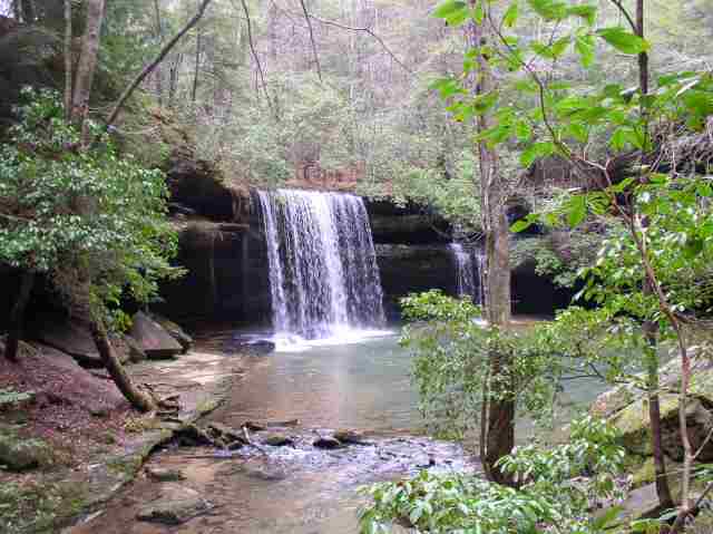
This place is a jewel of the forest and well worth the effort to
get there. I hope you enjoy this one.
***UPDATE***
Adding this description of an easier way to get to the falls
thanks to PhotoFrenzy. This will take you to the south side of the
falls. The cache is on the north side so the creek will have to be
crossed.
Hi, just wanted to let you know of a easier way to get to the
waterfall...Leaving from Moulton go south on 33. Turn right onto
County Road 2. Go 4 Miles and on the right is an old fire service
road. Coords are N 34 14.115 W 087 26.044 You can park there and
walk down that road. It will lead you to a trail at the top of the
water fall. Don't know what side of the creek your cache is on but
the waterfall is beautiful and this is a much easier path to
take.
UPDATE!! Original container has been replaced after being
muggled and has been moved farther down the creek to a slightly
less traveled area. Good coordinates are hard to get because of
terrain and tree cover. The hint is a spoiler if you need it.