Thymallus Thymallus: Cache archived.
GCRMQD ▼
Size: (regular)
Mitä ihmettä ovat HKI koordinaatit? What in the world are HKI coordinates?
Kuten monilla suurilla kaupungeilla Suomessa, Helsingillä on oma 1920-luvulta periytyvä koordinaatistojärjestelmä, jolla saatiin lisätarkkuutta paikalliseen maanmittaukseen aikana jolloin kansallisia standardeja ei vielä oltu luotu.
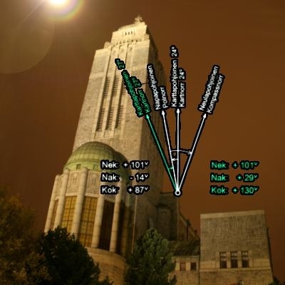
Nämä Helsinki-koordinaatit (lyhennetään HKI) perustuvat Kallion kirkon torniin, johon tämän kätkön referenssipiste vie sinut. Tämä piste määritellään olevan HKI X:20000 metriä, Y:50000 metriä. Pisteen kautta kulkeva X-akseli poikkeaa 47'55" länteen alueen 24 karttapohjoisesta, ja Y-akseli on luonnollisesti suorakulmainen tähän nähden.
Muunnoskaava annetun HKI-pohjois/itä-koordinaatin muuttamiseksi KKJ peruskoordinaatistoon on:
P = XHKI – 21411.896 I = YHKI – 51725.460 PKKJ = 6676543.079 + 0.9999286×P + 0.0139389×I IKKJ = 2554561.907 + 0.9999286×I – 0.0139389×P
Mikäli ETRS-GK25 -koordinaattien käyttö on helpompaa, muunnoskaava annetun HKI-pohjois/itä-koordinaatin muuttamiseksi niihin on:
NETRS-GK25 = 6654650.14636 + 0.99998725362 × XHKI + (-0.00120230340) × YHKI EETRS-GK25 = 25447166.49457 + 0.00120230340 × XHKI + (0.99998725362) × YHKI
Konversiot annetusta KKJ peruskoordinaatistopisteestä GPS-laitteiden kanssa tavallisimmin käytettyyn WGS84-järjestelmään (vastaa "EUREF-FIN maantieteelliset") ovat valitettavasti liian monimutkaisia käytäväksi läpi tässä. Helpoin ratkaisu on käyttää jotakin seuraavista koordinaattikonverttereista:
Nämä koordinaattijärjestelmät ja niiden varsin monimutkaiset muunnokset selostetaan perusteellisesti seuraavissa dokumenteissa.
Like many major cities in Finland, Helsinki has its own coordinate system dating back to the 1920's to enhance local map accuracy at a time when there was scant national standardization in these matters.
These Helsinki coordinates (abbreviated HKI) are based on the Kallio church tower where the cache given coordinates take you. This is defined as HKI X:20000 meters, Y:50000 meters. The X-axis passing through this point deviates westward 47'55" from the zone 24 map north, and the Y-axis is of course perpendicular to this.
The conversion formula for converting given HKI X/Y (north/east) coordinates to the Finnish Hayford coordinates (KKJ peruskoordinaatisto) is:
If using ETRS-GK25 coordinates is easier for you, the conversion formula for converting given HKI X/Y (north/east) coordinates to them is:
The conversion formulas for converting given Finnish Hayford (KKJ peruskoordinaatisto) northing/easting to the WGS84 system commonly used with GPS devices (equivalent to "EUREF-FIN maantieteelliset") are unfortunately too complex to go through here. The easiest solution is to use one of the following online coordinate converters:
Some of these coordinate systems and their rather complex conversions are documented with more depth in the following documents, all of them unfortunately written in Finnish.
Additional Hints (Decrypt)
Decryption Key
A|B|C|D|E|F|G|H|I|J|K|L|M ------------------------- N|O|P|Q|R|S|T|U|V|W|X|Y|Z
(letter above equals below, and vice versa)
What are Attributes?
Advertising with Us
There are no Trackables in this cache.
View past Trackables
What are Trackable Items?
View all bookmark lists...
 Geochecker